Steep Creek Campsite Campground
Community Reviews
Been here? Share the conditions.
Reviews, ratings & photos are added in the free Snoflo iOS app — rate a spot, tag the conditions, and your visit is verified by location. Add or manage your reviews from the app.
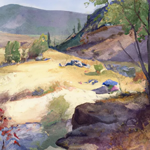
Steep Creek Campsite
Reservations are not accepted at Steep Creek Campsite, and campsites are available on a first-come, first-served basis. It is advisable to arrive early, especially during peak seasons, to secure a spot. The best time of year to visit this camping area is during the summer and early fall months when the weather is mild and conducive to outdoor activities. However, it is important to note that the campground is at a higher elevation, so visitors should be prepared for cooler temperatures during the evenings.
While staying at Steep Creek Campsite, campers can explore the surrounding area, which offers a variety of outdoor recreational opportunities. The nearby Steep Creek Trail provides access to stunning hiking trails, offering breathtaking views of the surrounding mountains and wildlife. Visitors should be cautious of wildlife encounters, such as bears, and should take necessary precautions by storing food properly and being aware of their surroundings. Overall, Steep Creek Campsite is an excellent choice for nature lovers looking to immerse themselves in the beauty of Idaho's wilderness.
What's on-site at Steep Creek Campsite
Key facilities Snoflo tracks for this campground. Confirm with the operator before booking -- amenities can change seasonally.
Plan your trip down to the hour
Same weather feed Snoflo's iOS app uses -- updated continuously from NOAA / yr.no.
Next 5 days, hour by hour
Temperature line with weather symbols on top, snow + rain accumulation as columns, humidity as a dotted line.
5-day forecast table
Every 3 hours, broken out across temperature, snow, rain, humidity, and wind. Each cell is colour-coded relative to the column min/max so trends jump out at a glance.
| Time | Condition | Temp (°F) | Snow (in) | Rain (in) | Humidity (%) | Wind (mps) | Wind dir |
|---|---|---|---|---|---|---|---|
| Loading detailed forecast… | |||||||
15-day temperature & precipitation
Daily temperatures, snow, and rain projected over the next two weeks. Hover any point for the full breakdown.
Other campgrounds in the area
Snoflo-tracked campsites within driving distance of Steep Creek Campsite, with reservations status.
| Campground | Reservations | Toilets | View |
|---|---|---|---|
| Yreka Bar Campsite | ✗ | ✗ | → |
| Upper Sand Creek Campsite | ✗ | ✗ | → |
| Johnson Bar Landing Campsite | ✗ | ✗ | → |
| Sand Creek Campsite | ✗ | ✗ | → |
| Pine Bar Campsite | ✗ | ✗ | → |
Nearby streamflow
USGS streamgauges within reach of Steep Creek Campsite -- pulled live from the National Water Information System.
| Streamgauge | Discharge | View |
|---|---|---|
| Little Salmon River At Riggins Id | 236 cfs | → |
| Imnaha River At Imnaha | 150 cfs | → |
| Snake River At Hells Canyon Dam Id-Or State Line | 19,200 cfs | → |
| Salmon River At White Bird Id | 6,070 cfs | → |
| Snake River Bl Mcduff Rapids At China Gardens | 15,300 cfs | → |
| Nf Payette River At Mccall Id | 55 cfs | → |
Nearby snow depths
NRCS SNOTEL stations within reach of Steep Creek Campsite -- relevant when planning a shoulder-season or alpine trip.
| SNOTEL station | Snowpack | 24h Snowfall | View |
|---|---|---|---|
| Lucile 1.2 Nne | 0.0 in | 0.0 in | → |
| West Branch | 1.0 in | 0.0 in | → |
| Nohrsc West Branch | 2.0 in | 0.0 in | → |
| Granite Mountain | 17.1 in | 0.0 in | → |
| Mt. Howard | 0.0 in | 0.0 in | → |
| Nohrsc Mt. Howard | 0.0 in | 0.0 in | → |
Plan a longer trip
The closest parks, lakes, boat launches, and paddle runs so a camping night can grow into a full weekend.
Parks
- National Wild And Scenic River Snake, Idaho And Oregon
- Nez Perce National Historic Park-Confluence Overlook
- Wilderness Hells Canyon
- Iwetemlaykin State Heritage Site
- Wallowa Lake State Park
Boat launches
- Pittsburg Landing Road Idaho County
- Us 95 Idaho County
- Main Street Idaho County
- Old Lucile Recreation Site
Points of interest
- Sawpit Saddle Viewpoint
- Hat Point Overlook And Day Use Area
- Kirkwood Ranch Museum
- Horse Creek Overlook
- Granny View Overlook
- Pittsburg Rockart Interpertive Site
Paddle runs
- Pittsburg Landing To Heller Bar
- Hells Canyon (Hells Canyon Dam To Pittsburg Landing)
- Salmon River, Sec. 36, T27n, R1e To Gospel-Hump Wilderness Boundary, Sec. 31, T27n, R4e
- Salmon River, Sec. 22, T28n, R1e To North And South Forks Of White Bird Creek
- Salmon River
- Hammer Creek To Heller Bar (Lower Salmon)
Camping essentials & Leave No Trace
- Pack it in, pack it out
- Take all trash, food scraps, and gear back with you to keep campsites clean and protect wildlife.
- Respect wildlife
- Observe animals from a distance, store food securely, and never feed wildlife to maintain natural behavior and safety.
- Know before you go
- Check weather, fire restrictions, trail conditions, and permit requirements to ensure a safe and well-planned trip.
- Minimize campfire impact
- Use established fire rings, keep fires small, fully extinguish them, or opt for a camp stove when fires are restricted.
- Leave what you find
- Preserve natural and cultural features by avoiding removal of plants, rocks, artifacts, or other elements of the environment.
Set push alerts in the Snoflo app
Save Steep Creek Campsite as a favorite, set a custom threshold (precipitation, snowpack, freezing temperatures), and the iOS app will push the moment conditions cross.
About Steep Creek Campsite
Can I make reservations at Steep Creek Campsite?
This campground does not appear to accept reservations -- it's typically first-come, first-served. Arrive early on summer weekends.
How fresh is the weather data on this page?
The hourly forecast updates throughout the day from the NOAA / yr.no public feeds. Streamflow data is pulled live from USGS streamgauges and snowpack from the NRCS SNOTEL network.
What's the best time of year to visit?
Use the 15-day temperature & precipitation outlook on this page to plan -- pick a window with comfortable temperatures and low precipitation. For longer trips, the 5-day hourly meteogram shows snow + rain accumulation hour-by-hour.
How do I get to Steep Creek Campsite?
Tap Directions in the hero above to open driving directions in Google Maps, or Open in map to center the Snoflo interactive map on the campground.
Can I get alerts when conditions change?
Yes -- alerts are managed through the Snoflo iOS app. Favorite this campground, set a threshold (temperature, snowpack, precipitation), and you'll get a push the moment it crosses.
Other campgrounds near here
Snoflo-tracked campgrounds within driving distance of Steep Creek Campsite.