Langlade County Veterans Memorial Park Campground
Community Reviews
Been here? Share the conditions.
Reviews, ratings & photos are added in the free Snoflo iOS app — rate a spot, tag the conditions, and your visit is verified by location. Add or manage your reviews from the app.
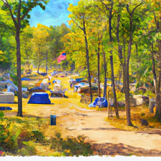
Langlade County Veterans Memorial Park
Reservations are accepted at Langlade County Veterans Memorial Park, allowing campers to secure their desired camping spot in advance. This ensures a stress-free trip and guarantees availability, especially during peak seasons. It is recommended to make reservations early, as the campground tends to fill up quickly, particularly during holiday weekends.
The best time to visit Langlade County Veterans Memorial Park is during the warmer months, from late spring to early fall. This allows campers to fully enjoy the outdoor activities and explore the beautiful surroundings. The park offers opportunities for fishing, boating, and hiking, with scenic nature trails to explore.
Campers should be aware of the park's rules and regulations, which include quiet hours from 10 PM to 7 AM, and a strict alcohol and pet policy. It is important to follow these guidelines to ensure a peaceful and enjoyable camping experience for everyone.
In conclusion, Langlade County Veterans Memorial Park in Wisconsin offers a great camping experience with its amenities, reservation system, and beautiful natural surroundings. It is an ideal destination for families and outdoor enthusiasts looking to immerse themselves in nature and enjoy recreational activities.
What's on-site at Langlade County Veterans Memorial Park
Key facilities Snoflo tracks for this campground. Confirm with the operator before booking -- amenities can change seasonally.
Plan your trip down to the hour
Same weather feed Snoflo's iOS app uses -- updated continuously from NOAA / yr.no.
Next 5 days, hour by hour
Temperature line with weather symbols on top, snow + rain accumulation as columns, humidity as a dotted line.
5-day forecast table
Every 3 hours, broken out across temperature, snow, rain, humidity, and wind. Each cell is colour-coded relative to the column min/max so trends jump out at a glance.
| Time | Condition | Temp (°F) | Snow (in) | Rain (in) | Humidity (%) | Wind (mps) | Wind dir |
|---|---|---|---|---|---|---|---|
| Loading detailed forecast… | |||||||
15-day temperature & precipitation
Daily temperatures, snow, and rain projected over the next two weeks. Hover any point for the full breakdown.
Other campgrounds in the area
Snoflo-tracked campsites within driving distance of Langlade County Veterans Memorial Park, with reservations status.
| Campground | Reservations | Toilets | View |
|---|---|---|---|
| Game Lake Primitive | ✗ | ✗ | → |
| High Lake County Park | ✗ | ✓ | → |
| Jack Pine | ✗ | ✗ | → |
| Birch | ✗ | ✗ | → |
| Clark | ✗ | ✗ | → |
Nearby streamflow
USGS streamgauges within reach of Langlade County Veterans Memorial Park -- pulled live from the National Water Information System.
| Streamgauge | Discharge | View |
|---|---|---|
| Wolf River At Langlade | 215 cfs | → |
| Prairie River Near Merrill | 101 cfs | → |
| Wisconsin River At Merrill | 1,060 cfs | → |
| Red River At Morgan Road Near Morgan | 107 cfs | → |
| Eau Claire River At Kelly | 82 cfs | → |
| Peshtigo River Near Wabeno | 179 cfs | → |
Nearby snow depths
NRCS SNOTEL stations within reach of Langlade County Veterans Memorial Park -- relevant when planning a shoulder-season or alpine trip.
| SNOTEL station | Snowpack | 24h Snowfall | View |
|---|---|---|---|
| Antigo | 0.0 in | 0.0 in | → |
| Crandon | 2.0 in | 0.0 in | → |
| Rhinelander 4ne | 10.0 in | 0.0 in | → |
| Rhinelander | 0.0 in | 0.0 in | → |
| Rhinelander Wjfw Tv-12 | 0.0 in | 0.0 in | → |
| Argonne-1.5 Nw | 8.0 in | 0.0 in | → |
Plan a longer trip
The closest parks, lakes, boat launches, and paddle runs so a camping night can grow into a full weekend.
Parks
- Peters Marsh Wildlife Area
- Bog Brook Wildlife Area
- Little Rice Wildlife Area
- Ackley Wildlife Area
- Bitzke Birdwalk And Waterfowl Refuge
- Almon Park Trail
Boat launches
- Veterans Memorial Park
- Pence Lake Park
- Kimball Lake
- South Neva Lake
- Perch Lake Road
- Lower Clear Lake
Points of interest
- M60a3
- Antigo Visual Arts Gallery
- Fcp Cultural Center, Library & Museum
- Nicolet College Art Gallery
- Art Start
Paddle runs
- Unnamed Creek To Forest Boundary In Sec 14, T37n, R13e
- North Branch (Sections 19/30 Line) To Unnamed Creek In Sec 4, T37n, R13e
- Railroad Bridge To 1/4 Mile Downstream From The Ccc Bridge
- 1/4 Mile Downstream From Ccc Bridge To 1/4 Mile Upstream From Evans Bridge
- Main Branch-Forest Boundary In Sec 18, T37n, R15e To Railroad Bridge
- 1/4 Mile Upstream From Evans Bridge To Confluence With Armstrong Creek
Camping essentials & Leave No Trace
- Pack it in, pack it out
- Take all trash, food scraps, and gear back with you to keep campsites clean and protect wildlife.
- Respect wildlife
- Observe animals from a distance, store food securely, and never feed wildlife to maintain natural behavior and safety.
- Know before you go
- Check weather, fire restrictions, trail conditions, and permit requirements to ensure a safe and well-planned trip.
- Minimize campfire impact
- Use established fire rings, keep fires small, fully extinguish them, or opt for a camp stove when fires are restricted.
- Leave what you find
- Preserve natural and cultural features by avoiding removal of plants, rocks, artifacts, or other elements of the environment.
Set push alerts in the Snoflo app
Save Langlade County Veterans Memorial Park as a favorite, set a custom threshold (precipitation, snowpack, freezing temperatures), and the iOS app will push the moment conditions cross.
About Langlade County Veterans Memorial Park
Can I make reservations at Langlade County Veterans Memorial Park?
This campground does not appear to accept reservations -- it's typically first-come, first-served. Arrive early on summer weekends.
How fresh is the weather data on this page?
The hourly forecast updates throughout the day from the NOAA / yr.no public feeds. Streamflow data is pulled live from USGS streamgauges and snowpack from the NRCS SNOTEL network.
What's the best time of year to visit?
Use the 15-day temperature & precipitation outlook on this page to plan -- pick a window with comfortable temperatures and low precipitation. For longer trips, the 5-day hourly meteogram shows snow + rain accumulation hour-by-hour.
How do I get to Langlade County Veterans Memorial Park?
Tap Directions in the hero above to open driving directions in Google Maps, or Open in map to center the Snoflo interactive map on the campground.
Can I get alerts when conditions change?
Yes -- alerts are managed through the Snoflo iOS app. Favorite this campground, set a threshold (temperature, snowpack, precipitation), and you'll get a push the moment it crosses.
Other campgrounds near here
Snoflo-tracked campgrounds within driving distance of Langlade County Veterans Memorial Park.