Springs Valley Rec Area Campground
Community Reviews
Been here? Share the conditions.
Reviews, ratings & photos are added in the free Snoflo iOS app — rate a spot, tag the conditions, and your visit is verified by location. Add or manage your reviews from the app.
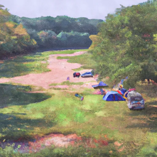
Springs Valley Rec Area
Reservations are accepted at Springs Valley Recreation Area, allowing campers to secure their preferred campsites in advance. It is advisable to make reservations, especially during peak seasons when the campground tends to be busy. The best time to visit Springs Valley is during the spring and fall, as the weather is mild and the scenic beauty of the surrounding forest is at its peak. Moreover, the campground offers a serene atmosphere and ample opportunities for bird watching and wildlife observation.
While exploring Springs Valley Recreation Area, campers should be cautious of the local wildlife, such as ticks and poison ivy. It is advisable to wear appropriate clothing, use insect repellent, and apply caution when wandering off the trails. Additionally, campers should be mindful of fire safety and strictly adhere to campground regulations to ensure a safe and enjoyable experience for all. Springs Valley Recreation Area is a fantastic camping destination that promises a memorable outdoor adventure for nature enthusiasts and families alike.
What's on-site at Springs Valley Rec Area
Key facilities Snoflo tracks for this campground. Confirm with the operator before booking -- amenities can change seasonally.
Plan your trip down to the hour
Same weather feed Snoflo's iOS app uses -- updated continuously from NOAA / yr.no.
Next 5 days, hour by hour
Temperature line with weather symbols on top, snow + rain accumulation as columns, humidity as a dotted line.
5-day forecast table
Every 3 hours, broken out across temperature, snow, rain, humidity, and wind. Each cell is colour-coded relative to the column min/max so trends jump out at a glance.
| Time | Condition | Temp (°F) | Snow (in) | Rain (in) | Humidity (%) | Wind (mps) | Wind dir |
|---|---|---|---|---|---|---|---|
| Loading detailed forecast… | |||||||
15-day temperature & precipitation
Daily temperatures, snow, and rain projected over the next two weeks. Hover any point for the full breakdown.
Other campgrounds in the area
Snoflo-tracked campsites within driving distance of Springs Valley Rec Area, with reservations status.
| Campground | Reservations | Toilets | View |
|---|---|---|---|
| Springs Valley Recreation Area | ✗ | ✗ | → |
| Modern Campground | ✗ | ✗ | → |
| Newton Stewart State Rec Area - Patoka Lake | ✗ | ✓ | → |
| Fishermen's Campground | ✗ | ✗ | → |
| Backcountry Campsite 1 | ✗ | ✗ | → |
Nearby streamflow
USGS streamgauges within reach of Springs Valley Rec Area -- pulled live from the National Water Information System.
| Streamgauge | Discharge | View |
|---|---|---|
| Patoka River At Jasper | 242 cfs | → |
| East Fork White River At Shoals | 4,720 cfs | → |
| Blue River At Fredericksburg | 94 cfs | → |
| East Fork White River Near Bedford | 1,890 cfs | → |
| Blue River Near White Cloud | 315 cfs | → |
| Middle Fork Anderson River At Bristow | 16 cfs | → |
Nearby snow depths
NRCS SNOTEL stations within reach of Springs Valley Rec Area -- relevant when planning a shoulder-season or alpine trip.
| SNOTEL station | Snowpack | 24h Snowfall | View |
|---|---|---|---|
| Huntingburg 0.4 Ssw | 0.0 in | 0.0 in | → |
| Campbellsburg 8.4 Nne | 0.0 in | 0.0 in | → |
| Washington 1.5 Nw | 0.0 in | 0.0 in | → |
| Elnora | 0.0 in | 0.0 in | → |
| Bloomfield Waterworks | 0.0 in | 0.0 in | → |
Plan a longer trip
The closest parks, lakes, boat launches, and paddle runs so a camping night can grow into a full weekend.
Parks
- Pioneer Mothers Memorial Forest
- Hilands Overlook State Park
- Spring Mill State Park
- Gutzweiler Park
- Bohnert Park
- Dave Buehler Plaza
Boat launches
- South Co Road 550 West 3941-4299, Paoli
- Indiana 145 7772, French Lick
- Indiana 145 9401-9679, French Lick
- Orange County
- Wall's Lake
- West County Road 1025 South Orange County
Fishing spots
Points of interest
- French Lick West Baden Museum
- Big Splash Adventure Indoor Water Park
- Indiana Railway Museum
- Flwb Indoor Karting
- Pioneer Mothers Memorial Forest
- Marengo Cave
Paddle runs
- State Road 337 Bridge To State Road 56 Bridge At Prospect, In
- State Road 56 Bridge To Forest Purchase Boundary At Roland, In
- Junction Of North/South Forks Of Lost River To State Road 337 Bridge, Approx 4 Miles Southeast Of Orleans, In
- City Limits Of English, In To Carnes Mill Site In Ne1/4ne1/4 Of Sec 13, T3s, R1w
- Carnes Mill Site To 7.65 Miles Above Confluece With Ohio River At Confluence With Turkey Creek
Camping essentials & Leave No Trace
- Pack it in, pack it out
- Take all trash, food scraps, and gear back with you to keep campsites clean and protect wildlife.
- Respect wildlife
- Observe animals from a distance, store food securely, and never feed wildlife to maintain natural behavior and safety.
- Know before you go
- Check weather, fire restrictions, trail conditions, and permit requirements to ensure a safe and well-planned trip.
- Minimize campfire impact
- Use established fire rings, keep fires small, fully extinguish them, or opt for a camp stove when fires are restricted.
- Leave what you find
- Preserve natural and cultural features by avoiding removal of plants, rocks, artifacts, or other elements of the environment.
Set push alerts in the Snoflo app
Save Springs Valley Rec Area as a favorite, set a custom threshold (precipitation, snowpack, freezing temperatures), and the iOS app will push the moment conditions cross.
About Springs Valley Rec Area
Can I make reservations at Springs Valley Rec Area?
This campground does not appear to accept reservations -- it's typically first-come, first-served. Arrive early on summer weekends.
How fresh is the weather data on this page?
The hourly forecast updates throughout the day from the NOAA / yr.no public feeds. Streamflow data is pulled live from USGS streamgauges and snowpack from the NRCS SNOTEL network.
What's the best time of year to visit?
Use the 15-day temperature & precipitation outlook on this page to plan -- pick a window with comfortable temperatures and low precipitation. For longer trips, the 5-day hourly meteogram shows snow + rain accumulation hour-by-hour.
How do I get to Springs Valley Rec Area?
Tap Directions in the hero above to open driving directions in Google Maps, or Open in map to center the Snoflo interactive map on the campground.
Can I get alerts when conditions change?
Yes -- alerts are managed through the Snoflo iOS app. Favorite this campground, set a threshold (temperature, snowpack, precipitation), and you'll get a push the moment it crosses.
Other campgrounds near here
Snoflo-tracked campgrounds within driving distance of Springs Valley Rec Area.