Upper Stamp Creek - Allatoona Lake campground
Community Reviews
Been here? Share the conditions.
Reviews, ratings & photos are added in the free Snoflo iOS app — rate a spot, tag the conditions, and your visit is verified by location. Add or manage your reviews from the app.
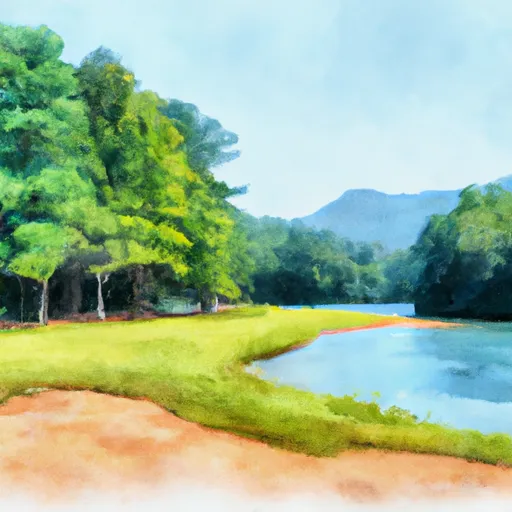
Upper Stamp Creek - Allatoona Lake
The campground amenities at Upper Stamp Creek include restrooms, showers, picnic tables, fire rings, and grills. There are a total of 30 campsites available, and reservations can be made online or by phone. The campground operates on a first-come-first-serve basis, so it's recommended to book in advance during peak season.
An interesting fact about the area is that it was once home to the Cherokee people, who were forced to leave during the Trail of Tears in the 1830s. Today, visitors can explore the nearby Etowah Indian Mounds Historic Site to learn more about the area's Native American heritage.
The best time of year to visit Upper Stamp Creek is during the spring and fall months, when temperatures are mild and the foliage is at its most vibrant. Average temperatures during these seasons range from the mid-50s to mid-70s. Summers can be hot and humid, with temperatures often reaching the 90s, while winters can be chilly with occasional snowfall.
What's on-site at Upper Stamp Creek - Allatoona Lake
Key facilities Snoflo tracks for this campground. Confirm with the operator before booking -- amenities can change seasonally.
Plan your trip down to the hour
Same weather feed Snoflo's iOS app uses -- updated continuously from NOAA / yr.no.
Next 5 days, hour by hour
Temperature line with weather symbols on top, snow + rain accumulation as columns, humidity as a dotted line.
5-day forecast table
Every 3 hours, broken out across temperature, snow, rain, humidity, and wind. Each cell is colour-coded relative to the column min/max so trends jump out at a glance.
| Time | Condition | Temp (°F) | Snow (in) | Rain (in) | Humidity (%) | Wind (mps) | Wind dir |
|---|---|---|---|---|---|---|---|
| Loading detailed forecast… | |||||||
15-day temperature & precipitation
Daily temperatures, snow, and rain projected over the next two weeks. Hover any point for the full breakdown.
Other campgrounds in the area
Snoflo-tracked campsites within driving distance of Upper Stamp Creek - Allatoona Lake, with reservations status.
| Campground | Reservations | Toilets | View |
|---|---|---|---|
| Macedonia - Lake Allatoona | ✗ | ✓ | → |
| Mckaskey Creek - Allatoona Lake | ✓ | ✗ | → |
| Gatewood - Lake Allatoona | ✗ | ✗ | → |
| Red Top Mountain State Park | ✓ | ✗ | → |
| Victoria - Allatoona Lake | ✓ | ✗ | → |
Nearby streamflow
USGS streamgauges within reach of Upper Stamp Creek - Allatoona Lake -- pulled live from the National Water Information System.
| Streamgauge | Discharge | View |
|---|---|---|
| Etowah River At Allatoona Dam | 3,350 cfs | → |
| Etowah River At Ga 61 | 785 cfs | → |
| Etowah River At Canton | 577 cfs | → |
| Two Run Creek Near Kingston | 11 cfs | → |
| Noonday Creek At Shallowford Road | 29 cfs | → |
| Noonday Creek At Hawkins Store Rd | 25 cfs | → |
Plan a longer trip
The closest parks, lakes, boat launches, and paddle runs so a camping night can grow into a full weekend.
Parks
- Red Top Mountain State Park
- Bartow Carver Park
- Matthew Hill Park
- Hobgood Park
- Clearwater Street Park
- Cartersville Baseball Complex
Boat launches
- State Highway 20 Spur Southeast 1121, Cartersville
- Overlook Drive 1 163, 30102
- Gayle Drive Southeast Bartow County
- North Main Street Southeast Bartow County
- Us 411;Ga 20 Bartow County
- Park Drive Northeast Gordon County
Fishing spots
Camping essentials & Leave No Trace
- Pack it in, pack it out
- Take all trash, food scraps, and gear back with you to keep campsites clean and protect wildlife.
- Respect wildlife
- Observe animals from a distance, store food securely, and never feed wildlife to maintain natural behavior and safety.
- Know before you go
- Check weather, fire restrictions, trail conditions, and permit requirements to ensure a safe and well-planned trip.
- Minimize campfire impact
- Use established fire rings, keep fires small, fully extinguish them, or opt for a camp stove when fires are restricted.
- Leave what you find
- Preserve natural and cultural features by avoiding removal of plants, rocks, artifacts, or other elements of the environment.
Set push alerts in the Snoflo app
Save Upper Stamp Creek - Allatoona Lake as a favorite, set a custom threshold (precipitation, snowpack, freezing temperatures), and the iOS app will push the moment conditions cross.
About Upper Stamp Creek - Allatoona Lake
Can I make reservations at Upper Stamp Creek - Allatoona Lake?
Yes -- this campground accepts reservations. Snoflo recommends booking early for peak season; check the operator (Recreation.gov / state park system / private operator) for the booking window and cancellation policy.
How fresh is the weather data on this page?
The hourly forecast updates throughout the day from the NOAA / yr.no public feeds. Streamflow data is pulled live from USGS streamgauges and snowpack from the NRCS SNOTEL network.
What's the best time of year to visit?
Use the 15-day temperature & precipitation outlook on this page to plan -- pick a window with comfortable temperatures and low precipitation. For longer trips, the 5-day hourly meteogram shows snow + rain accumulation hour-by-hour.
How do I get to Upper Stamp Creek - Allatoona Lake?
Tap Directions in the hero above to open driving directions in Google Maps, or Open in map to center the Snoflo interactive map on the campground.
Can I get alerts when conditions change?
Yes -- alerts are managed through the Snoflo iOS app. Favorite this campground, set a threshold (temperature, snowpack, precipitation), and you'll get a push the moment it crosses.
Other campgrounds near here
Snoflo-tracked campgrounds within driving distance of Upper Stamp Creek - Allatoona Lake.