Crystal Springs - Lake Ouachita campground
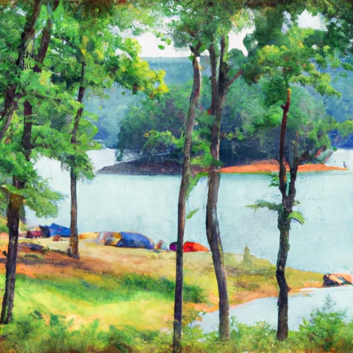
Crystal Springs - Lake Ouachita
Reservations are accepted at Crystal Springs - Lake Ouachita campground, allowing campers to secure their preferred campsite in advance. It is advisable to make reservations, especially during peak seasons, to ensure availability. The best time of year to visit this camping area is during the spring and fall when the weather is pleasant, and the campground offers stunning views of Lake Ouachita.
Campers should be cautious of certain aspects while camping at Crystal Springs - Lake Ouachita. The area is known for its wildlife, so it is vital to store food properly and be respectful of the natural habitat. Additionally, campers should be aware of any potential hazards in the campground, such as uneven terrain or slippery surfaces near the lake. By being mindful of these factors, campers can fully enjoy their experience at Crystal Springs - Lake Ouachita camping area.
What's on-site at Crystal Springs - Lake Ouachita
Key facilities Snoflo tracks for this campground. Confirm with the operator before booking -- amenities can change seasonally.
Plan your trip down to the hour
Same weather feed Snoflo's iOS app uses -- updated continuously from NOAA / yr.no.
Next 5 days, hour by hour
Temperature line with weather symbols on top, snow + rain accumulation as columns, humidity as a dotted line.
5-day forecast table
Every 3 hours, broken out across temperature, snow, rain, humidity, and wind. Each cell is colour-coded relative to the column min/max so trends jump out at a glance.
| Time | Condition | Temp (°F) | Snow (in) | Rain (in) | Humidity (%) | Wind (mps) | Wind dir |
|---|---|---|---|---|---|---|---|
| Loading detailed forecast… | |||||||
15-day temperature & precipitation
Daily temperatures, snow, and rain projected over the next two weeks. Hover any point for the full breakdown.
Other campgrounds in the area
Snoflo-tracked campsites within driving distance of Crystal Springs - Lake Ouachita, with reservations status.
| Campground | Reservations | Toilets | View |
|---|---|---|---|
| Charlton Recreation Area | ✓ | ✗ | → |
| Charlton | ✗ | ✗ | → |
| Camp Clearfork | ✓ | ✗ | → |
| Buckville - Lake Ouachita | ✗ | ✓ | → |
| Rabbit Tail - Lake Ouachita | ✗ | ✗ | → |
Nearby streamflow
USGS streamgauges within reach of Crystal Springs - Lake Ouachita -- pulled live from the National Water Information System.
| Streamgauge | Discharge | View |
|---|---|---|
| West Fork Hot Springs Creek At Hot Springs | · | → |
| Caddo River Near Caddo Gap | 173 cfs | → |
| Ouachita River Near Mount Ida | 4,680 cfs | → |
| Ouachita River At Remmel Dam Above Jones Mill | 279 cfs | → |
| Fourche Lafave River Near Gravelly | 3,650 cfs | → |
| Alum Fork Saline River Near Reform | 120 cfs | → |
Plan a longer trip
The closest parks, lakes, boat launches, and paddle runs so a camping night can grow into a full weekend.
Parks
- Lake Ouachita State Park
- Hill Wheatley Park
- Hot Springs National Park
- Ouachita National Wildlife Refuge
- Muddy Creek Wildlife Management Area
- Kimery Park
Boat launches
- Brady Mountain Road Garland County
- Blakely Dam Road Garland County
- Lena Use Area Cove Garland County
- Montgomery County
- Lake Vista Drive Montgomery County
- Stewart Circle 126, Garland County
Fishing spots
- Clearfork
- Camp Clear Fork Reservoir
- Lake Ouachita
- Dragover Day Use
- Rocky Shoals Day Use
- De Gray Lake
Paddle runs
- Highway 298 Bridge Near Sims, Ar To Slackwater Of Lake Ouachita
- Headwaters Sec 2, T1n, R20w To Sec 7, T1n, R19w
- Lake Winona Dam To Southern Line Of Sec 16, T2n, R17w
- Nf Boundary At Pine Ridge, Ar To Highway 298 Bridge Near Sims, Ar
- Sec 30, T3s, R27w To Sec 19, T4s, R24w
- Headwaters Sec 2, T2n, R18w To Forest Road 132c
Camping essentials & Leave No Trace
- Pack it in, pack it out
- Take all trash, food scraps, and gear back with you to keep campsites clean and protect wildlife.
- Respect wildlife
- Observe animals from a distance, store food securely, and never feed wildlife to maintain natural behavior and safety.
- Know before you go
- Check weather, fire restrictions, trail conditions, and permit requirements to ensure a safe and well-planned trip.
- Minimize campfire impact
- Use established fire rings, keep fires small, fully extinguish them, or opt for a camp stove when fires are restricted.
- Leave what you find
- Preserve natural and cultural features by avoiding removal of plants, rocks, artifacts, or other elements of the environment.
Set push alerts in the Snoflo app
Save Crystal Springs - Lake Ouachita as a favorite, set a custom threshold (precipitation, snowpack, freezing temperatures), and the iOS app will push the moment conditions cross.
About Crystal Springs - Lake Ouachita
Can I make reservations at Crystal Springs - Lake Ouachita?
Yes -- this campground accepts reservations. Snoflo recommends booking early for peak season; check the operator (Recreation.gov / state park system / private operator) for the booking window and cancellation policy.
How fresh is the weather data on this page?
The hourly forecast updates throughout the day from the NOAA / yr.no public feeds. Streamflow data is pulled live from USGS streamgauges and snowpack from the NRCS SNOTEL network.
What's the best time of year to visit?
Use the 15-day temperature & precipitation outlook on this page to plan -- pick a window with comfortable temperatures and low precipitation. For longer trips, the 5-day hourly meteogram shows snow + rain accumulation hour-by-hour.
How do I get to Crystal Springs - Lake Ouachita?
Tap Directions in the hero above to open driving directions in Google Maps, or Open in map to center the Snoflo interactive map on the campground.
Can I get alerts when conditions change?
Yes -- alerts are managed through the Snoflo iOS app. Favorite this campground, set a threshold (temperature, snowpack, precipitation), and you'll get a push the moment it crosses.
Other campgrounds near here
Snoflo-tracked campgrounds within driving distance of Crystal Springs - Lake Ouachita.