Highway 27 - Lake Ouachita campground
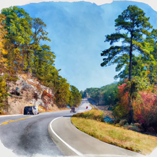
Highway 27 - Lake Ouachita
Reservations are accepted at Highway 27 - Lake Ouachita camping area, as stated by multiple sources. This allows campers to secure their preferred campsites in advance, ensuring a smooth and hassle-free arrival. It is advisable to make reservations early, especially during peak seasons, as this campground is popular among outdoor enthusiasts.
The best time of year to visit Highway 27 - Lake Ouachita camping area is during the spring and fall seasons. The moderate temperatures and milder weather make these times ideal for outdoor activities such as hiking, fishing, and boating. However, it is important to be cautious of potential crowds during holiday weekends and school breaks. Campers should also be aware of the wildlife in the area, including snakes and ticks, and take necessary precautions to stay safe. By following these tips and utilizing the amenities provided, campers can fully enjoy their experience at Highway 27 - Lake Ouachita camping area in Arkansas.
What's on-site at Highway 27 - Lake Ouachita
Key facilities Snoflo tracks for this campground. Confirm with the operator before booking -- amenities can change seasonally.
Plan your trip down to the hour
Same weather feed Snoflo's iOS app uses -- updated continuously from NOAA / yr.no.
Next 5 days, hour by hour
Temperature line with weather symbols on top, snow + rain accumulation as columns, humidity as a dotted line.
5-day forecast table
Every 3 hours, broken out across temperature, snow, rain, humidity, and wind. Each cell is colour-coded relative to the column min/max so trends jump out at a glance.
| Time | Condition | Temp (°F) | Snow (in) | Rain (in) | Humidity (%) | Wind (mps) | Wind dir |
|---|---|---|---|---|---|---|---|
| Loading detailed forecast… | |||||||
15-day temperature & precipitation
Daily temperatures, snow, and rain projected over the next two weeks. Hover any point for the full breakdown.
Other campgrounds in the area
Snoflo-tracked campsites within driving distance of Highway 27 - Lake Ouachita, with reservations status.
| Campground | Reservations | Toilets | View |
|---|---|---|---|
| Washita - Lake Ouachita | ✗ | ✗ | → |
| High Shoals Cabins | ✗ | ✗ | → |
| Little Fir - Lake Ouachita | ✗ | ✓ | → |
| River Bluff | ✗ | ✓ | → |
| Dragover | ✗ | ✓ | → |
Nearby streamflow
USGS streamgauges within reach of Highway 27 - Lake Ouachita -- pulled live from the National Water Information System.
| Streamgauge | Discharge | View |
|---|---|---|
| Ouachita River Near Mount Ida | 144 cfs | → |
| Caddo River Near Caddo Gap | 65 cfs | → |
| Fourche Lafave River Near Gravelly | 1,510 cfs | → |
| Dutch Creek At Waltreak | · | → |
| West Fork Hot Springs Creek At Hot Springs | · | → |
| Little Missouri River Near Langley | 82 cfs | → |
Plan a longer trip
The closest parks, lakes, boat launches, and paddle runs so a camping night can grow into a full weekend.
Parks
- Muddy Creek Wildlife Management Area
- Ouachita National Wildlife Refuge
- Mark Green Memorial Park
- Glenwood City Park
- Lake Ouachita State Park
- Hill Wheatley Park
Boat launches
- Montgomery County
- Lake Vista Drive Montgomery County
- Brady Mountain Road Garland County
- Lena Use Area Cove Garland County
- Blakely Dam Road Garland County
Fishing spots
- Dragover Day Use
- Rocky Shoals Day Use
- Lake Ouachita
- Camp Clear Fork Reservoir
- Clearfork
- Big Brushy Creek Day Use
Paddle runs
- Highway 298 Bridge Near Sims, Ar To Slackwater Of Lake Ouachita
- Nf Boundary At Pine Ridge, Ar To Highway 298 Bridge Near Sims, Ar
- Sec 30, T3s, R27w To Sec 19, T4s, R24w
- Headwaters Sec 2, T1n, R20w To Sec 7, T1n, R19w
- Lake Winona Dam To Southern Line Of Sec 16, T2n, R17w
- Headwaters In Sec 8, T1s, R31w To Nf Boundary At Acorn, Ar
Camping essentials & Leave No Trace
- Pack it in, pack it out
- Take all trash, food scraps, and gear back with you to keep campsites clean and protect wildlife.
- Respect wildlife
- Observe animals from a distance, store food securely, and never feed wildlife to maintain natural behavior and safety.
- Know before you go
- Check weather, fire restrictions, trail conditions, and permit requirements to ensure a safe and well-planned trip.
- Minimize campfire impact
- Use established fire rings, keep fires small, fully extinguish them, or opt for a camp stove when fires are restricted.
- Leave what you find
- Preserve natural and cultural features by avoiding removal of plants, rocks, artifacts, or other elements of the environment.
Set push alerts in the Snoflo app
Save Highway 27 - Lake Ouachita as a favorite, set a custom threshold (precipitation, snowpack, freezing temperatures), and the iOS app will push the moment conditions cross.
About Highway 27 - Lake Ouachita
Can I make reservations at Highway 27 - Lake Ouachita?
This campground does not appear to accept reservations -- it's typically first-come, first-served. Arrive early on summer weekends.
How fresh is the weather data on this page?
The hourly forecast updates throughout the day from the NOAA / yr.no public feeds. Streamflow data is pulled live from USGS streamgauges and snowpack from the NRCS SNOTEL network.
What's the best time of year to visit?
Use the 15-day temperature & precipitation outlook on this page to plan -- pick a window with comfortable temperatures and low precipitation. For longer trips, the 5-day hourly meteogram shows snow + rain accumulation hour-by-hour.
How do I get to Highway 27 - Lake Ouachita?
Tap Directions in the hero above to open driving directions in Google Maps, or Open in map to center the Snoflo interactive map on the campground.
Can I get alerts when conditions change?
Yes -- alerts are managed through the Snoflo iOS app. Favorite this campground, set a threshold (temperature, snowpack, precipitation), and you'll get a push the moment it crosses.
Other campgrounds near here
Snoflo-tracked campgrounds within driving distance of Highway 27 - Lake Ouachita.