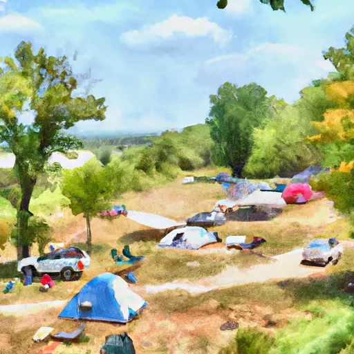
Model Campsite Campground
Community Reviews
Been here? Share the conditions.
Reviews, ratings & photos are added in the free Snoflo iOS app — rate a spot, tag the conditions, and your visit is verified by location. Add or manage your reviews from the app.
Model Campsite
Reservations are accepted at Model Campsite, allowing campers to secure their preferred campsites in advance. It is recommended to make a reservation, especially during the peak camping season, to ensure availability. The campground is open year-round, offering camping opportunities in all seasons.
The best time to visit Model Campsite is during the spring and fall when the weather is mild, and nature is at its most vibrant. Visitors can enjoy hiking and exploring the surrounding trails, fishing in nearby ponds, or simply relaxing amidst the beautiful natural scenery. However, it is advisable to check weather conditions before planning a trip, as Iowa's weather can be unpredictable.
It is important for campers to be cautious of wildlife, such as snakes and insects, that may be present in the camping area. It is recommended to keep a safe distance and take necessary precautions to avoid any unwanted encounters. Overall, Model Campsite offers a pleasant and well-maintained camping experience, making it an ideal destination for nature lovers and outdoor enthusiasts.
What's on-site at Model Campsite
Key facilities Snoflo tracks for this campground. Confirm with the operator before booking -- amenities can change seasonally.
Plan your trip down to the hour
Same weather feed Snoflo's iOS app uses -- updated continuously from NOAA / yr.no.
Next 5 days, hour by hour
Temperature line with weather symbols on top, snow + rain accumulation as columns, humidity as a dotted line.
5-day forecast table
Every 3 hours, broken out across temperature, snow, rain, humidity, and wind. Each cell is colour-coded relative to the column min/max so trends jump out at a glance.
| Time | Condition | Temp (°F) | Snow (in) | Rain (in) | Humidity (%) | Wind (mps) | Wind dir |
|---|---|---|---|---|---|---|---|
| Loading detailed forecast… | |||||||
15-day temperature & precipitation
Daily temperatures, snow, and rain projected over the next two weeks. Hover any point for the full breakdown.
Nearby streamflow
USGS streamgauges within reach of Model Campsite -- pulled live from the National Water Information System.
| Streamgauge | Discharge | View |
|---|---|---|
| Squaw Creek At Ames | 155 cfs | → |
| South Skunk River Below Squaw Creek Near Ames | 381 cfs | → |
| South Skunk River Near Ames | 185 cfs | → |
| Beaver Creek Near Grimes | 140 cfs | → |
| Des Moines River Near Stratford | 1,010 cfs | → |
| Des Moines River Near Saylorville | 1,520 cfs | → |
Nearby snow depths
NRCS SNOTEL stations within reach of Model Campsite -- relevant when planning a shoulder-season or alpine trip.
| SNOTEL station | Snowpack | 24h Snowfall | View |
|---|---|---|---|
| Boone | 0.0 in | 0.0 in | → |
| Ames 2.1 N | 0.0 in | 0.0 in | → |
| Ames 0.9 Ene | 0.0 in | 0.0 in | → |
| Johnston 3.7 Nnw | 0.0 in | 0.0 in | → |
| Des Moines | 0.0 in | 0.0 in | → |
| Blo Squaw Ck On The South Skunk R. | 0.0 in | 0.0 in | → |
Plan a longer trip
The closest parks, lakes, boat launches, and paddle runs so a camping night can grow into a full weekend.
Parks
- Ledges State Park
- Mchose Park
- Hermans Park
- Bouton City Park
- Don Williams County Park
- Barkley Memorial State Park
Camping essentials & Leave No Trace
- Pack it in, pack it out
- Take all trash, food scraps, and gear back with you to keep campsites clean and protect wildlife.
- Respect wildlife
- Observe animals from a distance, store food securely, and never feed wildlife to maintain natural behavior and safety.
- Know before you go
- Check weather, fire restrictions, trail conditions, and permit requirements to ensure a safe and well-planned trip.
- Minimize campfire impact
- Use established fire rings, keep fires small, fully extinguish them, or opt for a camp stove when fires are restricted.
- Leave what you find
- Preserve natural and cultural features by avoiding removal of plants, rocks, artifacts, or other elements of the environment.
Set push alerts in the Snoflo app
Save Model Campsite as a favorite, set a custom threshold (precipitation, snowpack, freezing temperatures), and the iOS app will push the moment conditions cross.
About Model Campsite
Can I make reservations at Model Campsite?
This campground does not appear to accept reservations -- it's typically first-come, first-served. Arrive early on summer weekends.
How fresh is the weather data on this page?
The hourly forecast updates throughout the day from the NOAA / yr.no public feeds. Streamflow data is pulled live from USGS streamgauges and snowpack from the NRCS SNOTEL network.
What's the best time of year to visit?
Use the 15-day temperature & precipitation outlook on this page to plan -- pick a window with comfortable temperatures and low precipitation. For longer trips, the 5-day hourly meteogram shows snow + rain accumulation hour-by-hour.
How do I get to Model Campsite?
Tap Directions in the hero above to open driving directions in Google Maps, or Open in map to center the Snoflo interactive map on the campground.
Can I get alerts when conditions change?
Yes -- alerts are managed through the Snoflo iOS app. Favorite this campground, set a threshold (temperature, snowpack, precipitation), and you'll get a push the moment it crosses.