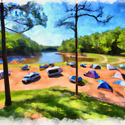
Shirley Creek campground
Shirley Creek
Reservations are accepted at Shirley Creek camping area, making it convenient for visitors to secure a spot. It is recommended to make reservations in advance, especially during peak season, to ensure availability. The best time to visit this campground is during the warmer months, from April to October, when the weather is pleasant and ideal for outdoor activities.
While camping at Shirley Creek, there are a few things to keep in mind. It is advisable to bring insect repellent, as mosquitoes and ticks can be present in the area. It is also important to be cautious of wildlife and practice proper food storage to prevent encounters with animals. Lastly, campers should follow all safety guidelines and regulations to ensure a safe and enjoyable experience.
In conclusion, Shirley Creek camping area in Arkansas offers a range of amenities, accepts reservations, and is best enjoyed from April to October. With its scenic hiking trails and well-maintained facilities, it provides a fantastic opportunity to connect with nature. Just remember to come prepared with insect repellent, be cautious of wildlife, and adhere to safety guidelines for a memorable camping experience.
What's on-site at Shirley Creek
Key facilities Snoflo tracks for this campground. Confirm with the operator before booking -- amenities can change seasonally.
Plan your trip down to the hour
Same weather feed Snoflo's iOS app uses -- updated continuously from NOAA / yr.no.
Next 5 days, hour by hour
Temperature line with weather symbols on top, snow + rain accumulation as columns, humidity as a dotted line.
5-day forecast table
Every 3 hours, broken out across temperature, snow, rain, humidity, and wind. Each cell is colour-coded relative to the column min/max so trends jump out at a glance.
| Time | Condition | Temp (°F) | Snow (in) | Rain (in) | Humidity (%) | Wind (mps) | Wind dir |
|---|---|---|---|---|---|---|---|
| Loading detailed forecast… | |||||||
15-day temperature & precipitation
Daily temperatures, snow, and rain projected over the next two weeks. Hover any point for the full breakdown.
Other campgrounds in the area
Snoflo-tracked campsites within driving distance of Shirley Creek, with reservations status.
| Campground | Reservations | Toilets | View |
|---|---|---|---|
| Big Brushy | ✗ | ✓ | → |
| Rocky Shoals | ✗ | ✓ | → |
| Fulton Branch | ✗ | ✓ | → |
| Dragover | ✗ | ✓ | → |
| River Bluff | ✗ | ✓ | → |
Nearby streamflow
USGS streamgauges within reach of Shirley Creek -- pulled live from the National Water Information System.
| Streamgauge | Discharge | View |
|---|---|---|
| Ouachita River Near Mount Ida | 144 cfs | → |
| Caddo River Near Caddo Gap | 65 cfs | → |
| Fourche Lafave River Near Gravelly | 1,510 cfs | → |
| Little Missouri River Near Langley | 82 cfs | → |
| Cossatot River Near Vandervoort | 141 cfs | → |
| Dutch Creek At Waltreak | · | → |
Nearby snow depths
NRCS SNOTEL stations within reach of Shirley Creek -- relevant when planning a shoulder-season or alpine trip.
| SNOTEL station | Snowpack | 24h Snowfall | View |
|---|---|---|---|
| Bogg Springs | 2.0 in | 0.0 in | → |
| Dequeen | 0.0 in | 0.0 in | → |
Plan a longer trip
The closest parks, lakes, boat launches, and paddle runs so a camping night can grow into a full weekend.
Parks
- Mark Green Memorial Park
- Muddy Creek Wildlife Management Area
- Ouachita National Wildlife Refuge
- National Wild And Scenic River Little Missouri, Arkansas
- Caney Creek National Game Refuge
- Caney Creek Wildlife Management Area
Camping essentials & Leave No Trace
- Pack it in, pack it out
- Take all trash, food scraps, and gear back with you to keep campsites clean and protect wildlife.
- Respect wildlife
- Observe animals from a distance, store food securely, and never feed wildlife to maintain natural behavior and safety.
- Know before you go
- Check weather, fire restrictions, trail conditions, and permit requirements to ensure a safe and well-planned trip.
- Minimize campfire impact
- Use established fire rings, keep fires small, fully extinguish them, or opt for a camp stove when fires are restricted.
- Leave what you find
- Preserve natural and cultural features by avoiding removal of plants, rocks, artifacts, or other elements of the environment.
Set push alerts in the Snoflo app
Save Shirley Creek as a favorite, set a custom threshold (precipitation, snowpack, freezing temperatures), and the iOS app will push the moment conditions cross.
About Shirley Creek
Can I make reservations at Shirley Creek?
This campground does not appear to accept reservations -- it's typically first-come, first-served. Arrive early on summer weekends.
How fresh is the weather data on this page?
The hourly forecast updates throughout the day from the NOAA / yr.no public feeds. Streamflow data is pulled live from USGS streamgauges and snowpack from the NRCS SNOTEL network.
What's the best time of year to visit?
Use the 15-day temperature & precipitation outlook on this page to plan -- pick a window with comfortable temperatures and low precipitation. For longer trips, the 5-day hourly meteogram shows snow + rain accumulation hour-by-hour.
How do I get to Shirley Creek?
Tap Directions in the hero above to open driving directions in Google Maps, or Open in map to center the Snoflo interactive map on the campground.
Can I get alerts when conditions change?
Yes -- alerts are managed through the Snoflo iOS app. Favorite this campground, set a threshold (temperature, snowpack, precipitation), and you'll get a push the moment it crosses.
Other campgrounds near here
Snoflo-tracked campgrounds within driving distance of Shirley Creek.