Wapsipinicon State Park Campground campground
Community Reviews
Been here? Share the conditions.
Reviews, ratings & photos are added in the free Snoflo iOS app — rate a spot, tag the conditions, and your visit is verified by location. Add or manage your reviews from the app.
Wapsipinicon State Park Campground
The campground itself offers a variety of amenities, including electric and non-electric sites, modern restrooms and showers, picnic tables, fire rings, and a playground for kids. The campground also has a dump station for RVs, and is pet-friendly. The campground is first-come-first-serve, so reservations are not required.
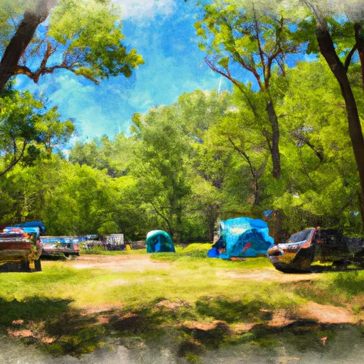
There are 40 campsites available at the Wapsipinicon State Park campground, which can accommodate both tents and RVs. The campsites are located in a wooded area, which offers a peaceful and quiet environment for visitors.
The Wapsipinicon River is known for its unique features, such as its winding curves and its ability to freeze over completely during the winter months. Visitors can also enjoy a variety of wildlife in the area, such as bald eagles and river otters.
The best time to visit Wapsipinicon State Park campground is during the summer months, from June to August, with average temperatures ranging from 70 to 85 degrees Fahrenheit. The fall months are also a popular time to visit, with cooler temperatures and stunning foliage.
What's on-site at Wapsipinicon State Park Campground
Key facilities Snoflo tracks for this campground. Confirm with the operator before booking -- amenities can change seasonally.
Plan your trip down to the hour
Same weather feed Snoflo's iOS app uses -- updated continuously from NOAA / yr.no.
Next 5 days, hour by hour
Temperature line with weather symbols on top, snow + rain accumulation as columns, humidity as a dotted line.
5-day forecast table
Every 3 hours, broken out across temperature, snow, rain, humidity, and wind. Each cell is colour-coded relative to the column min/max so trends jump out at a glance.
| Time | Condition | Temp (°F) | Snow (in) | Rain (in) | Humidity (%) | Wind (mps) | Wind dir |
|---|---|---|---|---|---|---|---|
| Loading detailed forecast… | |||||||
15-day temperature & precipitation
Daily temperatures, snow, and rain projected over the next two weeks. Hover any point for the full breakdown.
Other campgrounds in the area
Snoflo-tracked campsites within driving distance of Wapsipinicon State Park Campground, with reservations status.
| Campground | Reservations | Toilets | View |
|---|---|---|---|
| Wapsipinicon State Park | ✓ | ✗ | → |
| Matsell Bridge Natural Area | ✗ | ✗ | → |
| Pack In Campsite #1 | ✗ | ✗ | → |
| Pack In Campsite #2 | ✗ | ✗ | → |
| Central Park | ✗ | ✓ | → |
Nearby streamflow
USGS streamgauges within reach of Wapsipinicon State Park Campground -- pulled live from the National Water Information System.
| Streamgauge | Discharge | View |
|---|---|---|
| Wapsipinicon River Near Anamosa | 2,930 cfs | → |
| Cedar River At Cedar Rapids | 27,500 cfs | → |
| Maquoketa River At Manchester | 318 cfs | → |
| Iowa River Below Coralville Dam Nr Coralville | 4,150 cfs | → |
| North Fork Maquoketa River Near Fulton | 488 cfs | → |
| Rapid Creek Near Iowa City | 11 cfs | → |
Nearby snow depths
NRCS SNOTEL stations within reach of Wapsipinicon State Park Campground -- relevant when planning a shoulder-season or alpine trip.
| SNOTEL station | Snowpack | 24h Snowfall | View |
|---|---|---|---|
| Anamosa 3 Ssw | 0.0 in | 0.0 in | → |
| Cedar Rapids No 1 | 0.0 in | 0.0 in | → |
| Cedar Rapids 2.5 Wsw | 0.0 in | 0.0 in | → |
| Fairfax 4.0 Nw | 0.0 in | 0.0 in | → |
| Fulton | 0.0 in | 0.0 in | → |
| Coralville 1.4 S | 0.0 in | 0.0 in | → |
Plan a longer trip
The closest parks, lakes, boat launches, and paddle runs so a camping night can grow into a full weekend.
Camping essentials & Leave No Trace
- Pack it in, pack it out
- Take all trash, food scraps, and gear back with you to keep campsites clean and protect wildlife.
- Respect wildlife
- Observe animals from a distance, store food securely, and never feed wildlife to maintain natural behavior and safety.
- Know before you go
- Check weather, fire restrictions, trail conditions, and permit requirements to ensure a safe and well-planned trip.
- Minimize campfire impact
- Use established fire rings, keep fires small, fully extinguish them, or opt for a camp stove when fires are restricted.
- Leave what you find
- Preserve natural and cultural features by avoiding removal of plants, rocks, artifacts, or other elements of the environment.
Set push alerts in the Snoflo app
Save Wapsipinicon State Park Campground as a favorite, set a custom threshold (precipitation, snowpack, freezing temperatures), and the iOS app will push the moment conditions cross.
About Wapsipinicon State Park Campground
Can I make reservations at Wapsipinicon State Park Campground?
This campground does not appear to accept reservations -- it's typically first-come, first-served. Arrive early on summer weekends.
How fresh is the weather data on this page?
The hourly forecast updates throughout the day from the NOAA / yr.no public feeds. Streamflow data is pulled live from USGS streamgauges and snowpack from the NRCS SNOTEL network.
What's the best time of year to visit?
Use the 15-day temperature & precipitation outlook on this page to plan -- pick a window with comfortable temperatures and low precipitation. For longer trips, the 5-day hourly meteogram shows snow + rain accumulation hour-by-hour.
How do I get to Wapsipinicon State Park Campground?
Tap Directions in the hero above to open driving directions in Google Maps, or Open in map to center the Snoflo interactive map on the campground.
Can I get alerts when conditions change?
Yes -- alerts are managed through the Snoflo iOS app. Favorite this campground, set a threshold (temperature, snowpack, precipitation), and you'll get a push the moment it crosses.
Other campgrounds near here
Snoflo-tracked campgrounds within driving distance of Wapsipinicon State Park Campground.