Turnhole Bend Backcountry Campsite Campground
Community Reviews
Been here? Share the conditions.
Reviews, ratings & photos are added in the free Snoflo iOS app — rate a spot, tag the conditions, and your visit is verified by location. Add or manage your reviews from the app.
Turnhole Bend Backcountry Campsite
The nearby Mammoth Cave, the longest known cave system in the world, is undoubtedly the biggest attraction in the area. Visitors to Turnhole Bend can take guided tours of the cave or explore it on their own. Those interested in history can also visit the historic Mammoth Cave Hotel and the Mammoth Cave Baptist Church, both located within the park.
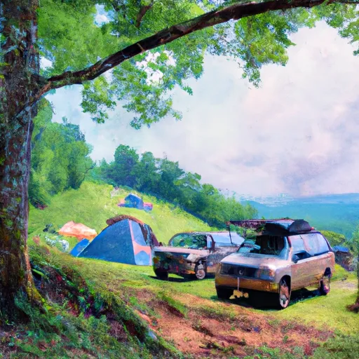
The campsite features basic amenities such as fire rings, picnic tables, and vault toilets. Visitors are advised to bring their own water, as there is no potable water available at the site. The camping area is only accessible by foot or by kayak/canoe, making it a truly remote wilderness experience.
Interesting facts about the area include the fact that it was once used by Native Americans for hunting and fishing. It was also a popular spot for moonshiners during Prohibition.
The best time to visit Turnhole Bend is in the fall or spring, when temperatures are mild and the foliage is at its most vibrant. Average temperatures in the fall range from the high 50s to the low 70s, while spring temperatures range from the 50s to the 80s.
Overall, Turnhole Bend is a beautiful and secluded camping area within Mammoth Cave National Park that offers stunning views, ample hiking opportunities, and a truly remote wilderness experience.
What's on-site at Turnhole Bend Backcountry Campsite
Key facilities Snoflo tracks for this campground. Confirm with the operator before booking -- amenities can change seasonally.
Plan your trip down to the hour
Same weather feed Snoflo's iOS app uses -- updated continuously from NOAA / yr.no.
Next 5 days, hour by hour
Temperature line with weather symbols on top, snow + rain accumulation as columns, humidity as a dotted line.
5-day forecast table
Every 3 hours, broken out across temperature, snow, rain, humidity, and wind. Each cell is colour-coded relative to the column min/max so trends jump out at a glance.
| Time | Condition | Temp (°F) | Snow (in) | Rain (in) | Humidity (%) | Wind (mps) | Wind dir |
|---|---|---|---|---|---|---|---|
| Loading detailed forecast… | |||||||
15-day temperature & precipitation
Daily temperatures, snow, and rain projected over the next two weeks. Hover any point for the full breakdown.
Other campgrounds in the area
Snoflo-tracked campsites within driving distance of Turnhole Bend Backcountry Campsite, with reservations status.
| Campground | Reservations | Toilets | View |
|---|---|---|---|
| Sal Hollow Backcountry Campsite | ✗ | ✗ | → |
| Maple Springs Group Campground | ✗ | ✗ | → |
| Green River | ✗ | ✗ | → |
| River Floodplain Campsites | ✗ | ✗ | → |
| Maple Springs | ✗ | ✗ | → |
Nearby streamflow
USGS streamgauges within reach of Turnhole Bend Backcountry Campsite -- pulled live from the National Water Information System.
| Streamgauge | Discharge | View |
|---|---|---|
| Bacon Creek Near Priceville | 42 cfs | → |
| Green River At Munfordville | 1,100 cfs | → |
| Barren River At Bowling Green | 405 cfs | → |
| Drakes Creek Near Alvaton | 222 cfs | → |
| Nolin River At White Mills | 359 cfs | → |
| Caney Creek Near Horse Branch | 101 cfs | → |
Plan a longer trip
The closest parks, lakes, boat launches, and paddle runs so a camping night can grow into a full weekend.
Parks
- Mammoth Cave National Park
- Brier Recreation Area
- Nolin Lake State Park
- Moutardier Recreation Area
- Dickeys Mill Recreation Area
- Wax Recreation Area
Camping essentials & Leave No Trace
- Pack it in, pack it out
- Take all trash, food scraps, and gear back with you to keep campsites clean and protect wildlife.
- Respect wildlife
- Observe animals from a distance, store food securely, and never feed wildlife to maintain natural behavior and safety.
- Know before you go
- Check weather, fire restrictions, trail conditions, and permit requirements to ensure a safe and well-planned trip.
- Minimize campfire impact
- Use established fire rings, keep fires small, fully extinguish them, or opt for a camp stove when fires are restricted.
- Leave what you find
- Preserve natural and cultural features by avoiding removal of plants, rocks, artifacts, or other elements of the environment.
Set push alerts in the Snoflo app
Save Turnhole Bend Backcountry Campsite as a favorite, set a custom threshold (precipitation, snowpack, freezing temperatures), and the iOS app will push the moment conditions cross.
About Turnhole Bend Backcountry Campsite
Can I make reservations at Turnhole Bend Backcountry Campsite?
This campground does not appear to accept reservations -- it's typically first-come, first-served. Arrive early on summer weekends.
How fresh is the weather data on this page?
The hourly forecast updates throughout the day from the NOAA / yr.no public feeds. Streamflow data is pulled live from USGS streamgauges and snowpack from the NRCS SNOTEL network.
What's the best time of year to visit?
Use the 15-day temperature & precipitation outlook on this page to plan -- pick a window with comfortable temperatures and low precipitation. For longer trips, the 5-day hourly meteogram shows snow + rain accumulation hour-by-hour.
How do I get to Turnhole Bend Backcountry Campsite?
Tap Directions in the hero above to open driving directions in Google Maps, or Open in map to center the Snoflo interactive map on the campground.
Can I get alerts when conditions change?
Yes -- alerts are managed through the Snoflo iOS app. Favorite this campground, set a threshold (temperature, snowpack, precipitation), and you'll get a push the moment it crosses.
Other campgrounds near here
Snoflo-tracked campgrounds within driving distance of Turnhole Bend Backcountry Campsite.