Guntersville Lake fishing
As of July 15, 2026, the nearest streamgauge to Guntersville Lake — Paint Rock River Near Woodville Al — reports 391 cfs. Source: USGS gauge data, refreshed throughout the day.
Community Reviews
Been here? Share the conditions.
Reviews, ratings & photos are added in the free Snoflo iOS app — rate a spot, tag the conditions, and your visit is verified by location. Add or manage your reviews from the app.
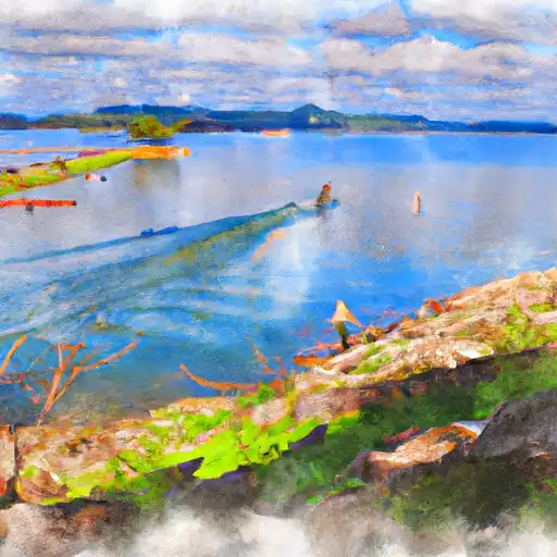
Guntersville Lake
What's biting at Guntersville Lake
Species commonly reported here -- tap any card for techniques, target seasons, and other waters where it's been caught.
Plan your trip down to the hour
Same weather feed Snoflo's iOS app uses -- updated continuously from NOAA / yr.no.
Next 5 days, hour by hour
Temperature line with weather symbols on top, snow + rain accumulation as columns, humidity as a dotted line.
5-day forecast table
Every 3 hours, broken out across temperature, snow, rain, humidity, and wind. Each cell is colour-coded relative to the column min/max so trends jump out at a glance.
| Time | Condition | Temp (°F) | Snow (in) | Rain (in) | Humidity (%) | Wind (mps) | Wind dir |
|---|---|---|---|---|---|---|---|
| Loading detailed forecast… | |||||||
15-day temperature & precipitation
Daily temperatures, snow, and rain projected over the next two weeks. Hover any point for the full breakdown.
Nearby streamflow
USGS streamgauges within reach of Guntersville Lake -- updated continuously from the National Water Information System.
| Streamgauge | Discharge | View |
|---|---|---|
| Paint Rock River Near Woodville Al | 391 cfs | → |
| Town Creek Near Geraldine Al | 49 cfs | → |
| Big Wills Creek At State Hwy 35 Nr Fort Payne | 14 cfs | → |
| Flint River At Brownsboro | 573 cfs | → |
| Aldridge Creek Near Farley Al | 93 cfs | → |
| Big Cove Creek At Dug Hill Road Nr Huntsville | 103 cfs | → |
Plan a longer trip
The closest campgrounds, parks, boat launches, and reservoirs so a fishing run can grow into a weekend.
Campgrounds
- Goose Pond Colony
- Bucks Pocket State Park
- Cathedral Caverns State Park
- Jackson County Park
- Town Creek Campground
- Lake Guntersville State Park
Parks
- Sauta Cave National Wildlife Refuge
- Bucks Pocket State Park
- Jackson County Park
- King Caldwell Park
- Lake Guntersville State Park
- Fern Cave National Wildlife Refuge
Reservoirs
- Little Paint Creek W/S Site 9
- Waites Dam
- Gilreath Lake
- Chitwood
- Bellefonte - Yard Drainage Pond
- Fletcher Gilbert
Boat launches
- County Road 67, Langston
- Highway 79 3333, Scottsboro
- The Docks
- Opposite Mile
- North Sauty Creek
- Winn Road 1162, Scottsboro
Points of interest
- Cathedral Caverns State Park
- Cathedral Caverns
- The Scottsboro Boy's Museum & Cultural Center
- Southern Scottsboro Depot
- B. B. Comer Bridge
- Mabrey's Rock Of Ages
Paddle runs
- Al 35 Bridge To Ends One Mile Upstream From Al 273 Bridge
- Desoto Falls In Desoto State Park To Confluence With Little River
- Begins One Mile Upstream From Al 273 Bridge To Lake Weiss
- Confluence With East And West Branches To Al 37 Bridge
- River Miles 8 Near Ga Sate Line To Confluence With Little River
Angling safety & ethics
- Know the regulations
- Check local fishing rules, seasons, size limits, and license requirements to ensure legal and sustainable angling.
- Handle fish responsibly
- Use wet hands, minimize air exposure, and release fish gently to improve survival rates when practicing catch-and-release.
- Choose the right gear
- Match your rod, line, and tackle to the species and conditions to increase success and reduce unnecessary harm to fish.
- Respect the waterway
- Avoid disturbing habitat, prevent bank erosion, and keep a safe distance from spawning areas to protect ecosystems.
- Keep it clean
- Pack out all line, hooks, bait containers, and trash. Discarded gear can injure wildlife and degrade waterways.
Set push alerts in the Snoflo app
Save Guntersville Lake as a favorite, set a custom threshold (water temperature, streamflow, snowpack), and the iOS app will push the moment conditions cross.
About Guntersville Lake
What fish species are found at Guntersville Lake?
Snoflo tracks the species commonly reported at Guntersville Lake -- see the Fish Species panel above for the live list with images and links to per-species pages.
How fresh is the weather data on this page?
The hourly forecast updates throughout the day from the NOAA / yr.no public feeds. Streamflow data comes live from USGS streamgauges, also refreshed continuously.
Can I get alerts when conditions change?
Yes -- alerts are managed through the Snoflo iOS app. Favorite this area, set a threshold (water temperature, streamflow, snowpack), and you'll get a push the moment it crosses.
Do I need a fishing license?
Yes. Check your state agency's regulations for license requirements, seasons, size limits, and any waterbody-specific rules before fishing Guntersville Lake.
How do I get to Guntersville Lake?
Tap Open in map in the hero above to center the Snoflo interactive map on this area, or grab the coordinates from the location facts panel.
Other angling spots near here
Snoflo-tracked fishing areas within driving distance of Guntersville Lake.