


-
 Snoflo Premium
Get unlimited access to all our content
With no Ad interruptions! - Start Your Free Trial Login with existing account
Weather Outlook
Seasonal Comparison
Historical Data
Regional Streamflow Levels
| Streamgauge | Streamflow | Gage Height |
|---|---|---|
| BAYOU DES CANNES NR EUNICE | 12 cfs | 1.3 ft |
| VERMILION RIVER AT SURREY ST. AT LAFAYETTE | 1,340 cfs | 7.7 ft |
| MERMENTAU RIVER AT MERMENTAU | 3,970 cfs | 3.0 ft |
| BAYOU COURTABLEAU AT WASHINGTON | 3,000 cfs | 21.6 ft |
| WHISKEY CHITTO CREEK NEAR OBERLIN | 2,780 cfs | 11.0 ft |
| BAYOU NEZPIQUE NEAR BASILE | 1,280 cfs | 14.7 ft |
| CALCASIEU RIVER NEAR OBERLIN | 2,810 cfs | 10.6 ft |
Fishing Destinations
Champagnolle Creek
Apache Trout • Blue Catfish • Kelp Bass
Moro Creek
Black Crappie • Blue Catfish • Kelp Bass
Coldwater Creek
Blue Catfish • Channel Catfish • Kelp Bass • Smallmouth Bass • Walleye
Delwein Lake
Black Crappie • Blue Catfish • Bluegill • Kelp Bass • Largemouth Bass • Walleye
Lake Cherrywood
Black Crappie • Blue Catfish • Bluegill • Kelp Bass
Gunner Creek
Apache Trout • Brook Trout • Kelp Bass • Smallmouth Bass
Lake Meyer
Black Crappie • Blue Catfish • Bluegill • Channel Catfish • Kelp Bass • Largemouth Bass
Bigalks Creek
American Shad • Apache Trout • Rainbow Trout
Bailey Lake
Black Crappie • Blue Catfish • Kelp Bass • Largemouth Bass
Barnett
Black Crappie • Blue Catfish • Kelp Bass
Lake Pine Bluff
Black Crappie • Blue Catfish • Kelp Bass
Lake Bennett
Black Crappie • Blue Catfish • Kelp Bass
Lake Georgia-Pacific
Black Crappie • Blue Catfish • Bluegill • Kelp Bass • Largemouth Bass
Fourche Creek
Black Crappie • Blue Catfish • Green Sunfish • Kelp Bass
Lake Valencia
Black Crappie • Blue Catfish • Bluegill • Kelp Bass • Largemouth Bass
Moro Bay
Largemouth Bass • Bluegill • Bowfin • Blue Catfish • Channel Catfish • Flathead Catfish • Black Crappie • Chain Pickerel
Craig D Campbell Lake Conway Reservoir
Black Crappie • Blue Catfish • Kelp Bass
Plum Bayou
Black Crappie • Blue Catfish • Kelp Bass
Little Maumelle River
Black Crappie • Blue Catfish • Kelp Bass
MacArthur Park Pond
Blue Catfish • Bluegill • Kelp Bass
Tri-County Lake
Black Crappie • Blue Catfish • Bluegill • Kelp Bass • Largemouth Bass
Area Boat Ramps
|
COUNTY ROUTE 809 OSAGE COUNTY
Watershed, |
|
PRAIRIE LAKE ROAD PHELPS COUNTY
Watershed, |
|
JEFFERSON CITY
Lower Missouri-Moreau Watershed, Missouri |
|
STATE HIGHWAY 14 DOUGLAS COUNTY
North Fork White Watershed, Missouri |
|
BULL SHOALS DAM BOULEVARD BULL SHOALS
Bull Shoals Lake Watershed, Arkansas |
|
US 54 OSAGE BEACH
Lake of the Ozarks Watershed, Missouri |
|
PA HE TSI BOAT LAUNCH
Lake of the Ozarks Watershed, Missouri |
|
STATE HIGHWAY HH OZARK COUNTY
Bull Shoals Lake Watershed, Missouri |
|
VALLEY AIRPORT DRIVE 380, COTTER
Bull Shoals Lake Watershed, Arkansas |
|
CHANEY ROAD LAKE OZARK
Lower Osage Watershed, Missouri |
Rafting & Kayaking
|
HEADWATERS SEC 2, T2N, R18W TO FOREST ROAD 132C
Upper Saline Watershed, Arkansas |
|
STATE HIGHWAY 49 BRIDGE NEAR DILLARD, MISSOURI TO FOREST BOUNDARY IN SECTIONS 13/24, T38N, R3W
Meramec Watershed, Missouri |
|
HEBRON ACCESS SITE TO SOUTHERN FOREST BOUNDARY IN SEC 33, T24N, R11W
North Fork White Watershed, Missouri |
|
EAST LINE OF NW 1/4, SEC 22, T2N, R17W TO WEST LINE OF SEC 26, T2N, R17W
Upper Saline Watershed, Arkansas |
|
LAKE WINONA DAM TO SOUTHERN LINE OF SEC 16, T2N, R17W
Upper Saline Watershed, Arkansas |
|
FOREST ROAD 179 TO EAST LINE OF NW 1/4 SEC 22, T2N, R17W
Upper Saline Watershed, Arkansas |
|
HEADWATERS SEC 2, T1N, R20W TO SEC 7, T1N, R19W
Upper Saline Watershed, Arkansas |
|
FOREST ROAD 132C TO FOREST RAOD 179
Upper Saline Watershed, Arkansas |
|
WESTERN EDGE OF OZARK NATIONAL SCENIC RIVERWAYS TO CONFLUENCE WITH ALLEY SPRING (BRANCH)
Current Watershed, Missouri |
|
NORTH FORK ILLINOIS BAYOU TO HEADWATERS BELOW PEDESTAL ROCK
Dardanelle Reservoir Watershed, Arkansas |
Parks & Recreation
|
HICKS STORE
The Hicks Store is a historic point of interest located in the Ozark National Forest in Arkansas. Originally built in the late 1800s, the store served as a hub for ... |
|
TAYLOR-MEDLEY GENERAL STORE
The Taylor-Medley General Store is a must-see point of interest in Arkansas. Located on the Buffalo National River, this historic general store has been around since the early 1900s and ... |
|
LEATHERWOOD WILDERNESS
|
|
NATIONAL PARK VISITOR CENTER
The National Park Visitor Center in Arkansas is a must-visit destination for nature enthusiasts. Located in the Hot Springs National Park, the center offers visitors a wealth of information about ... |
|
TYLER BEND VISITOR CENTER
The Tyler Bend Visitor Center is a must-visit point of interest in Arkansas for those interested in exploring the state's natural beauty. Located within the Buffalo National River park, the ... |
|
RUSH SMELTER
The Rush Smelter point of interest is a must-see attraction for visitors to Arkansas' Hot Springs National Park. This historic site was once home to a bustling silver mine and ... |
|
OLD WHITE EAGLE MILL RUINS
The Old White Eagle Mill Ruins, located in Arkansas, is a popular point of interest for visitors to the area. This historic site offers a glimpse into the state's past, ... |
|
BUFFALO POINT VISITOR CONTACT STATION
The Buffalo Point Visitor Contact Station is a point of interest in Arkansas that offers visitors a unique experience to explore the natural beauty of the Ozark Mountains. Located in ... |
|
NEW WHITE EAGLE MILL RUINS
The New White Eagle Mill Ruins is a point of interest located in Arkansas that is worth a visit for several reasons. First, the site offers a fascinating glimpse into ... |
|
HICKS HOTEL
Hicks Hotel is a historical point of interest located in the Hot Springs National Park in Arkansas. It is a former hotel that dates back to the 19th century and ... |
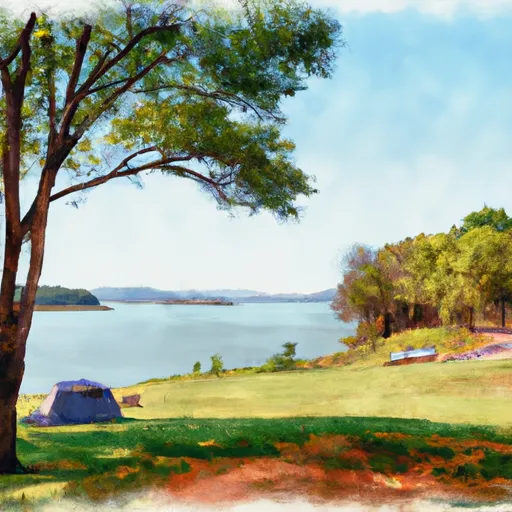
Nearby Campgrounds
| Camping Area | Campsites | Reservations | Toilets | Showers | Elevation |
|---|---|---|---|---|---|
| Ozark Isle - Bull Shoals Lake | Numerous | 689 ft | |||
| Gamaliel - Norfolk Lake | Numerous | 648 ft | |||
| Robinson Point - Norfolk Lake | Numerous | 605 ft | |||
| Buck Creek - Bull Shoals Lake | Numerous | 724 ft | |||
| Pontiac | Numerous | 796 ft | |||
| Theodosia | Numerous | 691 ft | |||
| Oakland - Bull Shoals Lake | Numerous | 722 ft | |||
| Lead Hill - Bull Shoals Lake | Numerous | 678 ft | |||
| Patrick Bridge Access - MDC | 12 | 613 ft | |||
| Highway 125 - Bull Shoals Lake | Numerous | 707 ft |