Bb Site Campground
Community Reviews
Been here? Share the conditions.
Reviews, ratings & photos are added in the free Snoflo iOS app — rate a spot, tag the conditions, and your visit is verified by location. Add or manage your reviews from the app.
Bb Site
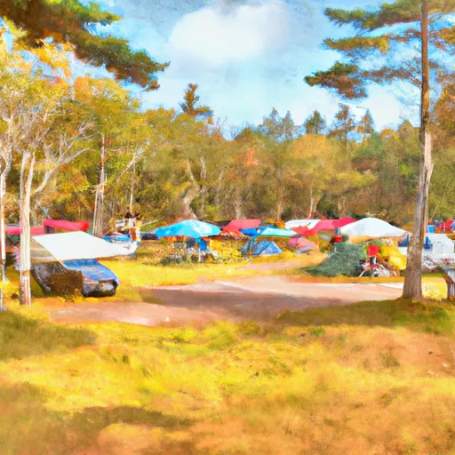
Reservations are accepted at Bb Site camping area, allowing campers to secure their preferred spot well in advance. It is recommended to make a reservation, especially during peak seasons, to ensure availability. The campground is open year-round, but the best time to visit is during the summer months when the weather is pleasant and the surrounding nature is at its most vibrant.
Bb Site camping area offers a variety of activities for campers, including hiking trails, fishing opportunities, and wildlife watching. It is important to be cautious of the local wildlife, such as bears, and take necessary precautions to store food securely. Additionally, campers should be aware of any specific regulations or guidelines set by the campground management to ensure a safe and enjoyable experience.
In conclusion, Bb Site camping area in Maine is a well-equipped campground that provides a comfortable and enjoyable camping experience for visitors. With its amenities, the option for reservations, and the beautiful natural surroundings, it is a great destination for outdoor enthusiasts.
What's on-site at Bb Site
Key facilities Snoflo tracks for this campground. Confirm with the operator before booking -- amenities can change seasonally.
Plan your trip down to the hour
Same weather feed Snoflo's iOS app uses -- updated continuously from NOAA / yr.no.
Next 5 days, hour by hour
Temperature line with weather symbols on top, snow + rain accumulation as columns, humidity as a dotted line.
5-day forecast table
Every 3 hours, broken out across temperature, snow, rain, humidity, and wind. Each cell is colour-coded relative to the column min/max so trends jump out at a glance.
| Time | Condition | Temp (°F) | Snow (in) | Rain (in) | Humidity (%) | Wind (mps) | Wind dir |
|---|---|---|---|---|---|---|---|
| Loading detailed forecast… | |||||||
15-day temperature & precipitation
Daily temperatures, snow, and rain projected over the next two weeks. Hover any point for the full breakdown.
Nearby streamflow
USGS streamgauges within reach of Bb Site -- pulled live from the National Water Information System.
| Streamgauge | Discharge | View |
|---|---|---|
| East Branch Penobscot River At Grindstone | 331 cfs | → |
| Mattawamkeag River Near Mattawamkeag | 98 cfs | → |
| Seboeis River Near Shin Pond | 13 cfs | → |
| Piscataquis River At Medford | 336 cfs | → |
| Penobscot River At West Enfield | 2,570 cfs | → |
| Piscataquis River Near Dover-Foxcroft | 52 cfs | → |
Nearby snow depths
NRCS SNOTEL stations within reach of Bb Site -- relevant when planning a shoulder-season or alpine trip.
| SNOTEL station | Snowpack | 24h Snowfall | View |
|---|---|---|---|
| Dover-Foxcroft | 0.0 in | 0.0 in | → |
| Moosehead Lake | 0.0 in | 0.0 in | → |
| East Sangerville | 0.0 in | 0.0 in | → |
| Brassua Dam | 0.0 in | 0.0 in | → |
Plan a longer trip
The closest parks, lakes, boat launches, and paddle runs so a camping night can grow into a full weekend.
Parks
- Baxter State Park
- Katahdin Iron Works Historic Site
- Mattawamkeag Wilderness Park
- Allagash Wilderness Waterway
- Aroostook National Wildlife Refuge
- Lily Bay State Park
Boat launches
- Golden Road Maine
- Fredericka's Way Maine
- Debsconeag Deadwater
- Trail Penobscot County
- Landing Road Penobscot County
- Mike Michaud Trail Millinocket
Points of interest
- Millinocket Contact Station
- Scenic Overlook-Katahdin Loop
- Last Katahdin View
- Nahmakanta Lake Wilderness Camp
- Fire Lookout
- Katahdin Iron Works State Historic Site
Paddle runs
- Ambajejus Falls To The End Of North And South Twin Lakes
- Hay Brook To Bridge Above Medway At State Route 157
- Headwaters To Confluence With West Branch Penobscot River
- Headwaters To Confluence With Penobscot River, East Branch
- Bowlin Camps To Hay Brook
- Headwaters To Mouth At West Branch Pleasant River
Camping essentials & Leave No Trace
- Pack it in, pack it out
- Take all trash, food scraps, and gear back with you to keep campsites clean and protect wildlife.
- Respect wildlife
- Observe animals from a distance, store food securely, and never feed wildlife to maintain natural behavior and safety.
- Know before you go
- Check weather, fire restrictions, trail conditions, and permit requirements to ensure a safe and well-planned trip.
- Minimize campfire impact
- Use established fire rings, keep fires small, fully extinguish them, or opt for a camp stove when fires are restricted.
- Leave what you find
- Preserve natural and cultural features by avoiding removal of plants, rocks, artifacts, or other elements of the environment.
Set push alerts in the Snoflo app
Save Bb Site as a favorite, set a custom threshold (precipitation, snowpack, freezing temperatures), and the iOS app will push the moment conditions cross.
About Bb Site
Can I make reservations at Bb Site?
This campground does not appear to accept reservations -- it's typically first-come, first-served. Arrive early on summer weekends.
How fresh is the weather data on this page?
The hourly forecast updates throughout the day from the NOAA / yr.no public feeds. Streamflow data is pulled live from USGS streamgauges and snowpack from the NRCS SNOTEL network.
What's the best time of year to visit?
Use the 15-day temperature & precipitation outlook on this page to plan -- pick a window with comfortable temperatures and low precipitation. For longer trips, the 5-day hourly meteogram shows snow + rain accumulation hour-by-hour.
How do I get to Bb Site?
Tap Directions in the hero above to open driving directions in Google Maps, or Open in map to center the Snoflo interactive map on the campground.
Can I get alerts when conditions change?
Yes -- alerts are managed through the Snoflo iOS app. Favorite this campground, set a threshold (temperature, snowpack, precipitation), and you'll get a push the moment it crosses.
Other campgrounds near here
Snoflo-tracked campgrounds within driving distance of Bb Site.
Create a free account, or sign in.
Get the free Bb Site report — alerts, favorites, and history & forecasts, plus the free iPhone app.
Pick your camping window two weeks out.
Snoflo Premium adds 15-day forecasts at every campground, weather alerts for your saved spots, and full seasonal history.