Turtle Run Campground
Community Reviews
Been here? Share the conditions.
Reviews, ratings & photos are added in the free Snoflo iOS app — rate a spot, tag the conditions, and your visit is verified by location. Add or manage your reviews from the app.
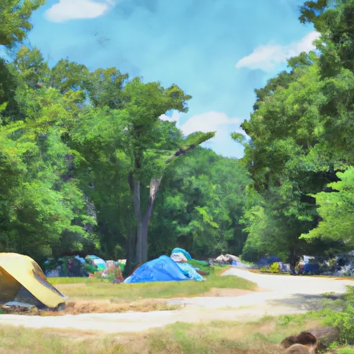
Turtle Run
There are several points of interest located near the campground, including the Appalachian Trail and historic Harper's Ferry. Visitors can also enjoy kayaking and fishing at nearby Antietam Creek.
The campground offers amenities such as picnic tables, fire pits, and access to clean water. It operates on a first-come, first-serve basis, and there are 25 campsites available.
An interesting fact about the area is that it was once a popular spot for Native American tribes. The campground is situated on the site of a former Lenape village.
The best time to visit Turtle Run Camping Area is during the spring or fall months when temperatures are mild. Average temperatures during the spring range from 50-70°F, while average temperatures during the fall range from 40-60°F. Overall, Turtle Run Camping Area provides a tranquil and picturesque camping experience for nature lovers and history buffs alike.
What's on-site at Turtle Run
Key facilities Snoflo tracks for this campground. Confirm with the operator before booking -- amenities can change seasonally.
Plan your trip down to the hour
Same weather feed Snoflo's iOS app uses -- updated continuously from NOAA / yr.no.
Next 5 days, hour by hour
Temperature line with weather symbols on top, snow + rain accumulation as columns, humidity as a dotted line.
5-day forecast table
Every 3 hours, broken out across temperature, snow, rain, humidity, and wind. Each cell is colour-coded relative to the column min/max so trends jump out at a glance.
| Time | Condition | Temp (°F) | Snow (in) | Rain (in) | Humidity (%) | Wind (mps) | Wind dir |
|---|---|---|---|---|---|---|---|
| Loading detailed forecast… | |||||||
15-day temperature & precipitation
Daily temperatures, snow, and rain projected over the next two weeks. Hover any point for the full breakdown.
Other campgrounds in the area
Snoflo-tracked campsites within driving distance of Turtle Run, with reservations status.
| Campground | Reservations | Toilets | View |
|---|---|---|---|
| Turtle Run Campsite | ✗ | ✗ | → |
| Marble Quarry Hiker-Biker Campsite | ✗ | ✗ | → |
| Marble Quarry | ✗ | ✓ | → |
| Chisel Branch | ✗ | ✓ | → |
| Chisel Branch Campsite | ✗ | ✗ | → |
Nearby streamflow
USGS streamgauges within reach of Turtle Run -- pulled live from the National Water Information System.
| Streamgauge | Discharge | View |
|---|---|---|
| Limestone Branch Near Leesburg | 19 cfs | → |
| S F Catoctin Creek At Rt 698 Near Waterford | 189 cfs | → |
| N F Catoctin Creek At Rt 681 Near Waterford | 22 cfs | → |
| Broad Run Near Leesburg | 274 cfs | → |
| Catoctin Creek At Taylorstown | 412 cfs | → |
| Goose Creek Near Leesburg | 67 cfs | → |
Nearby snow depths
NRCS SNOTEL stations within reach of Turtle Run -- relevant when planning a shoulder-season or alpine trip.
| SNOTEL station | Snowpack | 24h Snowfall | View |
|---|---|---|---|
| Purcellville Coop | 0.0 in | 0.0 in | → |
| Wfo Sterling Coop | 0.0 in | 0.0 in | → |
| Round Hill 2.7 Wsw | 0.0 in | 0.0 in | → |
| Damascus 3 Ssw Coop | 0.0 in | 0.0 in | → |
| Harpers Ferry 12.8 Ssw | 0.0 in | 0.0 in | → |
| Montgomery Village 1.1 Ene | 0.0 in | 0.0 in | → |
Plan a longer trip
The closest parks, lakes, boat launches, and paddle runs so a camping night can grow into a full weekend.
Parks
- Ball's Bluff Battlefield Regional Park
- Red Rock Wilderness Park
- Carrvale Park
- Temple Hall Farm Park
- Ida Lee Park
- Good Times Park
Boat launches
- Smart's Mill Rd (Private) Leesburg
- Edwards Ferry Road Montgomery County
- Ashburn Village Boulevard 20585, Lansdowne
- Chesapeake And Ohio Canal Frederick County
- Chesapeake And Ohio Canal Trail Point Of Rocks
- Mckimmey (Point Of Rocks)
Camping essentials & Leave No Trace
- Pack it in, pack it out
- Take all trash, food scraps, and gear back with you to keep campsites clean and protect wildlife.
- Respect wildlife
- Observe animals from a distance, store food securely, and never feed wildlife to maintain natural behavior and safety.
- Know before you go
- Check weather, fire restrictions, trail conditions, and permit requirements to ensure a safe and well-planned trip.
- Minimize campfire impact
- Use established fire rings, keep fires small, fully extinguish them, or opt for a camp stove when fires are restricted.
- Leave what you find
- Preserve natural and cultural features by avoiding removal of plants, rocks, artifacts, or other elements of the environment.
Set push alerts in the Snoflo app
Save Turtle Run as a favorite, set a custom threshold (precipitation, snowpack, freezing temperatures), and the iOS app will push the moment conditions cross.
About Turtle Run
Can I make reservations at Turtle Run?
This campground does not appear to accept reservations -- it's typically first-come, first-served. Arrive early on summer weekends.
How fresh is the weather data on this page?
The hourly forecast updates throughout the day from the NOAA / yr.no public feeds. Streamflow data is pulled live from USGS streamgauges and snowpack from the NRCS SNOTEL network.
What's the best time of year to visit?
Use the 15-day temperature & precipitation outlook on this page to plan -- pick a window with comfortable temperatures and low precipitation. For longer trips, the 5-day hourly meteogram shows snow + rain accumulation hour-by-hour.
How do I get to Turtle Run?
Tap Directions in the hero above to open driving directions in Google Maps, or Open in map to center the Snoflo interactive map on the campground.
Can I get alerts when conditions change?
Yes -- alerts are managed through the Snoflo iOS app. Favorite this campground, set a threshold (temperature, snowpack, precipitation), and you'll get a push the moment it crosses.
Other campgrounds near here
Snoflo-tracked campgrounds within driving distance of Turtle Run.