Koa Weathampton Campground
Community Reviews
Been here? Share the conditions.
Reviews, ratings & photos are added in the free Snoflo iOS app — rate a spot, tag the conditions, and your visit is verified by location. Add or manage your reviews from the app.
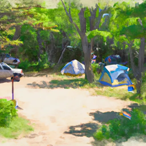
Koa Weathampton
Reservations are accepted at Koa Weathampton, allowing campers to secure their spot in advance. This ensures that visitors can plan their trip with confidence, especially during peak camping seasons. It is advisable to make reservations early, as availability can become limited during popular times of the year.
The best time to visit Koa Weathampton in Massachusetts is during the summer months, from June to August, when the weather is generally warm and pleasant. During this time, campers can enjoy outdoor activities such as hiking, fishing, and swimming in nearby lakes or rivers. It is worth noting that the campground can get busy during weekends and holidays, so planning ahead is recommended.
While camping at Koa Weathampton, campers should be aware of potential wildlife encounters, particularly with black bears. It is essential to store food and dispose of waste properly to minimize the risk of attracting animals. Additionally, campers should be cautious of ticks, as Massachusetts is known to have tick populations. Taking necessary precautions, such as wearing insect repellent and conducting regular tick checks, is essential to prevent tick-borne illnesses.
What's on-site at Koa Weathampton
Key facilities Snoflo tracks for this campground. Confirm with the operator before booking -- amenities can change seasonally.
Plan your trip down to the hour
Same weather feed Snoflo's iOS app uses -- updated continuously from NOAA / yr.no.
Next 5 days, hour by hour
Temperature line with weather symbols on top, snow + rain accumulation as columns, humidity as a dotted line.
5-day forecast table
Every 3 hours, broken out across temperature, snow, rain, humidity, and wind. Each cell is colour-coded relative to the column min/max so trends jump out at a glance.
| Time | Condition | Temp (°F) | Snow (in) | Rain (in) | Humidity (%) | Wind (mps) | Wind dir |
|---|---|---|---|---|---|---|---|
| Loading detailed forecast… | |||||||
15-day temperature & precipitation
Daily temperatures, snow, and rain projected over the next two weeks. Hover any point for the full breakdown.
Other campgrounds in the area
Snoflo-tracked campsites within driving distance of Koa Weathampton, with reservations status.
| Campground | Reservations | Toilets | View |
|---|---|---|---|
| Chester - Blanford State Forest | ✗ | ✗ | → |
| Dar State Forest | ✓ | ✗ | → |
| Westover Arb Military | ✓ | ✓ | → |
| Whately Oaks Primitive Campsite | ✗ | ✗ | → |
| White Rock | ✗ | ✗ | → |
Nearby streamflow
USGS streamgauges within reach of Koa Weathampton -- pulled live from the National Water Information System.
| Streamgauge | Discharge | View |
|---|---|---|
| Westfield River At Knightville | 49 cfs | → |
| Middle B Westfield River At Goss Heights | 8 cfs | → |
| Mill River At Northampton | 9 cfs | → |
| West Branch Westfield River At Huntington | 20 cfs | → |
| Connecticut R At Interstate 391 Bridge At Holyoke | 4,010 cfs | → |
| Westfield River Near Westfield | 107 cfs | → |
Nearby snow depths
NRCS SNOTEL stations within reach of Koa Weathampton -- relevant when planning a shoulder-season or alpine trip.
| SNOTEL station | Snowpack | 24h Snowfall | View |
|---|---|---|---|
| Westhampton 1.8 Sw | 0.0 in | 0.0 in | → |
| Nohrsc Westhampton 0.4 Wnw | 0.0 in | 0.0 in | → |
| Easthampton 1.0 E | 0.0 in | 0.0 in | → |
| Westfield 3 Sw | 0.0 in | 0.0 in | → |
| Amherst | 0.0 in | 0.0 in | → |
| Conway 3.4 Wsw | 0.0 in | 0.0 in | → |
Plan a longer trip
The closest parks, lakes, boat launches, and paddle runs so a camping night can grow into a full weekend.
Parks
- Mineral Hills Conservation Area
- Cm Gardner State Park
- Conant Memorial Park
- Galbraith Park
- Krug Sugarbush State Park
- Lower Mill Pond
Boat launches
- Huntington
- Nashawannuck Pond
- Mount Tom Road 900-978, Easthampton
- Old Apremont Way, Westfield
- Connecticut River
Points of interest
- Dorsey–Jones House
- Elm Street Historic District
- Smith College Greenhouse
- Union Station Northampton
- Dinosaur Footprints
- Holyoke City Hall
Paddle runs
- The Massachusetts-Connecticut State Line In Hartland To The Confluence With The Salmon Brook Main Stem
- The Hartland Headwaters To The Confluence With The Salmon Brook Main Stem
- The Confluence Of The East And West Branches To The Confluence With The Farmington River In East Granby
- Begins Below The Tailrace Of The Rainbow Dam To The Confluence With The Connecticut River
- New Hartford/Canton Town Line To The Confluence With The Nepaug River
- The Confluence With The Nepaug River To A Point 0.2 Miles Below The Lower Collinsville Dam Tailrace
Camping essentials & Leave No Trace
- Pack it in, pack it out
- Take all trash, food scraps, and gear back with you to keep campsites clean and protect wildlife.
- Respect wildlife
- Observe animals from a distance, store food securely, and never feed wildlife to maintain natural behavior and safety.
- Know before you go
- Check weather, fire restrictions, trail conditions, and permit requirements to ensure a safe and well-planned trip.
- Minimize campfire impact
- Use established fire rings, keep fires small, fully extinguish them, or opt for a camp stove when fires are restricted.
- Leave what you find
- Preserve natural and cultural features by avoiding removal of plants, rocks, artifacts, or other elements of the environment.
Set push alerts in the Snoflo app
Save Koa Weathampton as a favorite, set a custom threshold (precipitation, snowpack, freezing temperatures), and the iOS app will push the moment conditions cross.
About Koa Weathampton
Can I make reservations at Koa Weathampton?
This campground does not appear to accept reservations -- it's typically first-come, first-served. Arrive early on summer weekends.
How fresh is the weather data on this page?
The hourly forecast updates throughout the day from the NOAA / yr.no public feeds. Streamflow data is pulled live from USGS streamgauges and snowpack from the NRCS SNOTEL network.
What's the best time of year to visit?
Use the 15-day temperature & precipitation outlook on this page to plan -- pick a window with comfortable temperatures and low precipitation. For longer trips, the 5-day hourly meteogram shows snow + rain accumulation hour-by-hour.
How do I get to Koa Weathampton?
Tap Directions in the hero above to open driving directions in Google Maps, or Open in map to center the Snoflo interactive map on the campground.
Can I get alerts when conditions change?
Yes -- alerts are managed through the Snoflo iOS app. Favorite this campground, set a threshold (temperature, snowpack, precipitation), and you'll get a push the moment it crosses.
Other campgrounds near here
Snoflo-tracked campgrounds within driving distance of Koa Weathampton.