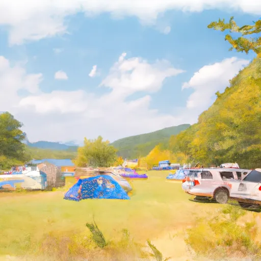
Stillwater State Park Campground
Community Reviews
Been here? Share the conditions.
Reviews, ratings & photos are added in the free Snoflo iOS app — rate a spot, tag the conditions, and your visit is verified by location. Add or manage your reviews from the app.
Stillwater State Park
Reservations are accepted at Stillwater State Park, allowing campers to secure their preferred campsite in advance. This is particularly important during peak seasons when the campground tends to be busy. It is recommended to make reservations early, especially for weekends and holidays, to avoid disappointment.
The best time to visit Stillwater State Park is during the summer months, between late May and early September, when the weather is generally pleasant and conducive to outdoor activities. Campers can enjoy swimming, boating, and fishing in the park's picturesque lake, or explore the surrounding trails for hiking and biking. Wildlife enthusiasts will also appreciate the opportunity to spot various bird species and observe other wildlife in their natural habitat.
While visiting the camping area, it is important for campers to be cautious of ticks, as they are prevalent in the area. Wearing long sleeves, using insect repellent, and conducting regular tick checks are recommended preventive measures. Additionally, campers should be mindful of fire safety and adhere to all park regulations to ensure a safe and enjoyable experience for everyone.
Overall, Stillwater State Park offers a serene and well-equipped camping area in Vermont, making it an ideal destination for nature lovers and outdoor enthusiasts.
What's on-site at Stillwater State Park
Key facilities Snoflo tracks for this campground. Confirm with the operator before booking -- amenities can change seasonally.
Plan your trip down to the hour
Same weather feed Snoflo's iOS app uses -- updated continuously from NOAA / yr.no.
Next 5 days, hour by hour
Temperature line with weather symbols on top, snow + rain accumulation as columns, humidity as a dotted line.
5-day forecast table
Every 3 hours, broken out across temperature, snow, rain, humidity, and wind. Each cell is colour-coded relative to the column min/max so trends jump out at a glance.
| Time | Condition | Temp (°F) | Snow (in) | Rain (in) | Humidity (%) | Wind (mps) | Wind dir |
|---|---|---|---|---|---|---|---|
| Loading detailed forecast… | |||||||
15-day temperature & precipitation
Daily temperatures, snow, and rain projected over the next two weeks. Hover any point for the full breakdown.
Other campgrounds in the area
Snoflo-tracked campsites within driving distance of Stillwater State Park, with reservations status.
| Campground | Reservations | Toilets | View |
|---|---|---|---|
| Big Deer State Park | ✓ | ✗ | → |
| Ricker Pond State Park | ✓ | ✗ | → |
| New Discovery State Park | ✓ | ✗ | → |
| Sugar Ridge Rv Resort | ✗ | ✗ | → |
| Harkdale Farm Campsite | ✗ | ✗ | → |
Nearby streamflow
USGS streamgauges within reach of Stillwater State Park -- pulled live from the National Water Information System.
| Streamgauge | Discharge | View |
|---|---|---|
| Passumpsic River At Passumpsic | 229 cfs | → |
| East Orange Branch At East Orange | 6 cfs | → |
| Wells River At Wells River | 36 cfs | → |
| Connecticut River At Wells River | 1,450 cfs | → |
| North Branch Winooski River At Wrightsville | 12 cfs | → |
| Pope Brook (Site W-3) Nr. N. Danville | 1 cfs | → |
Nearby snow depths
NRCS SNOTEL stations within reach of Stillwater State Park -- relevant when planning a shoulder-season or alpine trip.
| SNOTEL station | Snowpack | 24h Snowfall | View |
|---|---|---|---|
| Plainfield | 0.0 in | 0.0 in | → |
| Nohrsc Cabot 2.3 E | 0.0 in | 0.0 in | → |
| Ryegate 1.5 N | 0.0 in | 0.0 in | → |
| West Topsham 2sw | 0.0 in | 0.0 in | → |
| Woodbury 3.4 Nnw | 0.0 in | 0.0 in | → |
| Worcester 2 W | 0.0 in | 0.0 in | → |
Plan a longer trip
The closest parks, lakes, boat launches, and paddle runs so a camping night can grow into a full weekend.
Parks
- Boulder Beach State Park
- Barre Town Vermont Recreation Area
- Bedell Bridge State Historic Park
- Ainsworth State Forest
- Elmore State Park
- Dell's Park
Boat launches
- Peacham Pond Boat Ramp
- Camp Road Peacham
- Fosters Pond
- Molly's Pond Boat Launch
- Harvey Lake
- Taylor Road Peacham
Points of interest
- Martin Covered Bridge
- A.M. Foster Bridge
- Greenbanks Hollow Covered Bridge
- Kents Museum
- Studio Place Arts
- Socialist Labor Party Hall
Paddle runs
- Headwaters At Profile Lake To Southern Boundary Of Franconia Notch State Park
- Headwaters To Folsom Brook
- Woodstock/Thornton Town Line To Thornton Railroad Bridge
- Proclamation Boundary To Proclamation Boundary
- Confluence With Alder Creek To Confluence With Middlebury River
- Thornton Railroad Bridge To Bridgewater/Bristol Town Line
Camping essentials & Leave No Trace
- Pack it in, pack it out
- Take all trash, food scraps, and gear back with you to keep campsites clean and protect wildlife.
- Respect wildlife
- Observe animals from a distance, store food securely, and never feed wildlife to maintain natural behavior and safety.
- Know before you go
- Check weather, fire restrictions, trail conditions, and permit requirements to ensure a safe and well-planned trip.
- Minimize campfire impact
- Use established fire rings, keep fires small, fully extinguish them, or opt for a camp stove when fires are restricted.
- Leave what you find
- Preserve natural and cultural features by avoiding removal of plants, rocks, artifacts, or other elements of the environment.
Set push alerts in the Snoflo app
Save Stillwater State Park as a favorite, set a custom threshold (precipitation, snowpack, freezing temperatures), and the iOS app will push the moment conditions cross.
About Stillwater State Park
Can I make reservations at Stillwater State Park?
Yes -- this campground accepts reservations. Snoflo recommends booking early for peak season; check the operator (Recreation.gov / state park system / private operator) for the booking window and cancellation policy.
How fresh is the weather data on this page?
The hourly forecast updates throughout the day from the NOAA / yr.no public feeds. Streamflow data is pulled live from USGS streamgauges and snowpack from the NRCS SNOTEL network.
What's the best time of year to visit?
Use the 15-day temperature & precipitation outlook on this page to plan -- pick a window with comfortable temperatures and low precipitation. For longer trips, the 5-day hourly meteogram shows snow + rain accumulation hour-by-hour.
How do I get to Stillwater State Park?
Tap Directions in the hero above to open driving directions in Google Maps, or Open in map to center the Snoflo interactive map on the campground.
Can I get alerts when conditions change?
Yes -- alerts are managed through the Snoflo iOS app. Favorite this campground, set a threshold (temperature, snowpack, precipitation), and you'll get a push the moment it crosses.
Other campgrounds near here
Snoflo-tracked campgrounds within driving distance of Stillwater State Park.