Hovey Lake Campground Campground
Community Reviews
Been here? Share the conditions.
Reviews, ratings & photos are added in the free Snoflo iOS app — rate a spot, tag the conditions, and your visit is verified by location. Add or manage your reviews from the app.
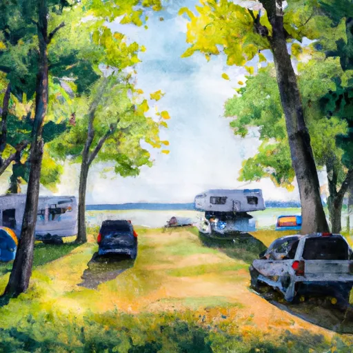
Hovey Lake Campground
Reservations are accepted at Hovey Lake Campground, ensuring that you have a guaranteed spot during your preferred camping dates. It is advisable to make a reservation in advance, especially during peak seasons, as the campground can get busy. The best time of year to visit Hovey Lake Campground is during the summer months when the weather is pleasant for outdoor activities like fishing, boating, and hiking. The campground is situated near Hovey Lake, offering campers the opportunity to indulge in water-based recreational activities.
While visiting the camping area, campers should be cautious of wildlife encounters, as the area is home to various species. It is recommended to store food properly and maintain a safe distance from wild animals. Additionally, campers should also be mindful of following Leave No Trace principles and keeping the camping area clean and free from litter. Overall, Hovey Lake Campground provides a serene and well-equipped camping destination for nature enthusiasts seeking a peaceful getaway in Michigan.
What's on-site at Hovey Lake Campground
Key facilities Snoflo tracks for this campground. Confirm with the operator before booking -- amenities can change seasonally.
Plan your trip down to the hour
Same weather feed Snoflo's iOS app uses -- updated continuously from NOAA / yr.no.
Next 5 days, hour by hour
Temperature line with weather symbols on top, snow + rain accumulation as columns, humidity as a dotted line.
5-day forecast table
Every 3 hours, broken out across temperature, snow, rain, humidity, and wind. Each cell is colour-coded relative to the column min/max so trends jump out at a glance.
| Time | Condition | Temp (°F) | Snow (in) | Rain (in) | Humidity (%) | Wind (mps) | Wind dir |
|---|---|---|---|---|---|---|---|
| Loading detailed forecast… | |||||||
15-day temperature & precipitation
Daily temperatures, snow, and rain projected over the next two weeks. Hover any point for the full breakdown.
Other campgrounds in the area
Snoflo-tracked campsites within driving distance of Hovey Lake Campground, with reservations status.
| Campground | Reservations | Toilets | View |
|---|---|---|---|
| Hovey Lake Campsites | ✗ | ✗ | → |
| Otter Lake Campground And Lodges | ✗ | ✗ | → |
| Island Lake Campground | ✗ | ✗ | → |
| Council Lake Campsites | ✓ | ✗ | → |
| Pete's Lake Campground | ✓ | ✗ | → |
Nearby streamflow
USGS streamgauges within reach of Hovey Lake Campground -- pulled live from the National Water Information System.
| Streamgauge | Discharge | View |
|---|---|---|
| Au Train River At Forest Lake | 137 cfs | → |
| Sturgeon River Near Nahma Junction | 89 cfs | → |
| Manistique River Near Manistique | 919 cfs | → |
| Escanaba River At Cornell | 370 cfs | → |
| Middle Branch Escanaba River Nr Princeton | 103 cfs | → |
| Ford River Near Hyde | 79 cfs | → |
Nearby snow depths
NRCS SNOTEL stations within reach of Hovey Lake Campground -- relevant when planning a shoulder-season or alpine trip.
| SNOTEL station | Snowpack | 24h Snowfall | View |
|---|---|---|---|
| Munising | 27.0 in | 0.0 in | → |
| Skandia 3.0 Sse | 0.0 in | 0.0 in | → |
| Garden Corners | 0.0 in | 0.0 in | → |
| Manistique 2.7 Nw | 0.0 in | 0.0 in | → |
| Green Garden No.2 | 0.0 in | 0.0 in | → |
| Manistique Wwtp | 0.0 in | 0.0 in | → |
Plan a longer trip
The closest parks, lakes, boat launches, and paddle runs so a camping night can grow into a full weekend.
Parks
- Pictured Rocks National Lakeshore
- Bay Furnace Recreation Area
- Wilderness Rock River Canyon
- Wilderness Big Island Lake
- Upper Peninsula Experimental Forest
- Wilderness Beaver Basin
Boat launches
- Boy Scout Road Alger County
- Federal Forest Highway 13 Inwood Township
- Red Jack Lake Road Alger County
- Ackerman Lake Road Au Train Township
Fishing spots
Points of interest
- Mckeever Cabin
- Munising Ranger District Native Gardens
- Munising Rear Range Light
- Munising Front Range Light
- Munising Falls
- Grand Island Harbor Rear Range Light
Paddle runs
- From Sixteen Mile Lake To North Line Of Sec 26, T43n, R19w
- County Road H-58 (Aka. Adams Trail/ Munising-Van Meer-Shingleton Rd.) To Mouth At Lake Superior
- West Branch From Source In Sec 26, T46n, R23 W To Junction With County Road 444
- Section 17, T48n, R17w (Boundary Of Pictured Rocks National Lakeshore Lands) To Mouth At Lake Superior
Camping essentials & Leave No Trace
- Pack it in, pack it out
- Take all trash, food scraps, and gear back with you to keep campsites clean and protect wildlife.
- Respect wildlife
- Observe animals from a distance, store food securely, and never feed wildlife to maintain natural behavior and safety.
- Know before you go
- Check weather, fire restrictions, trail conditions, and permit requirements to ensure a safe and well-planned trip.
- Minimize campfire impact
- Use established fire rings, keep fires small, fully extinguish them, or opt for a camp stove when fires are restricted.
- Leave what you find
- Preserve natural and cultural features by avoiding removal of plants, rocks, artifacts, or other elements of the environment.
Set push alerts in the Snoflo app
Save Hovey Lake Campground as a favorite, set a custom threshold (precipitation, snowpack, freezing temperatures), and the iOS app will push the moment conditions cross.
About Hovey Lake Campground
Can I make reservations at Hovey Lake Campground?
This campground does not appear to accept reservations -- it's typically first-come, first-served. Arrive early on summer weekends.
How fresh is the weather data on this page?
The hourly forecast updates throughout the day from the NOAA / yr.no public feeds. Streamflow data is pulled live from USGS streamgauges and snowpack from the NRCS SNOTEL network.
What's the best time of year to visit?
Use the 15-day temperature & precipitation outlook on this page to plan -- pick a window with comfortable temperatures and low precipitation. For longer trips, the 5-day hourly meteogram shows snow + rain accumulation hour-by-hour.
How do I get to Hovey Lake Campground?
Tap Directions in the hero above to open driving directions in Google Maps, or Open in map to center the Snoflo interactive map on the campground.
Can I get alerts when conditions change?
Yes -- alerts are managed through the Snoflo iOS app. Favorite this campground, set a threshold (temperature, snowpack, precipitation), and you'll get a push the moment it crosses.
Other campgrounds near here
Snoflo-tracked campgrounds within driving distance of Hovey Lake Campground.