Slabtown Recreation Area Campground
Community Reviews
Been here? Share the conditions.
Reviews, ratings & photos are added in the free Snoflo iOS app — rate a spot, tag the conditions, and your visit is verified by location. Add or manage your reviews from the app.
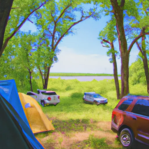
Slabtown Recreation Area
Reservations are accepted at Slabtown Recreation Area, ensuring that campers can secure their preferred dates in advance. It is advisable to make reservations, especially during peak seasons, to guarantee availability. The best time to visit this camping area is during the summer months when the weather is pleasant, and outdoor activities can be enjoyed to the fullest. However, it is important to note that the campground is open year-round, offering opportunities for winter camping and activities such as cross-country skiing and snowshoeing.
While exploring Slabtown Recreation Area, campers should be cautious of wildlife encounters, particularly bears. It is essential to follow proper food storage guidelines and never leave food unattended. Campers should also be aware of ticks and take necessary precautions, such as wearing insect repellent and conducting regular tick checks. By being prepared and aware, campers can have a safe and memorable camping experience at Slabtown Recreation Area in Minnesota.
What's on-site at Slabtown Recreation Area
Key facilities Snoflo tracks for this campground. Confirm with the operator before booking -- amenities can change seasonally.
Plan your trip down to the hour
Same weather feed Snoflo's iOS app uses -- updated continuously from NOAA / yr.no.
Next 5 days, hour by hour
Temperature line with weather symbols on top, snow + rain accumulation as columns, humidity as a dotted line.
5-day forecast table
Every 3 hours, broken out across temperature, snow, rain, humidity, and wind. Each cell is colour-coded relative to the column min/max so trends jump out at a glance.
| Time | Condition | Temp (°F) | Snow (in) | Rain (in) | Humidity (%) | Wind (mps) | Wind dir |
|---|---|---|---|---|---|---|---|
| Loading detailed forecast… | |||||||
15-day temperature & precipitation
Daily temperatures, snow, and rain projected over the next two weeks. Hover any point for the full breakdown.
Other campgrounds in the area
Snoflo-tracked campsites within driving distance of Slabtown Recreation Area, with reservations status.
| Campground | Reservations | Toilets | View |
|---|---|---|---|
| Big Piney Equestrian Camp | ✓ | ✗ | → |
| Paddy Creek | ✗ | ✗ | → |
| Primitive Campsite | ✗ | ✗ | → |
| Big Piney Trail Primitive | ✗ | ✗ | → |
Nearby streamflow
USGS streamgauges within reach of Slabtown Recreation Area -- pulled live from the National Water Information System.
| Streamgauge | Discharge | View |
|---|---|---|
| Big Piney River Near Big Piney | 169 cfs | → |
| Roubidoux Creek Above Ft. Leonard Wood | 18 cfs | → |
| Big Piney Below Ft. Leonard Wood | 222 cfs | → |
| Little Piney Creek At Newburg | 99 cfs | → |
| Gasconade River At Jerome | 866 cfs | → |
| Gasconade River Near Hazelgreen | 209 cfs | → |
Plan a longer trip
The closest parks, lakes, boat launches, and paddle runs so a camping night can grow into a full weekend.
Parks
- Wilderness Paddy Creek
- Piney River Narrows Natural Area
- Fort Leonard Wood Towersite State Conservation Area Or Park
- P. F. Barnes Conservation Area
- Montauk State Park
- Wilbur Allen Memorial Conservation Area
Boat launches
- Mason Road Texas County
- Lake Drive Texas County
- Boiling Spring Access
- Bloodland Lake (Fort Leonard Wood)
- Mineral Springs Access
- Crossroads Access
Points of interest
- U.S. Army Engineer, Chemical, And Military Police Museum
- Uranus, Missouri
- Frog Rock
- Old Stagecoach Stop
- John's "Modern" Cabins
- Sugar Tree Outer Road, Dead Ends
Paddle runs
- Missouri State Highway 17 To Fort Leonard Wood (Army Base)
- Northern Boundary Of Fort Leonard Wood To North Section Line Of Sec 31, T36n, R10w
- County Highway O, Laclede, County, Missouri To Ozark Spring
- Western Edge Of Ozark National Scenic Riverways To Confluence With Alley Spring (Branch)
- Confluence With Alley Spring (Branch) To Confluence With Current River (Does Not Include River Segment In Gap Between Parkland Units)
Camping essentials & Leave No Trace
- Pack it in, pack it out
- Take all trash, food scraps, and gear back with you to keep campsites clean and protect wildlife.
- Respect wildlife
- Observe animals from a distance, store food securely, and never feed wildlife to maintain natural behavior and safety.
- Know before you go
- Check weather, fire restrictions, trail conditions, and permit requirements to ensure a safe and well-planned trip.
- Minimize campfire impact
- Use established fire rings, keep fires small, fully extinguish them, or opt for a camp stove when fires are restricted.
- Leave what you find
- Preserve natural and cultural features by avoiding removal of plants, rocks, artifacts, or other elements of the environment.
Set push alerts in the Snoflo app
Save Slabtown Recreation Area as a favorite, set a custom threshold (precipitation, snowpack, freezing temperatures), and the iOS app will push the moment conditions cross.
About Slabtown Recreation Area
Can I make reservations at Slabtown Recreation Area?
This campground does not appear to accept reservations -- it's typically first-come, first-served. Arrive early on summer weekends.
How fresh is the weather data on this page?
The hourly forecast updates throughout the day from the NOAA / yr.no public feeds. Streamflow data is pulled live from USGS streamgauges and snowpack from the NRCS SNOTEL network.
What's the best time of year to visit?
Use the 15-day temperature & precipitation outlook on this page to plan -- pick a window with comfortable temperatures and low precipitation. For longer trips, the 5-day hourly meteogram shows snow + rain accumulation hour-by-hour.
How do I get to Slabtown Recreation Area?
Tap Directions in the hero above to open driving directions in Google Maps, or Open in map to center the Snoflo interactive map on the campground.
Can I get alerts when conditions change?
Yes -- alerts are managed through the Snoflo iOS app. Favorite this campground, set a threshold (temperature, snowpack, precipitation), and you'll get a push the moment it crosses.
Other campgrounds near here
Snoflo-tracked campgrounds within driving distance of Slabtown Recreation Area.