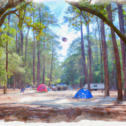
Big Biloxi Rec Area Campground
Community Reviews
Been here? Share the conditions.
Reviews, ratings & photos are added in the free Snoflo iOS app — rate a spot, tag the conditions, and your visit is verified by location. Add or manage your reviews from the app.
Big Biloxi Rec Area
Reservations are accepted at Big Biloxi Rec Area, which provides campers with the convenience of securing their spot in advance. It is recommended to make reservations, especially during peak seasons, to guarantee availability. The campground is open year-round, but the best time to visit is during the spring and fall when the weather is pleasant and the foliage is vibrant.
While staying at Big Biloxi Rec Area, visitors can explore the surrounding natural beauty. The campground is situated near the stunning Big Biloxi River, offering opportunities for fishing, canoeing, and kayaking. Hiking enthusiasts can venture onto the nearby trails, which provide breathtaking views of the surrounding forests and wildlife. It is important to be cautious of wildlife encounters and to follow proper safety protocols, such as storing food securely and respecting the habitat of the animals. Overall, Big Biloxi Rec Area is a fantastic camping destination for nature lovers seeking a tranquil and scenic experience in the heart of Mississippi.
What's on-site at Big Biloxi Rec Area
Key facilities Snoflo tracks for this campground. Confirm with the operator before booking -- amenities can change seasonally.
Plan your trip down to the hour
Same weather feed Snoflo's iOS app uses -- updated continuously from NOAA / yr.no.
Next 5 days, hour by hour
Temperature line with weather symbols on top, snow + rain accumulation as columns, humidity as a dotted line.
5-day forecast table
Every 3 hours, broken out across temperature, snow, rain, humidity, and wind. Each cell is colour-coded relative to the column min/max so trends jump out at a glance.
| Time | Condition | Temp (°F) | Snow (in) | Rain (in) | Humidity (%) | Wind (mps) | Wind dir |
|---|---|---|---|---|---|---|---|
| Loading detailed forecast… | |||||||
15-day temperature & precipitation
Daily temperatures, snow, and rain projected over the next two weeks. Hover any point for the full breakdown.
Other campgrounds in the area
Snoflo-tracked campsites within driving distance of Big Biloxi Rec Area, with reservations status.
| Campground | Reservations | Toilets | View |
|---|---|---|---|
| Big Biloxi Recreation Area | ✓ | ✗ | → |
| Airey Lake | ✗ | ✗ | → |
| Shields Rv Military - Gulfport Ncb | ✓ | ✗ | → |
| Keesler Afb Military | ✓ | ✓ | → |
| Gulf Marine State Park | ✗ | ✗ | → |
Nearby streamflow
USGS streamgauges within reach of Big Biloxi Rec Area -- pulled live from the National Water Information System.
| Streamgauge | Discharge | View |
|---|---|---|
| Biloxi River At Wortham | 62 cfs | → |
| Wolf River Nr Landon | 209 cfs | → |
| Red Creek At Vestry | 322 cfs | → |
| East Hobolochitto Creek Nr Caesar | 80 cfs | → |
| Pascagoula River At Graham Ferry | 4,210 cfs | → |
| Cypress Creek Nr Janice | 21 cfs | → |
Nearby snow depths
NRCS SNOTEL stations within reach of Big Biloxi Rec Area -- relevant when planning a shoulder-season or alpine trip.
| SNOTEL station | Snowpack | 24h Snowfall | View |
|---|---|---|---|
| Pass Christian 9.8 Nnw | 0.0 in | 0.0 in | → |
| Bay St. Louis 0.6 Ssw | 0.0 in | 0.0 in | → |
| Ocean Springs 3.3 E | 0.0 in | 0.0 in | → |
| Slidell 2.4 E | 0.0 in | 0.0 in | → |
| Slidell 0.2 Se | 0.0 in | 0.0 in | → |
| New Orleans/Baton Rouge | 0.0 in | 0.0 in | → |
Plan a longer trip
The closest parks, lakes, boat launches, and paddle runs so a camping night can grow into a full weekend.
Parks
- State Conservation Area Little Bilo
- Ben Reinike Park
- Owen T Palmer Jr Park
- Hiller Park Biloxi
- De Soto National Forest
- Flint Creek Water Park
Boat launches
- Harrison County Biloxi River Boat Launch
- Biloxi River
- Gulfport Lake Boat Launch
- Back Bay Biloxi
- East Oaklawn Road / I-10
- Ms 53 Harrison County
Camping essentials & Leave No Trace
- Pack it in, pack it out
- Take all trash, food scraps, and gear back with you to keep campsites clean and protect wildlife.
- Respect wildlife
- Observe animals from a distance, store food securely, and never feed wildlife to maintain natural behavior and safety.
- Know before you go
- Check weather, fire restrictions, trail conditions, and permit requirements to ensure a safe and well-planned trip.
- Minimize campfire impact
- Use established fire rings, keep fires small, fully extinguish them, or opt for a camp stove when fires are restricted.
- Leave what you find
- Preserve natural and cultural features by avoiding removal of plants, rocks, artifacts, or other elements of the environment.
Set push alerts in the Snoflo app
Save Big Biloxi Rec Area as a favorite, set a custom threshold (precipitation, snowpack, freezing temperatures), and the iOS app will push the moment conditions cross.
About Big Biloxi Rec Area
Can I make reservations at Big Biloxi Rec Area?
This campground does not appear to accept reservations -- it's typically first-come, first-served. Arrive early on summer weekends.
How fresh is the weather data on this page?
The hourly forecast updates throughout the day from the NOAA / yr.no public feeds. Streamflow data is pulled live from USGS streamgauges and snowpack from the NRCS SNOTEL network.
What's the best time of year to visit?
Use the 15-day temperature & precipitation outlook on this page to plan -- pick a window with comfortable temperatures and low precipitation. For longer trips, the 5-day hourly meteogram shows snow + rain accumulation hour-by-hour.
How do I get to Big Biloxi Rec Area?
Tap Directions in the hero above to open driving directions in Google Maps, or Open in map to center the Snoflo interactive map on the campground.
Can I get alerts when conditions change?
Yes -- alerts are managed through the Snoflo iOS app. Favorite this campground, set a threshold (temperature, snowpack, precipitation), and you'll get a push the moment it crosses.
Other campgrounds near here
Snoflo-tracked campgrounds within driving distance of Big Biloxi Rec Area.