Crooked River Campground Campground
Community Reviews
Been here? Share the conditions.
Reviews, ratings & photos are added in the free Snoflo iOS app — rate a spot, tag the conditions, and your visit is verified by location. Add or manage your reviews from the app.
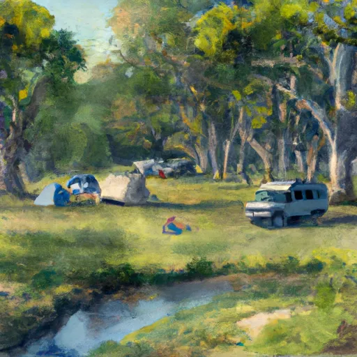
Crooked River Campground
Reservations are accepted at Crooked River Campground, allowing campers to secure their preferred campsites in advance. This is particularly beneficial during peak seasons when the campground tends to fill up quickly. As for the best time to visit, it is recommended to plan your trip between late spring and early fall when the weather is favorable for outdoor activities and the campground is fully operational.
While enjoying your stay at Crooked River Campground, be cautious of local wildlife such as bears and snakes. It is crucial to store food properly and be aware of your surroundings to avoid any unfortunate encounters. Additionally, make sure to follow all park regulations and practice Leave No Trace principles to help preserve the natural beauty of the area. With its tranquil ambiance and a variety of amenities, Crooked River Campground offers a remarkable camping experience for nature lovers.
What's on-site at Crooked River Campground
Key facilities Snoflo tracks for this campground. Confirm with the operator before booking -- amenities can change seasonally.
Plan your trip down to the hour
Same weather feed Snoflo's iOS app uses -- updated continuously from NOAA / yr.no.
Next 5 days, hour by hour
Temperature line with weather symbols on top, snow + rain accumulation as columns, humidity as a dotted line.
5-day forecast table
Every 3 hours, broken out across temperature, snow, rain, humidity, and wind. Each cell is colour-coded relative to the column min/max so trends jump out at a glance.
| Time | Condition | Temp (°F) | Snow (in) | Rain (in) | Humidity (%) | Wind (mps) | Wind dir |
|---|---|---|---|---|---|---|---|
| Loading detailed forecast… | |||||||
15-day temperature & precipitation
Daily temperatures, snow, and rain projected over the next two weeks. Hover any point for the full breakdown.
Other campgrounds in the area
Snoflo-tracked campsites within driving distance of Crooked River Campground, with reservations status.
| Campground | Reservations | Toilets | View |
|---|---|---|---|
| Shiloh | ✗ | ✗ | → |
| Gettysburg | ✗ | ✗ | → |
| Concord And Lexington | ✗ | ✗ | → |
| Valley Forge | ✗ | ✗ | → |
| Fort Mchenry | ✗ | ✗ | → |
Nearby streamflow
USGS streamgauges within reach of Crooked River Campground -- pulled live from the National Water Information System.
| Streamgauge | Discharge | View |
|---|---|---|
| Fox River At Princeton | 458 cfs | → |
| Puchyan River Ds N. Lawson Drive Nr Green Lake | 115 cfs | → |
| White Creek @ Spring Grove Road Nr Green Lake | 2 cfs | → |
| Green Lake Inlet At Ct Highwy A Near Green Lake | 67 cfs | → |
| Fox River At Berlin | 640 cfs | → |
| Wisconsin River Near Wisconsin Dells | 2,890 cfs | → |
Nearby snow depths
NRCS SNOTEL stations within reach of Crooked River Campground -- relevant when planning a shoulder-season or alpine trip.
| SNOTEL station | Snowpack | 24h Snowfall | View |
|---|---|---|---|
| Hancock Exp Farm | 8.0 in | 0.0 in | → |
| Berlin Wwtp | 0.0 in | 0.0 in | → |
| Friendship | 0.0 in | 0.0 in | → |
| Baraboo Wwtp | 0.0 in | 0.0 in | → |
| Beaver Dam 1 N | 0.0 in | 0.0 in | → |
| Beaver Dam | 0.0 in | 0.0 in | → |
Plan a longer trip
The closest parks, lakes, boat launches, and paddle runs so a camping night can grow into a full weekend.
Parks
- Germania Wildlife Area
- Fox River National Wildlife Refuge
- Lawrence Creek Wildlife Area
- Grand River Marsh Wildlife Area
- White River Marsh Wildlife Area
- Greenwood Wildlife Area
Camping essentials & Leave No Trace
- Pack it in, pack it out
- Take all trash, food scraps, and gear back with you to keep campsites clean and protect wildlife.
- Respect wildlife
- Observe animals from a distance, store food securely, and never feed wildlife to maintain natural behavior and safety.
- Know before you go
- Check weather, fire restrictions, trail conditions, and permit requirements to ensure a safe and well-planned trip.
- Minimize campfire impact
- Use established fire rings, keep fires small, fully extinguish them, or opt for a camp stove when fires are restricted.
- Leave what you find
- Preserve natural and cultural features by avoiding removal of plants, rocks, artifacts, or other elements of the environment.
Set push alerts in the Snoflo app
Save Crooked River Campground as a favorite, set a custom threshold (precipitation, snowpack, freezing temperatures), and the iOS app will push the moment conditions cross.
About Crooked River Campground
Can I make reservations at Crooked River Campground?
This campground does not appear to accept reservations -- it's typically first-come, first-served. Arrive early on summer weekends.
How fresh is the weather data on this page?
The hourly forecast updates throughout the day from the NOAA / yr.no public feeds. Streamflow data is pulled live from USGS streamgauges and snowpack from the NRCS SNOTEL network.
What's the best time of year to visit?
Use the 15-day temperature & precipitation outlook on this page to plan -- pick a window with comfortable temperatures and low precipitation. For longer trips, the 5-day hourly meteogram shows snow + rain accumulation hour-by-hour.
How do I get to Crooked River Campground?
Tap Directions in the hero above to open driving directions in Google Maps, or Open in map to center the Snoflo interactive map on the campground.
Can I get alerts when conditions change?
Yes -- alerts are managed through the Snoflo iOS app. Favorite this campground, set a threshold (temperature, snowpack, precipitation), and you'll get a push the moment it crosses.
Other campgrounds near here
Snoflo-tracked campgrounds within driving distance of Crooked River Campground.