Van Buren Campground
Community Reviews
Been here? Share the conditions.
Reviews, ratings & photos are added in the free Snoflo iOS app — rate a spot, tag the conditions, and your visit is verified by location. Add or manage your reviews from the app.
Van Buren
One of the main attractions near the Van Buren Camping Area is the Big Spring, which is the largest spring in the Ozark National Scenic Riverways. Visitors can take a short hike to the spring and witness the crystal-clear water that gushes out of the ground. Another nearby attraction is the Rocky Falls, a stunning waterfall that is perfect for picnics and hiking.
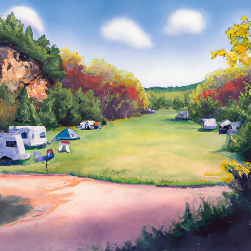
The Van Buren Camping Area offers a range of amenities including a convenience store, shower facilities, and picnic areas. The campsite also has 86 sites for tents and RVs, with some sites being located right next to the river.
Interesting facts about the area include the presence of wild horses in the Ozark National Scenic Riverways, which are descendants of the horses left by early settlers. The area is also home to a variety of wildlife, including black bears, coyotes, and bald eagles.
The best time to visit the Van Buren Camping Area is during the spring and fall seasons, when the temperatures are mild and the foliage is at its peak. The average temperature during the spring is around 65°F, while the fall temperatures average around 60°F.
Overall, the Van Buren Camping Area is a must-visit spot for anyone looking to experience the beauty of the Ozark National Scenic Riverways. With its stunning views, nearby attractions, and range of amenities, it is the perfect place for a relaxing camping trip in Missouri.
What's on-site at Van Buren
Key facilities Snoflo tracks for this campground. Confirm with the operator before booking -- amenities can change seasonally.
Plan your trip down to the hour
Same weather feed Snoflo's iOS app uses -- updated continuously from NOAA / yr.no.
Next 5 days, hour by hour
Temperature line with weather symbols on top, snow + rain accumulation as columns, humidity as a dotted line.
5-day forecast table
Every 3 hours, broken out across temperature, snow, rain, humidity, and wind. Each cell is colour-coded relative to the column min/max so trends jump out at a glance.
| Time | Condition | Temp (°F) | Snow (in) | Rain (in) | Humidity (%) | Wind (mps) | Wind dir |
|---|---|---|---|---|---|---|---|
| Loading detailed forecast… | |||||||
15-day temperature & precipitation
Daily temperatures, snow, and rain projected over the next two weeks. Hover any point for the full breakdown.
Other campgrounds in the area
Snoflo-tracked campsites within driving distance of Van Buren, with reservations status.
| Campground | Reservations | Toilets | View |
|---|---|---|---|
| Watercress Recreation Area | ✓ | ✗ | → |
| Watercress | ✓ | ✗ | → |
| Big Spring - Ozark National Scenic River | ✓ | ✗ | → |
| Big Spring Campgrounds | ✗ | ✗ | → |
Nearby streamflow
USGS streamgauges within reach of Van Buren -- pulled live from the National Water Information System.
| Streamgauge | Discharge | View |
|---|---|---|
| Current River At Van Buren | 1,010 cfs | → |
| Logan Creek At Ellington | 7 cfs | → |
| Black River At Leeper | 3,610 cfs | → |
| Jacks Fork At Eminence | 199 cfs | → |
| Jacks Fork At Alley Spring | 123 cfs | → |
| Eleven Point River Near Bardley | 473 cfs | → |
Nearby snow depths
NRCS SNOTEL stations within reach of Van Buren -- relevant when planning a shoulder-season or alpine trip.
| SNOTEL station | Snowpack | 24h Snowfall | View |
|---|---|---|---|
| Clearwater Dam - Black Rvr | 0.0 in | 0.0 in | → |
Plan a longer trip
The closest parks, lakes, boat launches, and paddle runs so a camping night can grow into a full weekend.
Parks
- Peck Ranch Conservation Area
- Conservation Area Current River
- Mule Hollow Glade Natural Area
- Conservation Area Rocky Creek
- Ozark National Scenic Riverways
- Logan Creek Conservation Area
Boat launches
- Van Buren
- Carter Co 105 Carter County
- County Road 60-102 Carter County
- Miller Community Lake
- Us 60 Carter County
- Webb Creek Marina
Fishing spots
Points of interest
- Ozark Nsr Headquarters
- Big Spring
- Walter Klepzig Mill And Farm
- Alley Mill
- Alley General Store
- Round Spring Visitor Center
Paddle runs
- The Most Upstream Portion Of Ozark National Scenic Riverways To The Most Downstream Portion Of Ozark National Scenic Riverways
- Markam Spring Recreation Area To Nf Boundary
- Confluence With Alley Spring (Branch) To Confluence With Current River (Does Not Include River Segment In Gap Between Parkland Units)
- Western Edge Of Ozark National Scenic Riverways To Confluence With Alley Spring (Branch)
- Forest Boundary At North Section Line Of Sec 4, T33n, R5e To Forest Boundary At South Section Line Of Sec 35, T32n, R5e
Camping essentials & Leave No Trace
- Pack it in, pack it out
- Take all trash, food scraps, and gear back with you to keep campsites clean and protect wildlife.
- Respect wildlife
- Observe animals from a distance, store food securely, and never feed wildlife to maintain natural behavior and safety.
- Know before you go
- Check weather, fire restrictions, trail conditions, and permit requirements to ensure a safe and well-planned trip.
- Minimize campfire impact
- Use established fire rings, keep fires small, fully extinguish them, or opt for a camp stove when fires are restricted.
- Leave what you find
- Preserve natural and cultural features by avoiding removal of plants, rocks, artifacts, or other elements of the environment.
Set push alerts in the Snoflo app
Save Van Buren as a favorite, set a custom threshold (precipitation, snowpack, freezing temperatures), and the iOS app will push the moment conditions cross.
About Van Buren
Can I make reservations at Van Buren?
This campground does not appear to accept reservations -- it's typically first-come, first-served. Arrive early on summer weekends.
How fresh is the weather data on this page?
The hourly forecast updates throughout the day from the NOAA / yr.no public feeds. Streamflow data is pulled live from USGS streamgauges and snowpack from the NRCS SNOTEL network.
What's the best time of year to visit?
Use the 15-day temperature & precipitation outlook on this page to plan -- pick a window with comfortable temperatures and low precipitation. For longer trips, the 5-day hourly meteogram shows snow + rain accumulation hour-by-hour.
How do I get to Van Buren?
Tap Directions in the hero above to open driving directions in Google Maps, or Open in map to center the Snoflo interactive map on the campground.
Can I get alerts when conditions change?
Yes -- alerts are managed through the Snoflo iOS app. Favorite this campground, set a threshold (temperature, snowpack, precipitation), and you'll get a push the moment it crosses.
Other campgrounds near here
Snoflo-tracked campgrounds within driving distance of Van Buren.