Tererro - State Fish And Game Campground
Community Reviews
Been here? Share the conditions.
Reviews, ratings & photos are added in the free Snoflo iOS app — rate a spot, tag the conditions, and your visit is verified by location. Add or manage your reviews from the app.
Tererro - State Fish And Game
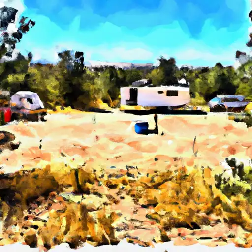
The campground offers amenities such as picnic tables, fire rings, and vault toilets. There are 13 campsites available, and visitors are advised to arrive early as the campground frequently reaches capacity during peak season. An interesting fact about the area is that it was once a bustling mining community, and remnants of the old mines can still be seen in the surrounding hills.
The best time to visit Tererro State Fish and Game Camping Area is during the summer months, when temperatures average in the mid-70s during the day and drop to the low 40s at night. However, visitors should be prepared for afternoon thunderstorms during this time. Overall, Tererro State Fish and Game Camping Area is a beautiful and peaceful place to camp and enjoy the natural beauty of New Mexico.
What's on-site at Tererro - State Fish And Game
Key facilities Snoflo tracks for this campground. Confirm with the operator before booking -- amenities can change seasonally.
Plan your trip down to the hour
Same weather feed Snoflo's iOS app uses -- updated continuously from NOAA / yr.no.
Next 5 days, hour by hour
Temperature line with weather symbols on top, snow + rain accumulation as columns, humidity as a dotted line.
5-day forecast table
Every 3 hours, broken out across temperature, snow, rain, humidity, and wind. Each cell is colour-coded relative to the column min/max so trends jump out at a glance.
| Time | Condition | Temp (°F) | Snow (in) | Rain (in) | Humidity (%) | Wind (mps) | Wind dir |
|---|---|---|---|---|---|---|---|
| Loading detailed forecast… | |||||||
15-day temperature & precipitation
Daily temperatures, snow, and rain projected over the next two weeks. Hover any point for the full breakdown.
Other campgrounds in the area
Snoflo-tracked campsites within driving distance of Tererro - State Fish And Game, with reservations status.
| Campground | Reservations | Toilets | View |
|---|---|---|---|
| Bert Chancy Campground | ✗ | ✗ | → |
| Davis Willow Dispersed Camping Area | ✗ | ✗ | → |
| Links Tract Campground | ✗ | ✗ | → |
| Holy Ghost Campground | ✗ | ✗ | → |
| Holy Ghost | ✗ | ✓ | → |
Nearby streamflow
USGS streamgauges within reach of Tererro - State Fish And Game -- pulled live from the National Water Information System.
| Streamgauge | Discharge | View |
|---|---|---|
| Pecos River Near Pecos | 21 cfs | → |
| Rio Mora Near Terrero | 8 cfs | → |
| Santa Fe R Abv Mcclure Res (8 Ft) | 1 cfs | → |
| Santa Fe River Near Santa Fe | 6 cfs | → |
| Tesuque Creek Above Diversions Near Santa Fe | 0 cfs | → |
| Rio Nambe Above Nambe Falls Dam Near Nambe | 36 cfs | → |
Nearby snow depths
NRCS SNOTEL stations within reach of Tererro - State Fish And Game -- relevant when planning a shoulder-season or alpine trip.
| SNOTEL station | Snowpack | 24h Snowfall | View |
|---|---|---|---|
| Santa Fe | 0.0 in | 0.0 in | → |
| Nohrsc Santa Fe | 0.0 in | 0.0 in | → |
| Elk Cabin | 0.0 in | 0.0 in | → |
| Nohrsc Wesner Springs | 0.0 in | 0.0 in | → |
| Nohrsc Elk Cabin | 1.0 in | 0.0 in | → |
| Wesner Springs | 0.0 in | 0.0 in | → |
Plan a longer trip
The closest parks, lakes, boat launches, and paddle runs so a camping night can grow into a full weekend.
Parks
- Wilderness Pecos
- Hyde Memorial State Park
- Cerro Gordo Park
- Atalaya Park
- Patrick Smith Park
- Santa Fe River Park
Boat launches
Fishing spots
- Cowles Ponds
- Cowles Ponds Fishing Site
- Windsor Creek
- Dalton Fishing
- Upper Dalton Fishing Access Fishing Site
- Trampas Lakes Fishing
Camping essentials & Leave No Trace
- Pack it in, pack it out
- Take all trash, food scraps, and gear back with you to keep campsites clean and protect wildlife.
- Respect wildlife
- Observe animals from a distance, store food securely, and never feed wildlife to maintain natural behavior and safety.
- Know before you go
- Check weather, fire restrictions, trail conditions, and permit requirements to ensure a safe and well-planned trip.
- Minimize campfire impact
- Use established fire rings, keep fires small, fully extinguish them, or opt for a camp stove when fires are restricted.
- Leave what you find
- Preserve natural and cultural features by avoiding removal of plants, rocks, artifacts, or other elements of the environment.
Set push alerts in the Snoflo app
Save Tererro - State Fish And Game as a favorite, set a custom threshold (precipitation, snowpack, freezing temperatures), and the iOS app will push the moment conditions cross.
About Tererro - State Fish And Game
Can I make reservations at Tererro - State Fish And Game?
This campground does not appear to accept reservations -- it's typically first-come, first-served. Arrive early on summer weekends.
How fresh is the weather data on this page?
The hourly forecast updates throughout the day from the NOAA / yr.no public feeds. Streamflow data is pulled live from USGS streamgauges and snowpack from the NRCS SNOTEL network.
What's the best time of year to visit?
Use the 15-day temperature & precipitation outlook on this page to plan -- pick a window with comfortable temperatures and low precipitation. For longer trips, the 5-day hourly meteogram shows snow + rain accumulation hour-by-hour.
How do I get to Tererro - State Fish And Game?
Tap Directions in the hero above to open driving directions in Google Maps, or Open in map to center the Snoflo interactive map on the campground.
Can I get alerts when conditions change?
Yes -- alerts are managed through the Snoflo iOS app. Favorite this campground, set a threshold (temperature, snowpack, precipitation), and you'll get a push the moment it crosses.
Other campgrounds near here
Snoflo-tracked campgrounds within driving distance of Tererro - State Fish And Game.