Thunder Ridge Camp Campground
Community Reviews
Been here? Share the conditions.
Reviews, ratings & photos are added in the free Snoflo iOS app — rate a spot, tag the conditions, and your visit is verified by location. Add or manage your reviews from the app.
Thunder Ridge Camp
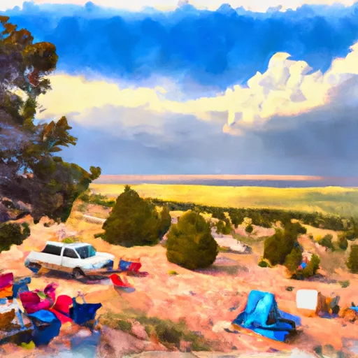
The campground provides a variety of amenities, including fire rings, picnic tables, and potable water. It is also equipped with vault toilets and a trash disposal area. Thunder Ridge Camp is a first-come, first-serve campground with 37 campsites available.
An interesting fact about the area is that the Jemez Mountains are actually the remnants of a massive volcanic eruption that occurred over a million years ago. Visitors can see evidence of this geological event in the form of lava fields and volcanic rocks.
The best time to visit Thunder Ridge Camp is during the summer months, with average temperatures ranging from 70 to 80 degrees Fahrenheit. However, visitors should be prepared for cooler temperatures at night due to the high altitude of the campground.
What's on-site at Thunder Ridge Camp
Key facilities Snoflo tracks for this campground. Confirm with the operator before booking -- amenities can change seasonally.
Plan your trip down to the hour
Same weather feed Snoflo's iOS app uses -- updated continuously from NOAA / yr.no.
Next 5 days, hour by hour
Temperature line with weather symbols on top, snow + rain accumulation as columns, humidity as a dotted line.
5-day forecast table
Every 3 hours, broken out across temperature, snow, rain, humidity, and wind. Each cell is colour-coded relative to the column min/max so trends jump out at a glance.
| Time | Condition | Temp (°F) | Snow (in) | Rain (in) | Humidity (%) | Wind (mps) | Wind dir |
|---|---|---|---|---|---|---|---|
| Loading detailed forecast… | |||||||
15-day temperature & precipitation
Daily temperatures, snow, and rain projected over the next two weeks. Hover any point for the full breakdown.
Other campgrounds in the area
Snoflo-tracked campsites within driving distance of Thunder Ridge Camp, with reservations status.
| Campground | Reservations | Toilets | View |
|---|---|---|---|
| Comanche Peak Camp | ✗ | ✗ | → |
| Cyphers Mine Camp | ✗ | ✗ | → |
| Divide Camp | ✗ | ✗ | → |
| Whistle Punk Camp | ✗ | ✗ | → |
| Lamberts Mine Camp | ✗ | ✗ | → |
Nearby streamflow
USGS streamgauges within reach of Thunder Ridge Camp -- pulled live from the National Water Information System.
| Streamgauge | Discharge | View |
|---|---|---|
| Cimarron River Below Eagle Nest Dam | 31 cfs | → |
| Cimarron River Near Cimarron | 28 cfs | → |
| Ponil Creek Near Cimarron | · | → |
| Rayado Creek Near Cimarron | 3 cfs | → |
| Rio Pueblo De Taos Near Taos | 3 cfs | → |
| Rio Lucero Near Arroyo Seco | 7 cfs | → |
Nearby snow depths
NRCS SNOTEL stations within reach of Thunder Ridge Camp -- relevant when planning a shoulder-season or alpine trip.
| SNOTEL station | Snowpack | 24h Snowfall | View |
|---|---|---|---|
| Tolby | 0.0 in | 0.0 in | → |
| Nohrsc Tolby | 0.0 in | 0.0 in | → |
| Eagle Nest | 0.0 in | 0.0 in | → |
| Palo | 0.0 in | 0.0 in | → |
| Nohrsc Palo Snotel | 0.0 in | 0.0 in | → |
| Nohrsc Red River Pass #2 | 0.0 in | 0.0 in | → |
Plan a longer trip
The closest parks, lakes, boat launches, and paddle runs so a camping night can grow into a full weekend.
Parks
- Cimarron Canyon State Park
- Eagle Nest Lake State Park
- Vietnam Veterans' Memorial State Park
- Ski Area
- Wilderness Wheeler Peak
- Coyote Creek State Park
Fishing spots
- Shuree Lakes Fishing
- Red River Fishing
- Rio Fernando Fishing
- Columbine Creek Fishing
- Rio Chiquito Fishing
- Rito De La Olla Fishing
Camping essentials & Leave No Trace
- Pack it in, pack it out
- Take all trash, food scraps, and gear back with you to keep campsites clean and protect wildlife.
- Respect wildlife
- Observe animals from a distance, store food securely, and never feed wildlife to maintain natural behavior and safety.
- Know before you go
- Check weather, fire restrictions, trail conditions, and permit requirements to ensure a safe and well-planned trip.
- Minimize campfire impact
- Use established fire rings, keep fires small, fully extinguish them, or opt for a camp stove when fires are restricted.
- Leave what you find
- Preserve natural and cultural features by avoiding removal of plants, rocks, artifacts, or other elements of the environment.
Set push alerts in the Snoflo app
Save Thunder Ridge Camp as a favorite, set a custom threshold (precipitation, snowpack, freezing temperatures), and the iOS app will push the moment conditions cross.
About Thunder Ridge Camp
Can I make reservations at Thunder Ridge Camp?
This campground does not appear to accept reservations -- it's typically first-come, first-served. Arrive early on summer weekends.
How fresh is the weather data on this page?
The hourly forecast updates throughout the day from the NOAA / yr.no public feeds. Streamflow data is pulled live from USGS streamgauges and snowpack from the NRCS SNOTEL network.
What's the best time of year to visit?
Use the 15-day temperature & precipitation outlook on this page to plan -- pick a window with comfortable temperatures and low precipitation. For longer trips, the 5-day hourly meteogram shows snow + rain accumulation hour-by-hour.
How do I get to Thunder Ridge Camp?
Tap Directions in the hero above to open driving directions in Google Maps, or Open in map to center the Snoflo interactive map on the campground.
Can I get alerts when conditions change?
Yes -- alerts are managed through the Snoflo iOS app. Favorite this campground, set a threshold (temperature, snowpack, precipitation), and you'll get a push the moment it crosses.
Other campgrounds near here
Snoflo-tracked campgrounds within driving distance of Thunder Ridge Camp.