Upper Scorpion Campground campground
Community Reviews
Been here? Share the conditions.
Reviews, ratings & photos are added in the free Snoflo iOS app — rate a spot, tag the conditions, and your visit is verified by location. Add or manage your reviews from the app.
Upper Scorpion Campground
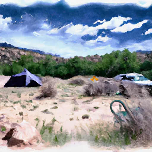
The campground offers several amenities, including picnic tables, fire rings, and vault toilets. There are 17 campsites available, and the campground operates on a first-come, first-served basis.
An interesting fact about the area is that it was once home to the Ute tribe, who were forced out by Spanish conquistadors in the 16th century. Today, visitors can still see evidence of the Ute's presence in the form of rock art and petroglyphs.
The best time to visit the Upper Scorpion Campground is in the summer months, from June to August, when temperatures average around 70°F during the day and drop to the mid-40s at night. However, the campground is also open during the winter months for visitors interested in snow sports.
What's on-site at Upper Scorpion Campground
Key facilities Snoflo tracks for this campground. Confirm with the operator before booking -- amenities can change seasonally.
Plan your trip down to the hour
Same weather feed Snoflo's iOS app uses -- updated continuously from NOAA / yr.no.
Next 5 days, hour by hour
Temperature line with weather symbols on top, snow + rain accumulation as columns, humidity as a dotted line.
5-day forecast table
Every 3 hours, broken out across temperature, snow, rain, humidity, and wind. Each cell is colour-coded relative to the column min/max so trends jump out at a glance.
| Time | Condition | Temp (°F) | Snow (in) | Rain (in) | Humidity (%) | Wind (mps) | Wind dir |
|---|---|---|---|---|---|---|---|
| Loading detailed forecast… | |||||||
15-day temperature & precipitation
Daily temperatures, snow, and rain projected over the next two weeks. Hover any point for the full breakdown.
Other campgrounds in the area
Snoflo-tracked campsites within driving distance of Upper Scorpion Campground, with reservations status.
| Campground | Reservations | Toilets | View |
|---|---|---|---|
| Lower Scorpion Campround | ✗ | ✗ | → |
| Scorpion - Gila Cliff Dwelllings | ✗ | ✓ | → |
| Forks | ✗ | ✓ | → |
| Forks Campground | ✓ | ✗ | → |
| Grapevine | ✗ | ✓ | → |
Nearby streamflow
USGS streamgauges within reach of Upper Scorpion Campground -- pulled live from the National Water Information System.
| Streamgauge | Discharge | View |
|---|---|---|
| Gila River Near Gila | 15 cfs | → |
| Mogollon Creek Near Cliff | 0 cfs | → |
| Mimbres River At Mimbres | 1,040 cfs | → |
| San Francisco River Near Glenwood | 13 cfs | → |
| Gila River Near Redrock | 18 cfs | → |
| San Francisco River Near Reserve | 3,350 cfs | → |
Nearby snow depths
NRCS SNOTEL stations within reach of Upper Scorpion Campground -- relevant when planning a shoulder-season or alpine trip.
| SNOTEL station | Snowpack | 24h Snowfall | View |
|---|---|---|---|
| Signal Peak | 0.0 in | 0.0 in | → |
| Nohrsc Signal Peak | 0.0 in | 0.0 in | → |
| Lookout Mountain | 0.0 in | 0.0 in | → |
| Mcknight Cabin | 0.0 in | 0.0 in | → |
| Nohrsc Mcknight Cabin | 1.0 in | 0.0 in | → |
| Nohrsc Silver Creek Divide | 0.0 in | 0.0 in | → |
Plan a longer trip
The closest parks, lakes, boat launches, and paddle runs so a camping night can grow into a full weekend.
Parks
Points of interest
- Cliff Dwellings
- Senator Clinton P. Anderson Overlook
- Ben Lilly Memorial
- Bear Canyon Lake
- Otto Huechling House Historic Site
- Doctor Granville Wood House Historic Site
Paddle runs
- Northern Boundary Nm To Eastern Boundary Gila Cliff Dwellings Nm
- Headwaters To Northern Boundary Gila Cliff Dwellings Nm
- Headwaters In Gila National Forest To Eastern Boundary Of Gila Cliff Dwellings National Monument
- Gila Wilderness Boundary (Below Snow Lake) To Gila Wilderness Boundary (Sec 24, T12s, R14w)
- Wilderness Run
- Gila Wilderness Boundary To Confluence With East Fork Gila River
Camping essentials & Leave No Trace
- Pack it in, pack it out
- Take all trash, food scraps, and gear back with you to keep campsites clean and protect wildlife.
- Respect wildlife
- Observe animals from a distance, store food securely, and never feed wildlife to maintain natural behavior and safety.
- Know before you go
- Check weather, fire restrictions, trail conditions, and permit requirements to ensure a safe and well-planned trip.
- Minimize campfire impact
- Use established fire rings, keep fires small, fully extinguish them, or opt for a camp stove when fires are restricted.
- Leave what you find
- Preserve natural and cultural features by avoiding removal of plants, rocks, artifacts, or other elements of the environment.
Set push alerts in the Snoflo app
Save Upper Scorpion Campground as a favorite, set a custom threshold (precipitation, snowpack, freezing temperatures), and the iOS app will push the moment conditions cross.
About Upper Scorpion Campground
Can I make reservations at Upper Scorpion Campground?
This campground does not appear to accept reservations -- it's typically first-come, first-served. Arrive early on summer weekends.
How fresh is the weather data on this page?
The hourly forecast updates throughout the day from the NOAA / yr.no public feeds. Streamflow data is pulled live from USGS streamgauges and snowpack from the NRCS SNOTEL network.
What's the best time of year to visit?
Use the 15-day temperature & precipitation outlook on this page to plan -- pick a window with comfortable temperatures and low precipitation. For longer trips, the 5-day hourly meteogram shows snow + rain accumulation hour-by-hour.
How do I get to Upper Scorpion Campground?
Tap Directions in the hero above to open driving directions in Google Maps, or Open in map to center the Snoflo interactive map on the campground.
Can I get alerts when conditions change?
Yes -- alerts are managed through the Snoflo iOS app. Favorite this campground, set a threshold (temperature, snowpack, precipitation), and you'll get a push the moment it crosses.
Other campgrounds near here
Snoflo-tracked campgrounds within driving distance of Upper Scorpion Campground.