Housatonic Meadows State Park campground
Community Reviews
Been here? Share the conditions.
Reviews, ratings & photos are added in the free Snoflo iOS app — rate a spot, tag the conditions, and your visit is verified by location. Add or manage your reviews from the app.
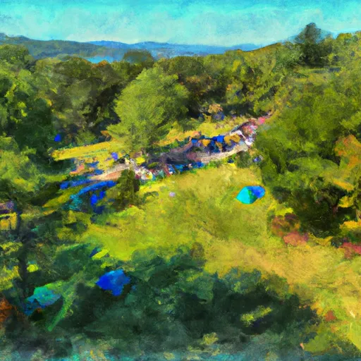
Housatonic Meadows State Park
Reservations are accepted at Housatonic Meadows State Park, allowing campers to secure their desired site in advance. It is highly recommended to make a reservation, especially during peak season, to guarantee availability. The best time to visit this camping area is during the summer and fall months when the weather is mild and the foliage is stunning. However, it is important to note that the campground is closed during the winter season.
Housatonic Meadows State Park offers campers a range of activities to enjoy, including hiking, fishing, and picnicking. The park features scenic trails that lead to the Housatonic River, providing opportunities for peaceful walks and birdwatching. Campers should be cautious of wildlife encounters, as the area is known for black bears. It is advised to store food properly and follow all safety guidelines to prevent any unwanted encounters. Overall, Housatonic Meadows State Park is a delightful camping destination that offers a tranquil retreat amidst nature's beauty.
What's on-site at Housatonic Meadows State Park
Key facilities Snoflo tracks for this campground. Confirm with the operator before booking -- amenities can change seasonally.
Plan your trip down to the hour
Same weather feed Snoflo's iOS app uses -- updated continuously from NOAA / yr.no.
Next 5 days, hour by hour
Temperature line with weather symbols on top, snow + rain accumulation as columns, humidity as a dotted line.
5-day forecast table
Every 3 hours, broken out across temperature, snow, rain, humidity, and wind. Each cell is colour-coded relative to the column min/max so trends jump out at a glance.
| Time | Condition | Temp (°F) | Snow (in) | Rain (in) | Humidity (%) | Wind (mps) | Wind dir |
|---|---|---|---|---|---|---|---|
| Loading detailed forecast… | |||||||
15-day temperature & precipitation
Daily temperatures, snow, and rain projected over the next two weeks. Hover any point for the full breakdown.
Other campgrounds in the area
Snoflo-tracked campsites within driving distance of Housatonic Meadows State Park, with reservations status.
| Campground | Reservations | Toilets | View |
|---|---|---|---|
| Silver Hill Campsite | ✗ | ✗ | → |
| Housatonic Meadows State Park Campground | ✗ | ✗ | → |
| Sharon Mountain Campsite | ✗ | ✗ | → |
| Macedonia Brook State Park | ✓ | ✗ | → |
| Dean's Ravine Campsite | ✗ | ✗ | → |
Nearby streamflow
USGS streamgauges within reach of Housatonic Meadows State Park -- pulled live from the National Water Information System.
| Streamgauge | Discharge | View |
|---|---|---|
| Salmon Creek At Lime Rock | 9 cfs | → |
| Shepaug River At Peters Dam At Woodville | 20 cfs | → |
| Housatonic River At Falls Village | 305 cfs | → |
| Housatonic River At Gaylordsville | 470 cfs | → |
| Tenmile River Near Gaylordsville | 62 cfs | → |
| Housatonic River Nr Ashley Falls | 239 cfs | → |
Nearby snow depths
NRCS SNOTEL stations within reach of Housatonic Meadows State Park -- relevant when planning a shoulder-season or alpine trip.
| SNOTEL station | Snowpack | 24h Snowfall | View |
|---|---|---|---|
| Warren 2.4 Wnw | 0.0 in | 0.0 in | → |
| South Kent 0.1 Se | 0.0 in | 0.0 in | → |
| Litchfield 2.3 Nne | 0.0 in | 0.0 in | → |
| Nohrsc Norfolk | 0.0 in | 0.0 in | → |
| Canaan 4.2 Ese | 0.0 in | 0.0 in | → |
| New Hartford Center 3.2 Sw | 0.0 in | 0.0 in | → |
Plan a longer trip
The closest parks, lakes, boat launches, and paddle runs so a camping night can grow into a full weekend.
Parks
- Housatonic Meadows State Park
- Housatonic State Forest
- Mohawk Mountain State Park
- Wyantenock State Forest-Coltsfoot Block
- Mohawk State Forest
- Wyantenock State Forest-Spectacle Pond Block
Boat launches
Fishing spots
Points of interest
- Cornwall Bridge Road
- Cornwall Bridge
- Kent Road
- Cornwall Historical Society
- West Cornwall Covered Bridge
- Gay-Holt House Museum
Paddle runs
- Pond Downstream Of Shepaug Reservoir Dam, Marked By Service Road Bridge To Ends In Backwaters Of Lake Lillinonah, Near Roxbury Falls
- Kent Bridge To Boardman Bridge
- Falls Mountain Road In Canaan, Connecticut To Kent Bridge
- Begins Downstream Of The Borough Of Bantam, At Stoddard Road Bridge To The Confluence With The Shepaug River
- The Massachusetts-Connecticut Border To Falls Mountain Road In Canaan, Connecticut
- New Hartford/Canton Town Line To The Confluence With The Nepaug River
Camping essentials & Leave No Trace
- Pack it in, pack it out
- Take all trash, food scraps, and gear back with you to keep campsites clean and protect wildlife.
- Respect wildlife
- Observe animals from a distance, store food securely, and never feed wildlife to maintain natural behavior and safety.
- Know before you go
- Check weather, fire restrictions, trail conditions, and permit requirements to ensure a safe and well-planned trip.
- Minimize campfire impact
- Use established fire rings, keep fires small, fully extinguish them, or opt for a camp stove when fires are restricted.
- Leave what you find
- Preserve natural and cultural features by avoiding removal of plants, rocks, artifacts, or other elements of the environment.
Set push alerts in the Snoflo app
Save Housatonic Meadows State Park as a favorite, set a custom threshold (precipitation, snowpack, freezing temperatures), and the iOS app will push the moment conditions cross.
About Housatonic Meadows State Park
Can I make reservations at Housatonic Meadows State Park?
Yes -- this campground accepts reservations. Snoflo recommends booking early for peak season; check the operator (Recreation.gov / state park system / private operator) for the booking window and cancellation policy.
How fresh is the weather data on this page?
The hourly forecast updates throughout the day from the NOAA / yr.no public feeds. Streamflow data is pulled live from USGS streamgauges and snowpack from the NRCS SNOTEL network.
What's the best time of year to visit?
Use the 15-day temperature & precipitation outlook on this page to plan -- pick a window with comfortable temperatures and low precipitation. For longer trips, the 5-day hourly meteogram shows snow + rain accumulation hour-by-hour.
How do I get to Housatonic Meadows State Park?
Tap Directions in the hero above to open driving directions in Google Maps, or Open in map to center the Snoflo interactive map on the campground.
Can I get alerts when conditions change?
Yes -- alerts are managed through the Snoflo iOS app. Favorite this campground, set a threshold (temperature, snowpack, precipitation), and you'll get a push the moment it crosses.
Other campgrounds near here
Snoflo-tracked campgrounds within driving distance of Housatonic Meadows State Park.