Schaghticoke Mountain Camping Area campground
Community Reviews
Been here? Share the conditions.
Reviews, ratings & photos are added in the free Snoflo iOS app — rate a spot, tag the conditions, and your visit is verified by location. Add or manage your reviews from the app.
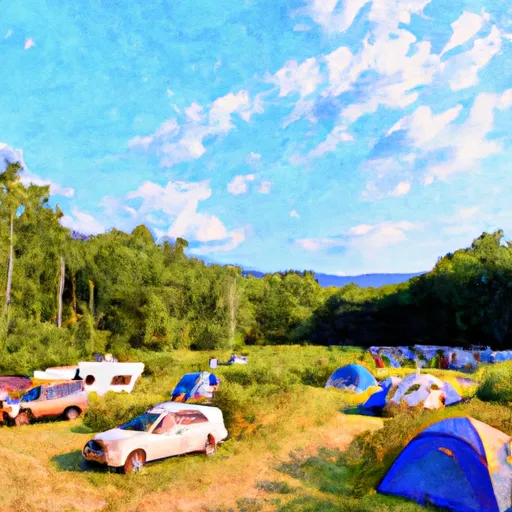
Schaghticoke Mountain Camping Area
Reservations are accepted at Schaghticoke Mountain Camping Area, allowing visitors to secure their spot in advance. This is especially recommended during peak seasons or weekends, as the campground can fill up quickly. It is advisable to make reservations well in advance to avoid disappointment.
The best time to visit Schaghticoke Mountain Camping Area is during the spring and fall months when the weather is mild and pleasant. The surrounding natural beauty, including the nearby Schaghticoke Mountain and Hoosic River, offers a picturesque setting for outdoor enthusiasts. Visitors can enjoy hiking, fishing, and bird watching in the area. However, it is important to be cautious of ticks, as they can be prevalent in the region. Campers should take necessary precautions, such as wearing appropriate clothing and using insect repellent, to avoid tick bites.
In conclusion, Schaghticoke Mountain Camping Area in New York is a well-equipped campground that provides a range of amenities for a comfortable stay. Reservations are accepted, and it is advisable to plan ahead, especially during busy periods. The best time to visit is during the spring and fall, offering an opportunity to explore the natural beauty of the surrounding area. However, campers should be mindful of tick presence and take necessary precautions.
What's on-site at Schaghticoke Mountain Camping Area
Key facilities Snoflo tracks for this campground. Confirm with the operator before booking -- amenities can change seasonally.
Plan your trip down to the hour
Same weather feed Snoflo's iOS app uses -- updated continuously from NOAA / yr.no.
Next 5 days, hour by hour
Temperature line with weather symbols on top, snow + rain accumulation as columns, humidity as a dotted line.
5-day forecast table
Every 3 hours, broken out across temperature, snow, rain, humidity, and wind. Each cell is colour-coded relative to the column min/max so trends jump out at a glance.
| Time | Condition | Temp (°F) | Snow (in) | Rain (in) | Humidity (%) | Wind (mps) | Wind dir |
|---|---|---|---|---|---|---|---|
| Loading detailed forecast… | |||||||
15-day temperature & precipitation
Daily temperatures, snow, and rain projected over the next two weeks. Hover any point for the full breakdown.
Other campgrounds in the area
Snoflo-tracked campsites within driving distance of Schaghticoke Mountain Camping Area, with reservations status.
| Campground | Reservations | Toilets | View |
|---|---|---|---|
| Macedonia Brook State Park | ✓ | ✗ | → |
| Lake Waramaug State Park | ✓ | ✗ | → |
| Silver Hill Campsite | ✗ | ✗ | → |
| Sr4 | ✗ | ✗ | → |
| Housatonic Meadows State Park | ✓ | ✗ | → |
Nearby streamflow
USGS streamgauges within reach of Schaghticoke Mountain Camping Area -- pulled live from the National Water Information System.
| Streamgauge | Discharge | View |
|---|---|---|
| Tenmile River Near Gaylordsville | 71 cfs | → |
| Housatonic River At Gaylordsville | 492 cfs | → |
| Shepaug River At Peters Dam At Woodville | 20 cfs | → |
| Still River At Route 7 At Brookfield Center | 73 cfs | → |
| East Branch Croton River Near Putnam Lake Ny | 37 cfs | → |
| Salmon Creek At Lime Rock | 10 cfs | → |
Nearby snow depths
NRCS SNOTEL stations within reach of Schaghticoke Mountain Camping Area -- relevant when planning a shoulder-season or alpine trip.
| SNOTEL station | Snowpack | 24h Snowfall | View |
|---|---|---|---|
| South Kent 0.1 Se | 0.0 in | 0.0 in | → |
| Warren 2.4 Wnw | 0.0 in | 0.0 in | → |
| Lagrangeville 3.4 Ne | 0.0 in | 0.0 in | → |
| New Milford 5.3 Ssw | 0.0 in | 0.0 in | → |
| Hopewell Junction 2.8 Ne | 0.0 in | 0.0 in | → |
| Litchfield 2.3 Nne | 0.0 in | 0.0 in | → |
Plan a longer trip
The closest parks, lakes, boat launches, and paddle runs so a camping night can grow into a full weekend.
Parks
- Kent Falls State Park
- Macedonia Brook State Park
- Emmanuel Williamson Park
- Wyantenock State Forest-Spectacle Pond Block
- Lake Waramaug State Park
- Mount Bushnell State Park
Boat launches
- South Kent Road Kent
- Grove Street 251, New Milford
- Squantz Pond
- Mohawk Pond
- Old Bogus Road 4, New Fairfield
- Mudge Pond
Fishing spots
Points of interest
Paddle runs
- Kent Bridge To Boardman Bridge
- Pond Downstream Of Shepaug Reservoir Dam, Marked By Service Road Bridge To Ends In Backwaters Of Lake Lillinonah, Near Roxbury Falls
- Begins Downstream Of The Borough Of Bantam, At Stoddard Road Bridge To The Confluence With The Shepaug River
- Falls Mountain Road In Canaan, Connecticut To Kent Bridge
- The Massachusetts-Connecticut Border To Falls Mountain Road In Canaan, Connecticut
- Begins Below The Tailrace Of The Lower Collinsville Dam To The Route 187 Bridge
Camping essentials & Leave No Trace
- Pack it in, pack it out
- Take all trash, food scraps, and gear back with you to keep campsites clean and protect wildlife.
- Respect wildlife
- Observe animals from a distance, store food securely, and never feed wildlife to maintain natural behavior and safety.
- Know before you go
- Check weather, fire restrictions, trail conditions, and permit requirements to ensure a safe and well-planned trip.
- Minimize campfire impact
- Use established fire rings, keep fires small, fully extinguish them, or opt for a camp stove when fires are restricted.
- Leave what you find
- Preserve natural and cultural features by avoiding removal of plants, rocks, artifacts, or other elements of the environment.
Set push alerts in the Snoflo app
Save Schaghticoke Mountain Camping Area as a favorite, set a custom threshold (precipitation, snowpack, freezing temperatures), and the iOS app will push the moment conditions cross.
About Schaghticoke Mountain Camping Area
Can I make reservations at Schaghticoke Mountain Camping Area?
This campground does not appear to accept reservations -- it's typically first-come, first-served. Arrive early on summer weekends.
How fresh is the weather data on this page?
The hourly forecast updates throughout the day from the NOAA / yr.no public feeds. Streamflow data is pulled live from USGS streamgauges and snowpack from the NRCS SNOTEL network.
What's the best time of year to visit?
Use the 15-day temperature & precipitation outlook on this page to plan -- pick a window with comfortable temperatures and low precipitation. For longer trips, the 5-day hourly meteogram shows snow + rain accumulation hour-by-hour.
How do I get to Schaghticoke Mountain Camping Area?
Tap Directions in the hero above to open driving directions in Google Maps, or Open in map to center the Snoflo interactive map on the campground.
Can I get alerts when conditions change?
Yes -- alerts are managed through the Snoflo iOS app. Favorite this campground, set a threshold (temperature, snowpack, precipitation), and you'll get a push the moment it crosses.
Other campgrounds near here
Snoflo-tracked campgrounds within driving distance of Schaghticoke Mountain Camping Area.