Tilly Jane Campground Campground
Community Reviews
Been here? Share the conditions.
Reviews, ratings & photos are added in the free Snoflo iOS app — rate a spot, tag the conditions, and your visit is verified by location. Add or manage your reviews from the app.
Tilly Jane Campground
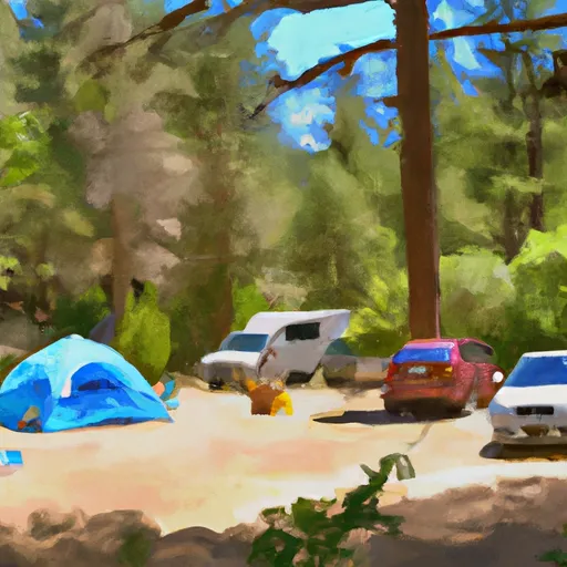
There are 18 campsites available at Tilly Jane Campground, with amenities including picnic tables, fire rings, and vault toilets. The campground operates on a first-come, first-served basis.
An interesting fact about the area is that Tilly Jane Creek, which runs through the campground, was named after a woman who homesteaded in the area in the late 19th century.
The best time to visit Tilly Jane Campground is during the summer months, with average temperatures ranging from the mid-60s to low 70s Fahrenheit. However, the campground is also open year-round for winter camping and activities such as snowshoeing and cross-country skiing.
What's on-site at Tilly Jane Campground
Key facilities Snoflo tracks for this campground. Confirm with the operator before booking -- amenities can change seasonally.
Plan your trip down to the hour
Same weather feed Snoflo's iOS app uses -- updated continuously from NOAA / yr.no.
Next 5 days, hour by hour
Temperature line with weather symbols on top, snow + rain accumulation as columns, humidity as a dotted line.
5-day forecast table
Every 3 hours, broken out across temperature, snow, rain, humidity, and wind. Each cell is colour-coded relative to the column min/max so trends jump out at a glance.
| Time | Condition | Temp (°F) | Snow (in) | Rain (in) | Humidity (%) | Wind (mps) | Wind dir |
|---|---|---|---|---|---|---|---|
| Loading detailed forecast… | |||||||
15-day temperature & precipitation
Daily temperatures, snow, and rain projected over the next two weeks. Hover any point for the full breakdown.
Other campgrounds in the area
Snoflo-tracked campsites within driving distance of Tilly Jane Campground, with reservations status.
| Campground | Reservations | Toilets | View |
|---|---|---|---|
| Tilly Jane Cabin (Guard Station) | ✓ | ✗ | → |
| Cloud Cap Saddle Campground | ✗ | ✗ | → |
| Elk Cove Camp | ✗ | ✗ | → |
| Sherwood Campground | ✗ | ✗ | → |
| Sherwood | ✗ | ✓ | → |
Nearby streamflow
USGS streamgauges within reach of Tilly Jane Campground -- pulled live from the National Water Information System.
| Streamgauge | Discharge | View |
|---|---|---|
| Bull Run River At Lower Flume Nr Brightwood | 19 cfs | → |
| Blazed Alder Creek Near Rhododendron | 2 cfs | → |
| Hood River At Tucker Bridge | 236 cfs | → |
| Bull Run River Near Multnomah Falls | 45 cfs | → |
| Fir Creek Near Brightwood | 3 cfs | → |
| North Fork Bull Run River Near Multnomah Falls | 11 cfs | → |
Nearby snow depths
NRCS SNOTEL stations within reach of Tilly Jane Campground -- relevant when planning a shoulder-season or alpine trip.
| SNOTEL station | Snowpack | 24h Snowfall | View |
|---|---|---|---|
| Mt. Hood Meadows Base | 13.7 in | 0.0 in | → |
| Red Hill | 0.0 in | 0.0 in | → |
| Nohrsc Red Hill | 1.0 in | 0.0 in | → |
| Timberline Lodge | 9.6 in | 0.0 in | → |
| Mt Hood Test Site | 1.0 in | 1.0 in | → |
| Mt Hood Test Site | 1.0 in | 0.0 in | → |
Plan a longer trip
The closest parks, lakes, boat launches, and paddle runs so a camping night can grow into a full weekend.
Parks
- National Wild And Scenic River East Fork Hood River, Oregon
- National Wild And Scenic River Fifteenmile Creek, Oregon
- Dimmick State Park
- Tollbridge County Park
- Wilderness Badger Creek
- Wilderness Mount Hood
Boat launches
- Laurance Lake
- Badger Lake
- Trillium Lake Camp
- Lost Lake Resort
- Clear Lake Campground
- Kingsley Campground
Camping essentials & Leave No Trace
- Pack it in, pack it out
- Take all trash, food scraps, and gear back with you to keep campsites clean and protect wildlife.
- Respect wildlife
- Observe animals from a distance, store food securely, and never feed wildlife to maintain natural behavior and safety.
- Know before you go
- Check weather, fire restrictions, trail conditions, and permit requirements to ensure a safe and well-planned trip.
- Minimize campfire impact
- Use established fire rings, keep fires small, fully extinguish them, or opt for a camp stove when fires are restricted.
- Leave what you find
- Preserve natural and cultural features by avoiding removal of plants, rocks, artifacts, or other elements of the environment.
Set push alerts in the Snoflo app
Save Tilly Jane Campground as a favorite, set a custom threshold (precipitation, snowpack, freezing temperatures), and the iOS app will push the moment conditions cross.
About Tilly Jane Campground
Can I make reservations at Tilly Jane Campground?
This campground does not appear to accept reservations -- it's typically first-come, first-served. Arrive early on summer weekends.
How fresh is the weather data on this page?
The hourly forecast updates throughout the day from the NOAA / yr.no public feeds. Streamflow data is pulled live from USGS streamgauges and snowpack from the NRCS SNOTEL network.
What's the best time of year to visit?
Use the 15-day temperature & precipitation outlook on this page to plan -- pick a window with comfortable temperatures and low precipitation. For longer trips, the 5-day hourly meteogram shows snow + rain accumulation hour-by-hour.
How do I get to Tilly Jane Campground?
Tap Directions in the hero above to open driving directions in Google Maps, or Open in map to center the Snoflo interactive map on the campground.
Can I get alerts when conditions change?
Yes -- alerts are managed through the Snoflo iOS app. Favorite this campground, set a threshold (temperature, snowpack, precipitation), and you'll get a push the moment it crosses.
Other campgrounds near here
Snoflo-tracked campgrounds within driving distance of Tilly Jane Campground.