Upper Sharps Bar Camp Campground
Community Reviews
Been here? Share the conditions.
Reviews, ratings & photos are added in the free Snoflo iOS app — rate a spot, tag the conditions, and your visit is verified by location. Add or manage your reviews from the app.
Upper Sharps Bar Camp
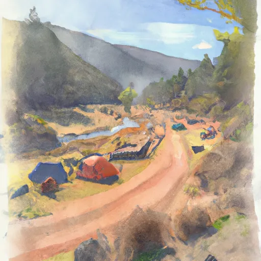
There are several points of interest near Upper Sharps Bar Camp, including the nearby Rogue River and the historic town of Grants Pass. The campground amenities include restrooms, picnic areas, and fire pits. The camping area is available on a first-come, first-serve basis, and there are a total of 10 campsites available.
One interesting fact about Upper Sharps Bar Camp is that it is located along the Rogue River, which is one of the most popular destinations for river rafting in Oregon. Visitors can also explore the nearby forests and wildlife, including bald eagles and black bears.
The best time of year to visit Upper Sharps Bar Camp is during the summer months, from June to September. The average temperature during this time of year is around 85°F during the day and 55°F at night, making it an ideal time for outdoor activities. Overall, Upper Sharps Bar Camp is a great destination for nature enthusiasts who want to explore the beautiful landscape of Oregon.
What's on-site at Upper Sharps Bar Camp
Key facilities Snoflo tracks for this campground. Confirm with the operator before booking -- amenities can change seasonally.
Plan your trip down to the hour
Same weather feed Snoflo's iOS app uses -- updated continuously from NOAA / yr.no.
Next 5 days, hour by hour
Temperature line with weather symbols on top, snow + rain accumulation as columns, humidity as a dotted line.
5-day forecast table
Every 3 hours, broken out across temperature, snow, rain, humidity, and wind. Each cell is colour-coded relative to the column min/max so trends jump out at a glance.
| Time | Condition | Temp (°F) | Snow (in) | Rain (in) | Humidity (%) | Wind (mps) | Wind dir |
|---|---|---|---|---|---|---|---|
| Loading detailed forecast… | |||||||
15-day temperature & precipitation
Daily temperatures, snow, and rain projected over the next two weeks. Hover any point for the full breakdown.
Other campgrounds in the area
Snoflo-tracked campsites within driving distance of Upper Sharps Bar Camp, with reservations status.
| Campground | Reservations | Toilets | View |
|---|---|---|---|
| D6.06l | ✗ | ✗ | → |
| D5.94l | ✗ | ✗ | → |
| Game Commission Camp | ✗ | ✗ | → |
| Lower Sharps Bar Camp | ✗ | ✗ | → |
| Gordon Ridge Camp | ✗ | ✗ | → |
Nearby streamflow
USGS streamgauges within reach of Upper Sharps Bar Camp -- pulled live from the National Water Information System.
| Streamgauge | Discharge | View |
|---|---|---|
| Deschutes River At Moody | 3,920 cfs | → |
| Columbia River At The Dalles | 118,000 cfs | → |
| Klickitat River Near Pitt | 767 cfs | → |
| Mosier Creek Near Mosier | 0 cfs | → |
| John Day River At Mcdonald Ferry | 55 cfs | → |
| Klickitat River Bl Summit Creek Near Glenwood | 1,820 cfs | → |
Nearby snow depths
NRCS SNOTEL stations within reach of Upper Sharps Bar Camp -- relevant when planning a shoulder-season or alpine trip.
| SNOTEL station | Snowpack | 24h Snowfall | View |
|---|---|---|---|
| Snowden | 0.0 in | 0.0 in | → |
| Nohrsc Indian Rock | 0.0 in | 0.0 in | → |
| Indian Rock | 0.0 in | 0.0 in | → |
| 20d01 - Satus Pass | 0.0 in | 0.0 in | → |
| Hood River | 0.0 in | 0.0 in | → |
| Satus Pass | 0.0 in | 0.0 in | → |
Plan a longer trip
The closest parks, lakes, boat launches, and paddle runs so a camping night can grow into a full weekend.
Parks
- Deschutes River State Recreation Area
- Celilo Park
- Maryhill State Park
- Horsethief Lake State Park
- Columbia Hills Natural Area Preserve
- Sorosis Park
Boat launches
- Heritage Landing State Park
- Heritage Landing
- Celilo Park
- Avery Park
- Maryhill State Park
- Lewis And Clark Trail Highway Dallesport
Camping essentials & Leave No Trace
- Pack it in, pack it out
- Take all trash, food scraps, and gear back with you to keep campsites clean and protect wildlife.
- Respect wildlife
- Observe animals from a distance, store food securely, and never feed wildlife to maintain natural behavior and safety.
- Know before you go
- Check weather, fire restrictions, trail conditions, and permit requirements to ensure a safe and well-planned trip.
- Minimize campfire impact
- Use established fire rings, keep fires small, fully extinguish them, or opt for a camp stove when fires are restricted.
- Leave what you find
- Preserve natural and cultural features by avoiding removal of plants, rocks, artifacts, or other elements of the environment.
Set push alerts in the Snoflo app
Save Upper Sharps Bar Camp as a favorite, set a custom threshold (precipitation, snowpack, freezing temperatures), and the iOS app will push the moment conditions cross.
About Upper Sharps Bar Camp
Can I make reservations at Upper Sharps Bar Camp?
This campground does not appear to accept reservations -- it's typically first-come, first-served. Arrive early on summer weekends.
How fresh is the weather data on this page?
The hourly forecast updates throughout the day from the NOAA / yr.no public feeds. Streamflow data is pulled live from USGS streamgauges and snowpack from the NRCS SNOTEL network.
What's the best time of year to visit?
Use the 15-day temperature & precipitation outlook on this page to plan -- pick a window with comfortable temperatures and low precipitation. For longer trips, the 5-day hourly meteogram shows snow + rain accumulation hour-by-hour.
How do I get to Upper Sharps Bar Camp?
Tap Directions in the hero above to open driving directions in Google Maps, or Open in map to center the Snoflo interactive map on the campground.
Can I get alerts when conditions change?
Yes -- alerts are managed through the Snoflo iOS app. Favorite this campground, set a threshold (temperature, snowpack, precipitation), and you'll get a push the moment it crosses.
Other campgrounds near here
Snoflo-tracked campgrounds within driving distance of Upper Sharps Bar Camp.