Shady Rest Camping Area Campground
Community Reviews
Been here? Share the conditions.
Reviews, ratings & photos are added in the free Snoflo iOS app — rate a spot, tag the conditions, and your visit is verified by location. Add or manage your reviews from the app.
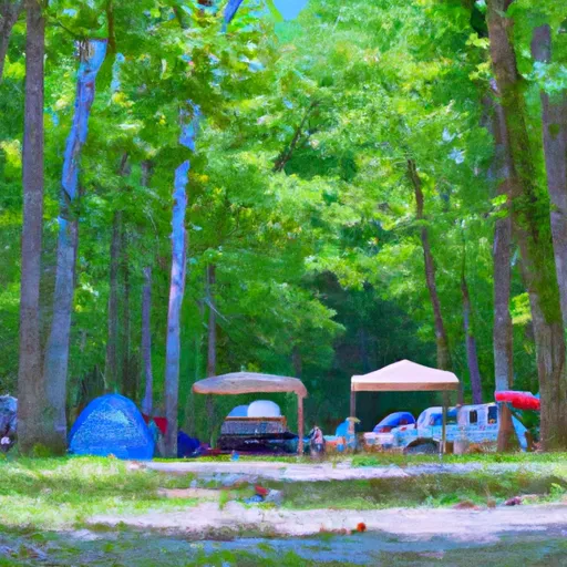
Shady Rest Camping Area
Reservations are accepted at Shady Rest Camping Area, ensuring visitors can secure their desired camping dates in advance. However, it is advisable to make reservations early, especially during peak season, as the campground can get quite busy. The best time to visit Shady Rest Camping Area is during the spring and fall seasons when the weather is mild, and the foliage is vibrant. This allows campers to fully enjoy the beauty of the area and engage in various outdoor activities.
While at the campground, campers should be mindful of the local wildlife, including bears, and take necessary precautions such as properly storing food and disposing of waste. Additionally, it is important to follow all campfire regulations to prevent accidental wildfires. Overall, Shady Rest Camping Area offers a peaceful and well-equipped camping experience for nature enthusiasts and is an ideal destination for those looking to immerse themselves in the beauty of Tennessee's outdoors.
What's on-site at Shady Rest Camping Area
Key facilities Snoflo tracks for this campground. Confirm with the operator before booking -- amenities can change seasonally.
Plan your trip down to the hour
Same weather feed Snoflo's iOS app uses -- updated continuously from NOAA / yr.no.
Next 5 days, hour by hour
Temperature line with weather symbols on top, snow + rain accumulation as columns, humidity as a dotted line.
5-day forecast table
Every 3 hours, broken out across temperature, snow, rain, humidity, and wind. Each cell is colour-coded relative to the column min/max so trends jump out at a glance.
| Time | Condition | Temp (°F) | Snow (in) | Rain (in) | Humidity (%) | Wind (mps) | Wind dir |
|---|---|---|---|---|---|---|---|
| Loading detailed forecast… | |||||||
15-day temperature & precipitation
Daily temperatures, snow, and rain projected over the next two weeks. Hover any point for the full breakdown.
Other campgrounds in the area
Snoflo-tracked campsites within driving distance of Shady Rest Camping Area, with reservations status.
| Campground | Reservations | Toilets | View |
|---|---|---|---|
| Sun Valley | ✗ | ✗ | → |
| White Oak | ✗ | ✗ | → |
| Kings Camp | ✗ | ✗ | → |
| Camping Islands | ✗ | ✗ | → |
Nearby streamflow
USGS streamgauges within reach of Shady Rest Camping Area -- pulled live from the National Water Information System.
| Streamgauge | Discharge | View |
|---|---|---|
| Rock River At Byron | 3,870 cfs | → |
| Kishwaukee River Near Perryville | 625 cfs | → |
| Elkhorn Creek Near Penrose | 68 cfs | → |
| South Branch Kishwaukee River Nr Fairdale Il | 173 cfs | → |
| Pecatonica River At Freeport | 915 cfs | → |
| Rock River At Como | 4,350 cfs | → |
Nearby snow depths
NRCS SNOTEL stations within reach of Shady Rest Camping Area -- relevant when planning a shoulder-season or alpine trip.
| SNOTEL station | Snowpack | 24h Snowfall | View |
|---|---|---|---|
| New Millford 3.3 W | 0.0 in | 0.0 in | → |
| Dixon | 0.0 in | 0.0 in | → |
| Amboy 0.5 Ssw | 0.0 in | 0.0 in | → |
| Pecatonica River | 0.0 in | 0.0 in | → |
| Freeport 1.7 Nw | 0.0 in | 0.0 in | → |
| Freeport 2.0 Nw | 0.0 in | 0.0 in | → |
Plan a longer trip
The closest parks, lakes, boat launches, and paddle runs so a camping night can grow into a full weekend.
Parks
- Lowden State Park
- Oregon Park East
- Oregon Park West
- Pine Rock Nature Preserve
- Weld Memorial Park
- Hal Palmer Park
Boat launches
- Dixon Boat Launch
- Il 2 Grand Detour
- Market Street Byron
- Byron Boat Ramp
- Lake Sule
- Lakeshore Drive 3630, Winnebago County
Points of interest
Camping essentials & Leave No Trace
- Pack it in, pack it out
- Take all trash, food scraps, and gear back with you to keep campsites clean and protect wildlife.
- Respect wildlife
- Observe animals from a distance, store food securely, and never feed wildlife to maintain natural behavior and safety.
- Know before you go
- Check weather, fire restrictions, trail conditions, and permit requirements to ensure a safe and well-planned trip.
- Minimize campfire impact
- Use established fire rings, keep fires small, fully extinguish them, or opt for a camp stove when fires are restricted.
- Leave what you find
- Preserve natural and cultural features by avoiding removal of plants, rocks, artifacts, or other elements of the environment.
Set push alerts in the Snoflo app
Save Shady Rest Camping Area as a favorite, set a custom threshold (precipitation, snowpack, freezing temperatures), and the iOS app will push the moment conditions cross.
About Shady Rest Camping Area
Can I make reservations at Shady Rest Camping Area?
This campground does not appear to accept reservations -- it's typically first-come, first-served. Arrive early on summer weekends.
How fresh is the weather data on this page?
The hourly forecast updates throughout the day from the NOAA / yr.no public feeds. Streamflow data is pulled live from USGS streamgauges and snowpack from the NRCS SNOTEL network.
What's the best time of year to visit?
Use the 15-day temperature & precipitation outlook on this page to plan -- pick a window with comfortable temperatures and low precipitation. For longer trips, the 5-day hourly meteogram shows snow + rain accumulation hour-by-hour.
How do I get to Shady Rest Camping Area?
Tap Directions in the hero above to open driving directions in Google Maps, or Open in map to center the Snoflo interactive map on the campground.
Can I get alerts when conditions change?
Yes -- alerts are managed through the Snoflo iOS app. Favorite this campground, set a threshold (temperature, snowpack, precipitation), and you'll get a push the moment it crosses.
Other campgrounds near here
Snoflo-tracked campgrounds within driving distance of Shady Rest Camping Area.