Warriors Path State Park Campground
Community Reviews
Been here? Share the conditions.
Reviews, ratings & photos are added in the free Snoflo iOS app — rate a spot, tag the conditions, and your visit is verified by location. Add or manage your reviews from the app.
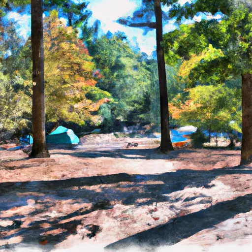
Warriors Path State Park
A unique feature of the Warriors Path State Park camping area is that it is located on the site of a former Cherokee village. Visitors can explore the history of the area through the park's interpretive center and the nearby Emissaries of Peace sculpture.
The best time of year to visit Warriors Path State Park camping area is during the fall season, from September to November, when the temperatures are mild and the colors of the leaves are vibrant. The average temperature during this time ranges from 55°F to 74°F. Overall, Warriors Path State Park camping area offers a peaceful and scenic camping experience in Tennessee.
What's on-site at Warriors Path State Park
Key facilities Snoflo tracks for this campground. Confirm with the operator before booking -- amenities can change seasonally.
Plan your trip down to the hour
Same weather feed Snoflo's iOS app uses -- updated continuously from NOAA / yr.no.
Next 5 days, hour by hour
Temperature line with weather symbols on top, snow + rain accumulation as columns, humidity as a dotted line.
5-day forecast table
Every 3 hours, broken out across temperature, snow, rain, humidity, and wind. Each cell is colour-coded relative to the column min/max so trends jump out at a glance.
| Time | Condition | Temp (°F) | Snow (in) | Rain (in) | Humidity (%) | Wind (mps) | Wind dir |
|---|---|---|---|---|---|---|---|
| Loading detailed forecast… | |||||||
15-day temperature & precipitation
Daily temperatures, snow, and rain projected over the next two weeks. Hover any point for the full breakdown.
Other campgrounds in the area
Snoflo-tracked campsites within driving distance of Warriors Path State Park, with reservations status.
| Campground | Reservations | Toilets | View |
|---|---|---|---|
| Round Top Rv Park | ✗ | ✗ | → |
| Persimmon Ridge City Park | ✗ | ✗ | → |
| Primitive Campground | ✗ | ✗ | → |
| Natural Tunnel State Park | ✓ | ✗ | → |
| Low Gap Camp | ✗ | ✗ | → |
Nearby streamflow
USGS streamgauges within reach of Warriors Path State Park -- pulled live from the National Water Information System.
| Streamgauge | Discharge | View |
|---|---|---|
| N F Holston River Near Gate City | 411 cfs | → |
| Watauga River At Elizabethton | 493 cfs | → |
| Clinch River At Speers Ferry | 763 cfs | → |
| Doe River At Elizabethton | 293 cfs | → |
| Beaver Creek At Bristol | 22 cfs | → |
| Big Limestone Creek Near Limestone | 76 cfs | → |
Nearby snow depths
NRCS SNOTEL stations within reach of Warriors Path State Park -- relevant when planning a shoulder-season or alpine trip.
| SNOTEL station | Snowpack | 24h Snowfall | View |
|---|---|---|---|
| Kingsport | 0.0 in | 0.0 in | → |
| Elizabethton | 0.0 in | 0.0 in | → |
| Erwin | 0.0 in | 0.0 in | → |
| Abingdon 3s | 0.0 in | 0.0 in | → |
| Flat Springs 1e | 0.0 in | 0.0 in | → |
| Flat Springs 1.2 E | 0.0 in | 0.0 in | → |
Plan a longer trip
The closest parks, lakes, boat launches, and paddle runs so a camping night can grow into a full weekend.
Parks
- Warriors Path State Park
- Borden Park
- Appalachian Fairgrounds
- Bays Mountain State Natural Area
- R P Kane Athletic Field
- New Kiwanis Park
Boat launches
- Light Street Sullivan County
- Cooks Valley Road 1908, Kingsport
- Beulah Church Drive Sullivan County
- Smith Shoals
- Minga Road Sullivan County
- Lakeview Marina
Fishing spots
- Bark Camp Recreation Area
- Watauga River
- Nolichucky River
- Lake Keokee Day Use Area
- Dillard Place
- Moses Turn
Points of interest
- Kingsport Aquatic Center
- Suzanne Barrett Justis Fine Art
- Gray Fossil Site And Museum
- Rocky Mount State Historic Site
- Bristol Thunder Valley Dragway
- Jonesborough History Museum
Paddle runs
- Fs Route 700 To Confluence With Clinch River
- Confluence With Guest River To Confluence With Little Stony Creek
- Tn/Nc State Line (Rm 100.6) To Mine Branch (Rm 99.3)
- State Route 72 Bridge To Confluence With Clinch River
- Headwaters To Tn/Va State Line
- Headwaters To Alternative Route 58
Camping essentials & Leave No Trace
- Pack it in, pack it out
- Take all trash, food scraps, and gear back with you to keep campsites clean and protect wildlife.
- Respect wildlife
- Observe animals from a distance, store food securely, and never feed wildlife to maintain natural behavior and safety.
- Know before you go
- Check weather, fire restrictions, trail conditions, and permit requirements to ensure a safe and well-planned trip.
- Minimize campfire impact
- Use established fire rings, keep fires small, fully extinguish them, or opt for a camp stove when fires are restricted.
- Leave what you find
- Preserve natural and cultural features by avoiding removal of plants, rocks, artifacts, or other elements of the environment.
Set push alerts in the Snoflo app
Save Warriors Path State Park as a favorite, set a custom threshold (precipitation, snowpack, freezing temperatures), and the iOS app will push the moment conditions cross.
About Warriors Path State Park
Can I make reservations at Warriors Path State Park?
Yes -- this campground accepts reservations. Snoflo recommends booking early for peak season; check the operator (Recreation.gov / state park system / private operator) for the booking window and cancellation policy.
How fresh is the weather data on this page?
The hourly forecast updates throughout the day from the NOAA / yr.no public feeds. Streamflow data is pulled live from USGS streamgauges and snowpack from the NRCS SNOTEL network.
What's the best time of year to visit?
Use the 15-day temperature & precipitation outlook on this page to plan -- pick a window with comfortable temperatures and low precipitation. For longer trips, the 5-day hourly meteogram shows snow + rain accumulation hour-by-hour.
How do I get to Warriors Path State Park?
Tap Directions in the hero above to open driving directions in Google Maps, or Open in map to center the Snoflo interactive map on the campground.
Can I get alerts when conditions change?
Yes -- alerts are managed through the Snoflo iOS app. Favorite this campground, set a threshold (temperature, snowpack, precipitation), and you'll get a push the moment it crosses.
Other campgrounds near here
Snoflo-tracked campgrounds within driving distance of Warriors Path State Park.