South Fork Camping Area Campground
Community Reviews
Been here? Share the conditions.
Reviews, ratings & photos are added in the free Snoflo iOS app — rate a spot, tag the conditions, and your visit is verified by location. Add or manage your reviews from the app.
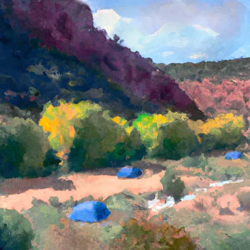
South Fork Camping Area
Reservations are accepted at South Fork Camping Area, making it convenient for campers to secure their spot in advance. It is advisable to book in advance, especially during peak seasons, to ensure availability. The campground is open year-round, but the best time to visit is during the spring and fall seasons when the weather is mild and pleasant.
Visitors to South Fork Camping Area should be cautious of the wildlife in the area, such as bears and other animals. It is crucial to properly store food and dispose of waste to prevent any unwanted encounters. Additionally, campers should be aware of their surroundings and exercise caution when hiking or exploring the trails. Overall, South Fork Camping Area offers a comfortable and well-equipped campground for those seeking a peaceful and nature-filled camping experience.
What's on-site at South Fork Camping Area
Key facilities Snoflo tracks for this campground. Confirm with the operator before booking -- amenities can change seasonally.
Plan your trip down to the hour
Same weather feed Snoflo's iOS app uses -- updated continuously from NOAA / yr.no.
Next 5 days, hour by hour
Temperature line with weather symbols on top, snow + rain accumulation as columns, humidity as a dotted line.
5-day forecast table
Every 3 hours, broken out across temperature, snow, rain, humidity, and wind. Each cell is colour-coded relative to the column min/max so trends jump out at a glance.
| Time | Condition | Temp (°F) | Snow (in) | Rain (in) | Humidity (%) | Wind (mps) | Wind dir |
|---|---|---|---|---|---|---|---|
| Loading detailed forecast… | |||||||
15-day temperature & precipitation
Daily temperatures, snow, and rain projected over the next two weeks. Hover any point for the full breakdown.
Other campgrounds in the area
Snoflo-tracked campsites within driving distance of South Fork Camping Area, with reservations status.
| Campground | Reservations | Toilets | View |
|---|---|---|---|
| North Fork Camping Area | ✗ | ✗ | → |
| Trout Creek Guard Station | ✓ | ✗ | → |
| Red Springs | ✓ | ✗ | → |
| Red Springs Campground | ✗ | ✗ | → |
| Windy Park Camping Area | ✗ | ✗ | → |
Nearby streamflow
USGS streamgauges within reach of South Fork Camping Area -- pulled live from the National Water Information System.
| Streamgauge | Discharge | View |
|---|---|---|
| Ashley Cr Abv Sp Nr Vernal Ut | 4 cfs | → |
| Ashley Creek Near Vernal | 68 cfs | → |
| Whiterocks River Near Whiterocks | 126 cfs | → |
| Big Brush Creek Abv Red Fleet Res | 10 cfs | → |
| Henrys Fork Near Manila | 9 cfs | → |
| Green River Near Greendale | 1,730 cfs | → |
Nearby snow depths
NRCS SNOTEL stations within reach of South Fork Camping Area -- relevant when planning a shoulder-season or alpine trip.
| SNOTEL station | Snowpack | 24h Snowfall | View |
|---|---|---|---|
| Trout Creek | 0.0 in | 0.0 in | → |
| Trout Creek | 194.0 in | 0.0 in | → |
| Sr-44 At Mp 9 Moose Pond | 4.2 in | 0.0 in | → |
| Nohrsc King's Cabin | 0.0 in | 0.0 in | → |
| King's Cabin | 1.0 in | 0.0 in | → |
| Mosby Mtn. | 0.0 in | 0.0 in | → |
Plan a longer trip
The closest parks, lakes, boat launches, and paddle runs so a camping night can grow into a full weekend.
Parks
- Flaming Gorge National Recreation Area
- State Conservation Area Utah State Department Of Wildlife Resources 166
- Steinaker State Park
- Red Fleet State Park
- Vernal City Park
- Utah Field House Of Natural Historic State Park Museum
Boat launches
- Ute Mountain Trail Daggett County
- Forest Road 009 Daggett County
- Sheep Creek Bay
- Long Park Reservoir Trail Daggett County
- Spirit Lake
- Forest Road 145; Us Highway Fs Road 145 Daggett County
Fishing spots
- Ashley Twin Lakes
- Browne Reservoir
- Long Park Boat Launch Area
- West Greens Lake Fishing Site
- Chepeta Lake
- Red Fleet Reservoir
Camping essentials & Leave No Trace
- Pack it in, pack it out
- Take all trash, food scraps, and gear back with you to keep campsites clean and protect wildlife.
- Respect wildlife
- Observe animals from a distance, store food securely, and never feed wildlife to maintain natural behavior and safety.
- Know before you go
- Check weather, fire restrictions, trail conditions, and permit requirements to ensure a safe and well-planned trip.
- Minimize campfire impact
- Use established fire rings, keep fires small, fully extinguish them, or opt for a camp stove when fires are restricted.
- Leave what you find
- Preserve natural and cultural features by avoiding removal of plants, rocks, artifacts, or other elements of the environment.
Set push alerts in the Snoflo app
Save South Fork Camping Area as a favorite, set a custom threshold (precipitation, snowpack, freezing temperatures), and the iOS app will push the moment conditions cross.
About South Fork Camping Area
Can I make reservations at South Fork Camping Area?
This campground does not appear to accept reservations -- it's typically first-come, first-served. Arrive early on summer weekends.
How fresh is the weather data on this page?
The hourly forecast updates throughout the day from the NOAA / yr.no public feeds. Streamflow data is pulled live from USGS streamgauges and snowpack from the NRCS SNOTEL network.
What's the best time of year to visit?
Use the 15-day temperature & precipitation outlook on this page to plan -- pick a window with comfortable temperatures and low precipitation. For longer trips, the 5-day hourly meteogram shows snow + rain accumulation hour-by-hour.
How do I get to South Fork Camping Area?
Tap Directions in the hero above to open driving directions in Google Maps, or Open in map to center the Snoflo interactive map on the campground.
Can I get alerts when conditions change?
Yes -- alerts are managed through the Snoflo iOS app. Favorite this campground, set a threshold (temperature, snowpack, precipitation), and you'll get a push the moment it crosses.
Other campgrounds near here
Snoflo-tracked campgrounds within driving distance of South Fork Camping Area.