The Cove Campground
Community Reviews
Been here? Share the conditions.
Reviews, ratings & photos are added in the free Snoflo iOS app — rate a spot, tag the conditions, and your visit is verified by location. Add or manage your reviews from the app.
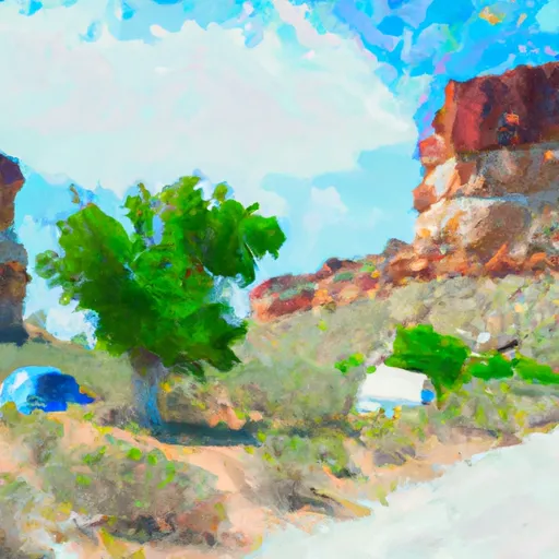
The Cove
The Cove Camping Area offers several amenities, including 11 campsites, each with a picnic table and fire ring. The campground also includes vault toilets and potable water. The campsites are available on a first-come-first-serve basis.
An interesting fact about the Cove Camping Area is that it was once a popular spot for moonshine distillers during Prohibition. The canyon provided a secluded location for moonshiners to avoid detection from law enforcement.
The best time to visit the Cove Camping Area is during the summer months, from June to August. The average temperature during this time is around 85 degrees Fahrenheit. However, visitors should be prepared for cooler temperatures at night, as temperatures can drop significantly in the canyon.
What's on-site at The Cove
Key facilities Snoflo tracks for this campground. Confirm with the operator before booking -- amenities can change seasonally.
Plan your trip down to the hour
Same weather feed Snoflo's iOS app uses -- updated continuously from NOAA / yr.no.
Next 5 days, hour by hour
Temperature line with weather symbols on top, snow + rain accumulation as columns, humidity as a dotted line.
5-day forecast table
Every 3 hours, broken out across temperature, snow, rain, humidity, and wind. Each cell is colour-coded relative to the column min/max so trends jump out at a glance.
| Time | Condition | Temp (°F) | Snow (in) | Rain (in) | Humidity (%) | Wind (mps) | Wind dir |
|---|---|---|---|---|---|---|---|
| Loading detailed forecast… | |||||||
15-day temperature & precipitation
Daily temperatures, snow, and rain projected over the next two weeks. Hover any point for the full breakdown.
Other campgrounds in the area
Snoflo-tracked campsites within driving distance of The Cove, with reservations status.
| Campground | Reservations | Toilets | View |
|---|---|---|---|
| Big Island Camp | ✗ | ✗ | → |
| Big Island River Camp | ✗ | ✗ | → |
| Island Park Camp | ✗ | ✗ | → |
| Island Park River Camp | ✗ | ✗ | → |
| Comprimise Camp | ✗ | ✗ | → |
Nearby streamflow
USGS streamgauges within reach of The Cove -- pulled live from the National Water Information System.
| Streamgauge | Discharge | View |
|---|---|---|
| Green River Near Jensen | 2,230 cfs | → |
| Big Brush Creek Abv Red Fleet Res | 11 cfs | → |
| Ashley Creek Near Vernal | 51 cfs | → |
| Ashley Cr Abv Sp Nr Vernal Ut | 4 cfs | → |
| Yampa River At Deerlodge Park | 58 cfs | → |
| Green River Near Greendale | 1,740 cfs | → |
Nearby snow depths
NRCS SNOTEL stations within reach of The Cove -- relevant when planning a shoulder-season or alpine trip.
| SNOTEL station | Snowpack | 24h Snowfall | View |
|---|---|---|---|
| Jensen Coop | 0.0 in | 0.0 in | → |
| Dinosaur 0.3 Sw | 0.0 in | 0.0 in | → |
| King's Cabin | 1.0 in | 0.0 in | → |
| Nohrsc King's Cabin | 0.0 in | 0.0 in | → |
| Us-191 At Mp 386 Willie Spring | 0.1 in | 0.0 in | → |
| Trout Creek | 194.0 in | 0.0 in | → |
Plan a longer trip
The closest parks, lakes, boat launches, and paddle runs so a camping night can grow into a full weekend.
Parks
- Dinosaur National Monument
- Red Fleet State Park
- Stewart Lake State Wildlife Area
- Browns Park National Wildlife Refuge
- Utah Field House Of Natural Historic State Park Museum
- Steinaker State Park
Boat launches
- Uintah County
- Desert Voices Trail Uintah County
- Crouse Reservoir
- Calder Reservoir
- Red Fleet State Park
- County Road 34 Moffat County
Fishing spots
- Box Reservoir
- Little Brush Creek
- Crouse Reservoir
- Red Fleet Reservoir
- Green River Below Flaming Gorge Dam
- Cart Creek
Camping essentials & Leave No Trace
- Pack it in, pack it out
- Take all trash, food scraps, and gear back with you to keep campsites clean and protect wildlife.
- Respect wildlife
- Observe animals from a distance, store food securely, and never feed wildlife to maintain natural behavior and safety.
- Know before you go
- Check weather, fire restrictions, trail conditions, and permit requirements to ensure a safe and well-planned trip.
- Minimize campfire impact
- Use established fire rings, keep fires small, fully extinguish them, or opt for a camp stove when fires are restricted.
- Leave what you find
- Preserve natural and cultural features by avoiding removal of plants, rocks, artifacts, or other elements of the environment.
Set push alerts in the Snoflo app
Save The Cove as a favorite, set a custom threshold (precipitation, snowpack, freezing temperatures), and the iOS app will push the moment conditions cross.
About The Cove
Can I make reservations at The Cove?
This campground does not appear to accept reservations -- it's typically first-come, first-served. Arrive early on summer weekends.
How fresh is the weather data on this page?
The hourly forecast updates throughout the day from the NOAA / yr.no public feeds. Streamflow data is pulled live from USGS streamgauges and snowpack from the NRCS SNOTEL network.
What's the best time of year to visit?
Use the 15-day temperature & precipitation outlook on this page to plan -- pick a window with comfortable temperatures and low precipitation. For longer trips, the 5-day hourly meteogram shows snow + rain accumulation hour-by-hour.
How do I get to The Cove?
Tap Directions in the hero above to open driving directions in Google Maps, or Open in map to center the Snoflo interactive map on the campground.
Can I get alerts when conditions change?
Yes -- alerts are managed through the Snoflo iOS app. Favorite this campground, set a threshold (temperature, snowpack, precipitation), and you'll get a push the moment it crosses.
Other campgrounds near here
Snoflo-tracked campgrounds within driving distance of The Cove.