Glen Maury Park Campground
Community Reviews
Been here? Share the conditions.
Reviews, ratings & photos are added in the free Snoflo iOS app — rate a spot, tag the conditions, and your visit is verified by location. Add or manage your reviews from the app.
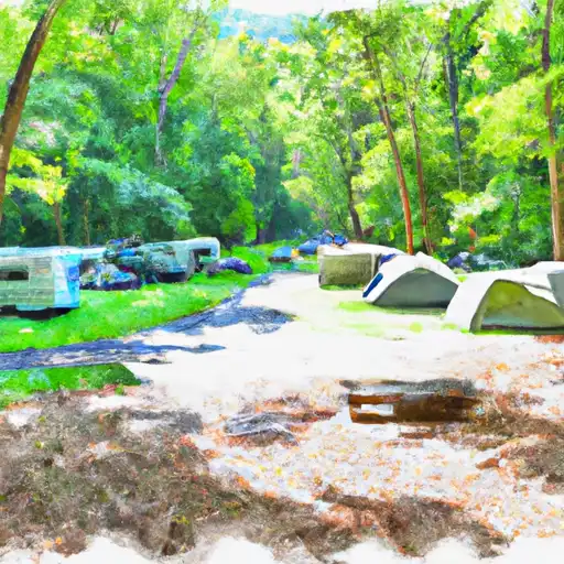
Glen Maury Park
What's on-site at Glen Maury Park
Key facilities Snoflo tracks for this campground. Confirm with the operator before booking -- amenities can change seasonally.
Plan your trip down to the hour
Same weather feed Snoflo's iOS app uses -- updated continuously from NOAA / yr.no.
Next 5 days, hour by hour
Temperature line with weather symbols on top, snow + rain accumulation as columns, humidity as a dotted line.
5-day forecast table
Every 3 hours, broken out across temperature, snow, rain, humidity, and wind. Each cell is colour-coded relative to the column min/max so trends jump out at a glance.
| Time | Condition | Temp (°F) | Snow (in) | Rain (in) | Humidity (%) | Wind (mps) | Wind dir |
|---|---|---|---|---|---|---|---|
| Loading detailed forecast… | |||||||
15-day temperature & precipitation
Daily temperatures, snow, and rain projected over the next two weeks. Hover any point for the full breakdown.
Other campgrounds in the area
Snoflo-tracked campsites within driving distance of Glen Maury Park, with reservations status.
| Campground | Reservations | Toilets | View |
|---|---|---|---|
| Oronoco | ✗ | ✓ | → |
| Town Shelter (With Shower, Toilet & Electricity) | ✗ | ✗ | → |
| Otter Creek Recreation Area | ✗ | ✗ | → |
| Otter Creek - Blue Ridge Parkway | ✗ | ✗ | → |
| Marble Spring Campsite | ✗ | ✗ | → |
Nearby streamflow
USGS streamgauges within reach of Glen Maury Park -- pulled live from the National Water Information System.
| Streamgauge | Discharge | View |
|---|---|---|
| Maury River Near Buena Vista | 91 cfs | → |
| Pedlar River At Forest Road Near Buena Vista | 18 cfs | → |
| Kerrs Creek Near Lexington | 7 cfs | → |
| Maury River At Rockbridge Baths | 37 cfs | → |
| James River At Holcomb Rock | 716 cfs | → |
| Piney River At Piney River | 17 cfs | → |
Nearby snow depths
NRCS SNOTEL stations within reach of Glen Maury Park -- relevant when planning a shoulder-season or alpine trip.
| SNOTEL station | Snowpack | 24h Snowfall | View |
|---|---|---|---|
| Buena Vista | 0.0 in | 0.0 in | → |
| Glasgow 1 Se | 0.0 in | 0.0 in | → |
| Big Island | 0.0 in | 0.0 in | → |
| Millboro 0.3 Nw | 0.0 in | 0.0 in | → |
| Radio Stn Wblt | 0.0 in | 0.0 in | → |
| Hot Springs | 0.0 in | 0.0 in | → |
Plan a longer trip
The closest parks, lakes, boat launches, and paddle runs so a camping night can grow into a full weekend.
Parks
- Wilderness James River Face
- Goshen Pass State Natural Area Preserve
- Lake Robertson Park
- Moores Creek State Forest
- Wilderness Saint Mary's
- Wilderness Thunder Ridge
Boat launches
- Vmi Route 60 Bridge
- Locker Landing
- Elon Road Amherst County
- Thrasher's Creek
- Lake Robertson
- Stone House Creek
Fishing spots
Points of interest
- Cedar Hill
- Indian Gap Parking Area
- House Mountain Overlook
- Buena Vista Overlook
- Chimney Rock Mountain Pullout
- Punch Bowl Mountain
Paddle runs
- 1 Mile Southeast Of Buchanan (At End Of Nfs Land) To Snowden Dam Reservoir
- Headwaters South Of Flint Mountain To St. Mary's Wilderness Boundary
- Top Of Apple Orchards Falls To Confluence Of North Creek With Jennings Creek
- Nf Boundary Along The South Fork Tye River Near Fdt 526 And State Highway 56 To Town Of Nash
- Segment A--Route 42 Bridge To Confluence With Jackson River
- Segment B--Confluence With Bullpasture River To Route 42 Bridge
Camping essentials & Leave No Trace
- Pack it in, pack it out
- Take all trash, food scraps, and gear back with you to keep campsites clean and protect wildlife.
- Respect wildlife
- Observe animals from a distance, store food securely, and never feed wildlife to maintain natural behavior and safety.
- Know before you go
- Check weather, fire restrictions, trail conditions, and permit requirements to ensure a safe and well-planned trip.
- Minimize campfire impact
- Use established fire rings, keep fires small, fully extinguish them, or opt for a camp stove when fires are restricted.
- Leave what you find
- Preserve natural and cultural features by avoiding removal of plants, rocks, artifacts, or other elements of the environment.
Set push alerts in the Snoflo app
Save Glen Maury Park as a favorite, set a custom threshold (precipitation, snowpack, freezing temperatures), and the iOS app will push the moment conditions cross.
About Glen Maury Park
Can I make reservations at Glen Maury Park?
Yes -- this campground accepts reservations. Snoflo recommends booking early for peak season; check the operator (Recreation.gov / state park system / private operator) for the booking window and cancellation policy.
How fresh is the weather data on this page?
The hourly forecast updates throughout the day from the NOAA / yr.no public feeds. Streamflow data is pulled live from USGS streamgauges and snowpack from the NRCS SNOTEL network.
What's the best time of year to visit?
Use the 15-day temperature & precipitation outlook on this page to plan -- pick a window with comfortable temperatures and low precipitation. For longer trips, the 5-day hourly meteogram shows snow + rain accumulation hour-by-hour.
How do I get to Glen Maury Park?
Tap Directions in the hero above to open driving directions in Google Maps, or Open in map to center the Snoflo interactive map on the campground.
Can I get alerts when conditions change?
Yes -- alerts are managed through the Snoflo iOS app. Favorite this campground, set a threshold (temperature, snowpack, precipitation), and you'll get a push the moment it crosses.
Other campgrounds near here
Snoflo-tracked campgrounds within driving distance of Glen Maury Park.