Huckleberry Hill Hiker-Biker Campsite campground
Community Reviews
Been here? Share the conditions.
Reviews, ratings & photos are added in the free Snoflo iOS app — rate a spot, tag the conditions, and your visit is verified by location. Add or manage your reviews from the app.
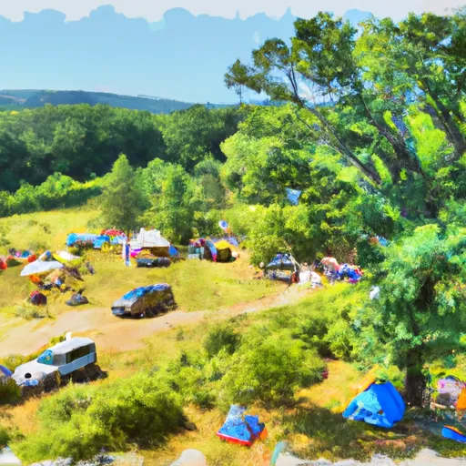
Huckleberry Hill Hiker-Biker Campsite
Reservations are not accepted at Huckleberry Hill Hiker-Biker Campsite, as it operates on a first-come, first-served basis. Therefore, it is advisable to arrive early, especially during peak season, to secure a spot. The best time to visit this camping area is during the spring and fall seasons when the weather is mild, and the surrounding foliage enhances the beauty of the site. Summers can be hot and humid, while winters can be cold, so it is important to plan accordingly.
While camping at Huckleberry Hill Hiker-Biker Campsite, visitors can explore the nearby trails and enjoy activities such as hiking and biking. The campsite offers easy access to a trail system that leads to stunning viewpoints and natural attractions. However, it is crucial to be cautious of wildlife in the area, particularly bears. Campers are advised to properly store food and dispose of trash to avoid attracting wildlife. Overall, Huckleberry Hill Hiker-Biker Campsite provides a serene and scenic camping experience, perfect for nature enthusiasts looking to disconnect and explore Virginia's beautiful wilderness.
What's on-site at Huckleberry Hill Hiker-Biker Campsite
Key facilities Snoflo tracks for this campground. Confirm with the operator before booking -- amenities can change seasonally.
Plan your trip down to the hour
Same weather feed Snoflo's iOS app uses -- updated continuously from NOAA / yr.no.
Next 5 days, hour by hour
Temperature line with weather symbols on top, snow + rain accumulation as columns, humidity as a dotted line.
5-day forecast table
Every 3 hours, broken out across temperature, snow, rain, humidity, and wind. Each cell is colour-coded relative to the column min/max so trends jump out at a glance.
| Time | Condition | Temp (°F) | Snow (in) | Rain (in) | Humidity (%) | Wind (mps) | Wind dir |
|---|---|---|---|---|---|---|---|
| Loading detailed forecast… | |||||||
15-day temperature & precipitation
Daily temperatures, snow, and rain projected over the next two weeks. Hover any point for the full breakdown.
Other campgrounds in the area
Snoflo-tracked campsites within driving distance of Huckleberry Hill Hiker-Biker Campsite, with reservations status.
| Campground | Reservations | Toilets | View |
|---|---|---|---|
| Huckleberry Hill | ✗ | ✓ | → |
| 4 Mile Campsite | ✗ | ✗ | → |
| Antietam Creek Campground | ✗ | ✗ | → |
| Brunswick City Campground | ✓ | ✗ | → |
| Killiansburg Cave Campsite | ✗ | ✗ | → |
Nearby streamflow
USGS streamgauges within reach of Huckleberry Hill Hiker-Biker Campsite -- pulled live from the National Water Information System.
| Streamgauge | Discharge | View |
|---|---|---|
| Piney Run Near Lovettsville | 2 cfs | → |
| Shenandoah River At Millville | 1,070 cfs | → |
| Potomac River At Shepherdstown | 2,880 cfs | → |
| Antietam Creek Near Sharpsburg | 115 cfs | → |
| Opequon Creek Near Martinsburg | 79 cfs | → |
| Catoctin Creek At Taylorstown | 15 cfs | → |
Nearby snow depths
NRCS SNOTEL stations within reach of Huckleberry Hill Hiker-Biker Campsite -- relevant when planning a shoulder-season or alpine trip.
| SNOTEL station | Snowpack | 24h Snowfall | View |
|---|---|---|---|
| Harpers Ferry 12.8 Ssw | 0.0 in | 0.0 in | → |
| Purcellville Coop | 0.0 in | 0.0 in | → |
| Round Hill 2.7 Wsw | 0.0 in | 0.0 in | → |
| Bunker Hill 1.5 Sw | 0.0 in | 0.0 in | → |
| Berryville 0.9 Nnw | 0.0 in | 0.0 in | → |
| Hagerstown 1e Coop | 0.0 in | 0.0 in | → |
Plan a longer trip
The closest parks, lakes, boat launches, and paddle runs so a camping night can grow into a full weekend.
Parks
- Harpers Ferry National Historical Park
- Nell Boone Park
- South Mountain State Park
- Antietam National Battlefield
- Brunswick Heights Park
- Gathland State Park
Boat launches
- Armory Canal Trail Harpers Ferry
- Chesapeake And Ohio Canal Trail Antietam
- Millville (Below Dam)
- Millville Dam
- Millville Dam (Above Dam)
- Millville
Fishing spots
- Potomac River Reservoir
- Chesapeake And Ohio Canal
- Culler Lake
- Hunting Creek Lake
- Blairs Valley Lake
- Little Owens Creek
Points of interest
- Bolivar Heights
- Appalachian Trail Visitor Center
- Naval Battery
- Jefferson Rock
- Armory Site
- Roeder’S Confectionery
Paddle runs
- Begins South Of Largent To The Confluence With The Potomac At Great Cacapon
- Capon Bridge To Ends Just South Of Largent
- Headwaters Adjacent To Fdt 573 To State Route 622 Bridge
- State Route 675 At Edinburg, Va To State Highway 55 Southeast Of Strasburg, Va
- Bixler Bridge On State Route 675 To Karo Landing, Approximately 6 Miles South Of Town Of Front Royal
- Segment C--Nf Boundary To Confluence With North Fork Shenandoah River
Camping essentials & Leave No Trace
- Pack it in, pack it out
- Take all trash, food scraps, and gear back with you to keep campsites clean and protect wildlife.
- Respect wildlife
- Observe animals from a distance, store food securely, and never feed wildlife to maintain natural behavior and safety.
- Know before you go
- Check weather, fire restrictions, trail conditions, and permit requirements to ensure a safe and well-planned trip.
- Minimize campfire impact
- Use established fire rings, keep fires small, fully extinguish them, or opt for a camp stove when fires are restricted.
- Leave what you find
- Preserve natural and cultural features by avoiding removal of plants, rocks, artifacts, or other elements of the environment.
Set push alerts in the Snoflo app
Save Huckleberry Hill Hiker-Biker Campsite as a favorite, set a custom threshold (precipitation, snowpack, freezing temperatures), and the iOS app will push the moment conditions cross.
About Huckleberry Hill Hiker-Biker Campsite
Can I make reservations at Huckleberry Hill Hiker-Biker Campsite?
This campground does not appear to accept reservations -- it's typically first-come, first-served. Arrive early on summer weekends.
How fresh is the weather data on this page?
The hourly forecast updates throughout the day from the NOAA / yr.no public feeds. Streamflow data is pulled live from USGS streamgauges and snowpack from the NRCS SNOTEL network.
What's the best time of year to visit?
Use the 15-day temperature & precipitation outlook on this page to plan -- pick a window with comfortable temperatures and low precipitation. For longer trips, the 5-day hourly meteogram shows snow + rain accumulation hour-by-hour.
How do I get to Huckleberry Hill Hiker-Biker Campsite?
Tap Directions in the hero above to open driving directions in Google Maps, or Open in map to center the Snoflo interactive map on the campground.
Can I get alerts when conditions change?
Yes -- alerts are managed through the Snoflo iOS app. Favorite this campground, set a threshold (temperature, snowpack, precipitation), and you'll get a push the moment it crosses.
Other campgrounds near here
Snoflo-tracked campgrounds within driving distance of Huckleberry Hill Hiker-Biker Campsite.