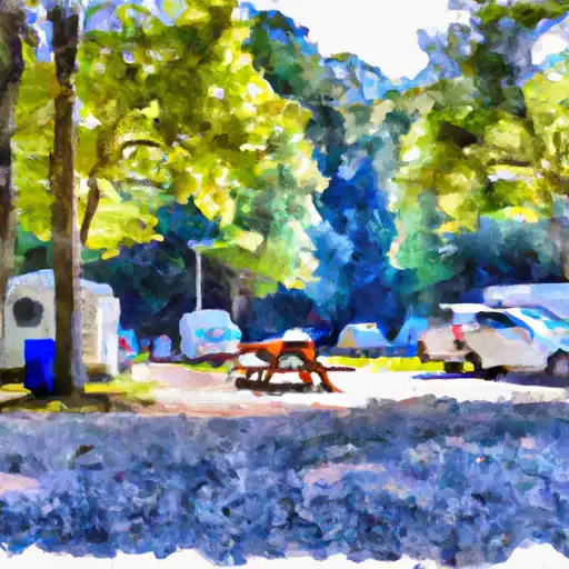
North Creek Campground
Community Reviews
Been here? Share the conditions.
Reviews, ratings & photos are added in the free Snoflo iOS app — rate a spot, tag the conditions, and your visit is verified by location. Add or manage your reviews from the app.
North Creek
Reservations are accepted at North Creek Camping Area, ensuring that visitors can secure their preferred campsites ahead of time. This feature allows for a more convenient and organized camping experience. As for the best time to visit, it is recommended to plan your trip during the spring, summer, or fall months when the weather is pleasant and conducive to outdoor activities. However, it is advisable to check weather conditions beforehand, as rain or extreme temperatures may affect your camping experience.
While exploring the camping area, it is important to be cautious of the wildlife that inhabits the region. Bears are known to roam in the vicinity, so campers should take appropriate safety measures, such as storing food securely and keeping a safe distance from any encountered wildlife. Overall, North Creek Camping Area offers a serene and well-equipped environment for campers to enjoy the natural beauty of Virginia.
What's on-site at North Creek
Key facilities Snoflo tracks for this campground. Confirm with the operator before booking -- amenities can change seasonally.
Plan your trip down to the hour
Same weather feed Snoflo's iOS app uses -- updated continuously from NOAA / yr.no.
Next 5 days, hour by hour
Temperature line with weather symbols on top, snow + rain accumulation as columns, humidity as a dotted line.
5-day forecast table
Every 3 hours, broken out across temperature, snow, rain, humidity, and wind. Each cell is colour-coded relative to the column min/max so trends jump out at a glance.
| Time | Condition | Temp (°F) | Snow (in) | Rain (in) | Humidity (%) | Wind (mps) | Wind dir |
|---|---|---|---|---|---|---|---|
| Loading detailed forecast… | |||||||
15-day temperature & precipitation
Daily temperatures, snow, and rain projected over the next two weeks. Hover any point for the full breakdown.
Other campgrounds in the area
Snoflo-tracked campsites within driving distance of North Creek, with reservations status.
| Campground | Reservations | Toilets | View |
|---|---|---|---|
| North Creek Campground | ✗ | ✗ | → |
| Cave Mountain Lake Recreation Area | ✓ | ✗ | → |
| Cave Mountain Lake | ✓ | ✗ | → |
| Cave Mountain Lake Campground | ✗ | ✗ | → |
| Hopper Creek Group Campground | ✗ | ✗ | → |
Nearby streamflow
USGS streamgauges within reach of North Creek -- pulled live from the National Water Information System.
| Streamgauge | Discharge | View |
|---|---|---|
| James River At Buchanan | 671 cfs | → |
| Big Otter River Near Bedford | 53 cfs | → |
| James River At Holcomb Rock | 787 cfs | → |
| Maury River Near Buena Vista | 60 cfs | → |
| James River At Lick Run | 507 cfs | → |
| Cowpasture River Near Clifton Forge | 79 cfs | → |
Nearby snow depths
NRCS SNOTEL stations within reach of North Creek -- relevant when planning a shoulder-season or alpine trip.
| SNOTEL station | Snowpack | 24h Snowfall | View |
|---|---|---|---|
| Glasgow 1 Se | 0.0 in | 0.0 in | → |
| Big Island | 0.0 in | 0.0 in | → |
| Radio Stn Wblt | 0.0 in | 0.0 in | → |
| Buena Vista | 0.0 in | 0.0 in | → |
| Covington Filter Plant | 0.0 in | 0.0 in | → |
| Huddleston 4 Sw | 0.0 in | 0.0 in | → |
Plan a longer trip
The closest parks, lakes, boat launches, and paddle runs so a camping night can grow into a full weekend.
Parks
- Wilderness Thunder Ridge
- Blue Ridge Parkway
- Wilderness James River Face
- Moores Creek State Forest
- Liberty Lake Park
- Lake Robertson Park
Boat launches
- Arcadia Road Botetourt County
- Lowe Street Buchanan
- Horseshoe Bend
- Springwood
- Locker Landing
- Elon Road Amherst County
Points of interest
- Black Rock Hill Pullout
- Onion Mountain Overlook
- Sunset Field Overlook
- Headforemost Mountain Pullout
- Arnold Valley South Overlook
- Apple Orchard Mountain Pullout
Paddle runs
- Top Of Apple Orchards Falls To Confluence Of North Creek With Jennings Creek
- 1 Mile Southeast Of Buchanan (At End Of Nfs Land) To Snowden Dam Reservoir
- Segment A--Route 42 Bridge To Confluence With Jackson River
- Segment B--Confluence With Bullpasture River To Route 42 Bridge
- Segment D--Gathright Dam To State Route 687 Bridge At Clearwater Park
- Headwaters South Of Flint Mountain To St. Mary's Wilderness Boundary
Camping essentials & Leave No Trace
- Pack it in, pack it out
- Take all trash, food scraps, and gear back with you to keep campsites clean and protect wildlife.
- Respect wildlife
- Observe animals from a distance, store food securely, and never feed wildlife to maintain natural behavior and safety.
- Know before you go
- Check weather, fire restrictions, trail conditions, and permit requirements to ensure a safe and well-planned trip.
- Minimize campfire impact
- Use established fire rings, keep fires small, fully extinguish them, or opt for a camp stove when fires are restricted.
- Leave what you find
- Preserve natural and cultural features by avoiding removal of plants, rocks, artifacts, or other elements of the environment.
Set push alerts in the Snoflo app
Save North Creek as a favorite, set a custom threshold (precipitation, snowpack, freezing temperatures), and the iOS app will push the moment conditions cross.
About North Creek
Can I make reservations at North Creek?
This campground does not appear to accept reservations -- it's typically first-come, first-served. Arrive early on summer weekends.
How fresh is the weather data on this page?
The hourly forecast updates throughout the day from the NOAA / yr.no public feeds. Streamflow data is pulled live from USGS streamgauges and snowpack from the NRCS SNOTEL network.
What's the best time of year to visit?
Use the 15-day temperature & precipitation outlook on this page to plan -- pick a window with comfortable temperatures and low precipitation. For longer trips, the 5-day hourly meteogram shows snow + rain accumulation hour-by-hour.
How do I get to North Creek?
Tap Directions in the hero above to open driving directions in Google Maps, or Open in map to center the Snoflo interactive map on the campground.
Can I get alerts when conditions change?
Yes -- alerts are managed through the Snoflo iOS app. Favorite this campground, set a threshold (temperature, snowpack, precipitation), and you'll get a push the moment it crosses.
Other campgrounds near here
Snoflo-tracked campgrounds within driving distance of North Creek.