Roanoke Mtn campground
Community Reviews
Been here? Share the conditions.
Reviews, ratings & photos are added in the free Snoflo iOS app — rate a spot, tag the conditions, and your visit is verified by location. Add or manage your reviews from the app.
Roanoke Mtn
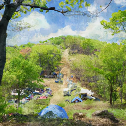
Reservations are not accepted at Roanoke Mountain Camping Area as it operates on a first-come, first-served basis. It is recommended to arrive early, especially during peak seasons, to secure a campsite. The best time to visit this campground is during the spring and fall when the weather is mild and the surrounding landscape is vibrant with colors.
Visitors to Roanoke Mountain Camping Area can look forward to exploring numerous hiking trails that offer breathtaking views of the surrounding mountains and valleys. The popular Roanoke Mountain Loop Trail is a must-try for hikers of all levels. It is also advised to be cautious of wildlife in the area, as encounters with black bears are not uncommon. Proper food storage techniques and following park guidelines for wildlife safety are essential.
Overall, Roanoke Mountain Camping Area provides a peaceful and scenic getaway for nature lovers. Its basic amenities, lack of reservation system, and ideal timing to visit make it an attractive destination for those seeking an authentic camping experience in Virginia.
What's on-site at Roanoke Mtn
Key facilities Snoflo tracks for this campground. Confirm with the operator before booking -- amenities can change seasonally.
Plan your trip down to the hour
Same weather feed Snoflo's iOS app uses -- updated continuously from NOAA / yr.no.
Next 5 days, hour by hour
Temperature line with weather symbols on top, snow + rain accumulation as columns, humidity as a dotted line.
5-day forecast table
Every 3 hours, broken out across temperature, snow, rain, humidity, and wind. Each cell is colour-coded relative to the column min/max so trends jump out at a glance.
| Time | Condition | Temp (°F) | Snow (in) | Rain (in) | Humidity (%) | Wind (mps) | Wind dir |
|---|---|---|---|---|---|---|---|
| Loading detailed forecast… | |||||||
15-day temperature & precipitation
Daily temperatures, snow, and rain projected over the next two weeks. Hover any point for the full breakdown.
Other campgrounds in the area
Snoflo-tracked campsites within driving distance of Roanoke Mtn, with reservations status.
| Campground | Reservations | Toilets | View |
|---|---|---|---|
| Roanoke Mountain - Blue Ridge Parkway | ✗ | ✗ | → |
| Pig Farm Campsite | ✗ | ✗ | → |
| Horseshoe Bend Campground | ✗ | ✗ | → |
| Blue Ridge Campground | ✗ | ✗ | → |
| Smith Mountain Lake | ✓ | ✗ | → |
Nearby streamflow
USGS streamgauges within reach of Roanoke Mtn -- pulled live from the National Water Information System.
| Streamgauge | Discharge | View |
|---|---|---|
| Roanoke River At Roanoke | 198 cfs | → |
| Back Creek Near Dundee | 30 cfs | → |
| Roanoke River At Niagara | 284 cfs | → |
| Roanoke River At Glenvar | 144 cfs | → |
| Blackwater River Near Rocky Mount | 62 cfs | → |
| Tinker Creek Near Daleville | 3 cfs | → |
Nearby snow depths
NRCS SNOTEL stations within reach of Roanoke Mtn -- relevant when planning a shoulder-season or alpine trip.
| SNOTEL station | Snowpack | 24h Snowfall | View |
|---|---|---|---|
| Copper Hill | 0.0 in | 0.0 in | → |
| Huddleston 4 Sw | 0.0 in | 0.0 in | → |
| Radio Stn Wblt | 0.0 in | 0.0 in | → |
| Blacksburg Nwso | 0.0 in | 0.0 in | → |
| Christiansburg | 0.0 in | 0.0 in | → |
| Big Island | 0.0 in | 0.0 in | → |
Plan a longer trip
The closest parks, lakes, boat launches, and paddle runs so a camping night can grow into a full weekend.
Parks
- Rivers Edge Sports Complex
- Maher Field / Victory Stadium
- Harkrader Park
- Argone Circle Park
- Fishburn Park
- Shrine Hill Park
Boat launches
- Hardy Road Bedford County
- Reservoir Road Hollins
- Walnut Run
- Indian Point
- Hannabass Campground
- Halesford Harbor
Points of interest
- Roanoke Mountain Overlook
- No Name Parking Overlook (Roanoke Mtn. Loop Road)
- Mill Mountain Overlook
- Gum Spring Overlook
- Chestnut Ridge Overlook
- Roanoke Star
Paddle runs
- Top Of Apple Orchards Falls To Confluence Of North Creek With Jennings Creek
- Jefferson Nf Boundary (Above Cascades Fall) To Jefferson Nf Boundary (Below Cascades Fall)
- Jefferson Nf Boundary Near Confluence With Nettle Hollow To Confluence With Laurel Branch
- 1 Mile Southeast Of Buchanan (At End Of Nfs Land) To Snowden Dam Reservoir
- Segment A--Route 42 Bridge To Confluence With Jackson River
Camping essentials & Leave No Trace
- Pack it in, pack it out
- Take all trash, food scraps, and gear back with you to keep campsites clean and protect wildlife.
- Respect wildlife
- Observe animals from a distance, store food securely, and never feed wildlife to maintain natural behavior and safety.
- Know before you go
- Check weather, fire restrictions, trail conditions, and permit requirements to ensure a safe and well-planned trip.
- Minimize campfire impact
- Use established fire rings, keep fires small, fully extinguish them, or opt for a camp stove when fires are restricted.
- Leave what you find
- Preserve natural and cultural features by avoiding removal of plants, rocks, artifacts, or other elements of the environment.
Set push alerts in the Snoflo app
Save Roanoke Mtn as a favorite, set a custom threshold (precipitation, snowpack, freezing temperatures), and the iOS app will push the moment conditions cross.
About Roanoke Mtn
Can I make reservations at Roanoke Mtn?
This campground does not appear to accept reservations -- it's typically first-come, first-served. Arrive early on summer weekends.
How fresh is the weather data on this page?
The hourly forecast updates throughout the day from the NOAA / yr.no public feeds. Streamflow data is pulled live from USGS streamgauges and snowpack from the NRCS SNOTEL network.
What's the best time of year to visit?
Use the 15-day temperature & precipitation outlook on this page to plan -- pick a window with comfortable temperatures and low precipitation. For longer trips, the 5-day hourly meteogram shows snow + rain accumulation hour-by-hour.
How do I get to Roanoke Mtn?
Tap Directions in the hero above to open driving directions in Google Maps, or Open in map to center the Snoflo interactive map on the campground.
Can I get alerts when conditions change?
Yes -- alerts are managed through the Snoflo iOS app. Favorite this campground, set a threshold (temperature, snowpack, precipitation), and you'll get a push the moment it crosses.
Other campgrounds near here
Snoflo-tracked campgrounds within driving distance of Roanoke Mtn.