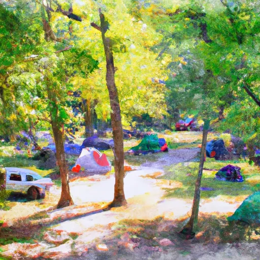
Seminole Campground
Community Reviews
Been here? Share the conditions.
Reviews, ratings & photos are added in the free Snoflo iOS app — rate a spot, tag the conditions, and your visit is verified by location. Add or manage your reviews from the app.
Seminole
Reservations are accepted at the Seminole camping area, allowing visitors to secure their preferred campsite in advance. It is recommended to make reservations early, especially during peak seasons, to guarantee a spot.
The best time of year to visit the Seminole camping area is during the spring and fall seasons when the weather is mild and comfortable. This allows campers to enjoy various outdoor activities such as hiking, fishing, and nature walks. It is important to note that Virginia experiences hot and humid summers and cold winters, so it is advisable to plan accordingly.
While at the Seminole camping area, visitors can explore the nearby Jefferson National Forest, which offers stunning natural landscapes, hiking trails, and wildlife viewing opportunities. It is important to be cautious of local wildlife, including bears, and to follow proper food storage and wildlife safety guidelines. Additionally, campers should be aware of any potential weather changes and prepare accordingly to ensure a safe and enjoyable camping experience.
What's on-site at Seminole
Key facilities Snoflo tracks for this campground. Confirm with the operator before booking -- amenities can change seasonally.
Plan your trip down to the hour
Same weather feed Snoflo's iOS app uses -- updated continuously from NOAA / yr.no.
Next 5 days, hour by hour
Temperature line with weather symbols on top, snow + rain accumulation as columns, humidity as a dotted line.
5-day forecast table
Every 3 hours, broken out across temperature, snow, rain, humidity, and wind. Each cell is colour-coded relative to the column min/max so trends jump out at a glance.
| Time | Condition | Temp (°F) | Snow (in) | Rain (in) | Humidity (%) | Wind (mps) | Wind dir |
|---|---|---|---|---|---|---|---|
| Loading detailed forecast… | |||||||
15-day temperature & precipitation
Daily temperatures, snow, and rain projected over the next two weeks. Hover any point for the full breakdown.
Nearby streamflow
USGS streamgauges within reach of Seminole -- pulled live from the National Water Information System.
| Streamgauge | Discharge | View |
|---|---|---|
| Little River At Graysontown | 110 cfs | → |
| New River At Allisonia | 1,430 cfs | → |
| New River At Radford | 897 cfs | → |
| Reed Creek At Grahams Forge | 107 cfs | → |
| S F Roanoke River Near Shawsville | 37 cfs | → |
| Walker Creek At Bane | 129 cfs | → |
Nearby snow depths
NRCS SNOTEL stations within reach of Seminole -- relevant when planning a shoulder-season or alpine trip.
| SNOTEL station | Snowpack | 24h Snowfall | View |
|---|---|---|---|
| Christiansburg | 0.0 in | 0.0 in | → |
| Blacksburg Nwso | 0.0 in | 0.0 in | → |
| Copper Hill | 0.0 in | 0.0 in | → |
| Galax Water Plant | 0.0 in | 0.0 in | → |
| Greenville 1 Se | 0.0 in | 0.0 in | → |
| Bluefield | 0.0 in | 0.0 in | → |
Plan a longer trip
The closest parks, lakes, boat launches, and paddle runs so a camping night can grow into a full weekend.
Parks
- Claytor Lake Dublin
- Bisset Park
- Buffalo Mountain State Natural Area Preserve
- Winfrey Fields
- Dehart Street Tot Lot
- Lark Lane Park
Boat launches
- Ben H. Bolen Drive 6620, Dublin
- Hidden Valley Pulaski County
- Beach Drive 6833, Pulaski County
- Little River Dam Road Radford City
- Brown Road 2598, Pulaski County
- Julia Simpkins Road 1711, Pulaski County
Fishing spots
Points of interest
- Sapphire Ballroom & Dance Center
- One Clear View
- Linkous-Kipps House
- Whitethorn
- Wilson Creek Bridge
- Historic Smithfield Plantation
Paddle runs
- Jefferson Nf Boundary (Above Cascades Fall) To Jefferson Nf Boundary (Below Cascades Fall)
- Jefferson Nf Boundary Near Confluence With Nettle Hollow To Confluence With Laurel Branch
- The U.S. Route 460 Bridge In Glen Lyn, Virginia To The Maximum Summer Pool Elevation Of Bluestone Lake, South Of Hinton, West Virginia
Camping essentials & Leave No Trace
- Pack it in, pack it out
- Take all trash, food scraps, and gear back with you to keep campsites clean and protect wildlife.
- Respect wildlife
- Observe animals from a distance, store food securely, and never feed wildlife to maintain natural behavior and safety.
- Know before you go
- Check weather, fire restrictions, trail conditions, and permit requirements to ensure a safe and well-planned trip.
- Minimize campfire impact
- Use established fire rings, keep fires small, fully extinguish them, or opt for a camp stove when fires are restricted.
- Leave what you find
- Preserve natural and cultural features by avoiding removal of plants, rocks, artifacts, or other elements of the environment.
Set push alerts in the Snoflo app
Save Seminole as a favorite, set a custom threshold (precipitation, snowpack, freezing temperatures), and the iOS app will push the moment conditions cross.
About Seminole
Can I make reservations at Seminole?
This campground does not appear to accept reservations -- it's typically first-come, first-served. Arrive early on summer weekends.
How fresh is the weather data on this page?
The hourly forecast updates throughout the day from the NOAA / yr.no public feeds. Streamflow data is pulled live from USGS streamgauges and snowpack from the NRCS SNOTEL network.
What's the best time of year to visit?
Use the 15-day temperature & precipitation outlook on this page to plan -- pick a window with comfortable temperatures and low precipitation. For longer trips, the 5-day hourly meteogram shows snow + rain accumulation hour-by-hour.
How do I get to Seminole?
Tap Directions in the hero above to open driving directions in Google Maps, or Open in map to center the Snoflo interactive map on the campground.
Can I get alerts when conditions change?
Yes -- alerts are managed through the Snoflo iOS app. Favorite this campground, set a threshold (temperature, snowpack, precipitation), and you'll get a push the moment it crosses.