Site 14 campground
Community Reviews
Been here? Share the conditions.
Reviews, ratings & photos are added in the free Snoflo iOS app — rate a spot, tag the conditions, and your visit is verified by location. Add or manage your reviews from the app.
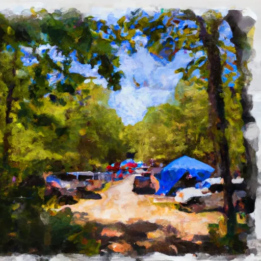
Site 14
Reservations are accepted at Site 14 camping area, ensuring that campers can secure their preferred dates and campsites in advance. It is recommended to make reservations early, especially during peak seasons, to ensure availability.
The best time to visit Site 14 camping area is during the spring and fall seasons when the weather is mild and comfortable. The beautiful foliage during the fall months adds to the scenic beauty of the campground. However, it is important to note that the camping area can get crowded during holiday weekends and summer months, so planning ahead is advisable.
Campers should be cautious of wildlife in the area and take necessary precautions to store food securely. It is also essential to follow any posted guidelines or regulations to ensure a safe and enjoyable camping experience. With its amenities, reservation availability, and natural beauty, Site 14 camping area in Virginia is a great choice for outdoor enthusiasts looking for a memorable camping trip.
What's on-site at Site 14
Key facilities Snoflo tracks for this campground. Confirm with the operator before booking -- amenities can change seasonally.
Plan your trip down to the hour
Same weather feed Snoflo's iOS app uses -- updated continuously from NOAA / yr.no.
Next 5 days, hour by hour
Temperature line with weather symbols on top, snow + rain accumulation as columns, humidity as a dotted line.
5-day forecast table
Every 3 hours, broken out across temperature, snow, rain, humidity, and wind. Each cell is colour-coded relative to the column min/max so trends jump out at a glance.
| Time | Condition | Temp (°F) | Snow (in) | Rain (in) | Humidity (%) | Wind (mps) | Wind dir |
|---|---|---|---|---|---|---|---|
| Loading detailed forecast… | |||||||
15-day temperature & precipitation
Daily temperatures, snow, and rain projected over the next two weeks. Hover any point for the full breakdown.
Nearby streamflow
USGS streamgauges within reach of Site 14 -- pulled live from the National Water Information System.
| Streamgauge | Discharge | View |
|---|---|---|
| Goose Creek Near Middleburg | 11 cfs | → |
| Cedar Run Near Catlett | 4 cfs | → |
| Goose Creek Near Leesburg | 43 cfs | → |
| Beaverdam Creek At Rt 734 Near Mountville | 3 cfs | → |
| N F Goose Creek At Rt 729 Near Lincoln | 3 cfs | → |
| Broad Run Near Leesburg | 59 cfs | → |
Nearby snow depths
NRCS SNOTEL stations within reach of Site 14 -- relevant when planning a shoulder-season or alpine trip.
| SNOTEL station | Snowpack | 24h Snowfall | View |
|---|---|---|---|
| Wfo Sterling Coop | 0.0 in | 0.0 in | → |
| Vienna Coop | 0.0 in | 0.0 in | → |
| Purcellville Coop | 0.0 in | 0.0 in | → |
| Round Hill 2.7 Wsw | 0.0 in | 0.0 in | → |
| Harpers Ferry 12.8 Ssw | 0.0 in | 0.0 in | → |
| Berryville 0.9 Nnw | 0.0 in | 0.0 in | → |
Plan a longer trip
The closest parks, lakes, boat launches, and paddle runs so a camping night can grow into a full weekend.
Parks
- Bull Run Mountains State Natural Area Preserve
- Waterfall Park
- James S. Long Regional Park
- Conway Robinson State Forest
- Vint Hill Park
- Manassas National Battle Park
Boat launches
- Lake Brittle
- Sinclair Lane Prince William County
- Doves Trail Prince William County
- Rogues Road Fauquier County
- Ashburn Village Boulevard 20585, Lansdowne
- Lake Burke
Fishing spots
- Gillam Branch (Historical)
- Washington Aqueduct
- Davis Branch (Historical)
- Dalecarlia Reservoir
- Maddox Branch
- Georgetown Reservoir
Points of interest
Paddle runs
- Bixler Bridge On State Route 675 To Karo Landing, Approximately 6 Miles South Of Town Of Front Royal
- Segment C--Nf Boundary To Confluence With North Fork Shenandoah River
- Segment B--State Route 730 Bridge To Nf Boundary
- State Route 675 At Edinburg, Va To State Highway 55 Southeast Of Strasburg, Va
- Headwaters Adjacent To Fdt 573 To State Route 622 Bridge
Camping essentials & Leave No Trace
- Pack it in, pack it out
- Take all trash, food scraps, and gear back with you to keep campsites clean and protect wildlife.
- Respect wildlife
- Observe animals from a distance, store food securely, and never feed wildlife to maintain natural behavior and safety.
- Know before you go
- Check weather, fire restrictions, trail conditions, and permit requirements to ensure a safe and well-planned trip.
- Minimize campfire impact
- Use established fire rings, keep fires small, fully extinguish them, or opt for a camp stove when fires are restricted.
- Leave what you find
- Preserve natural and cultural features by avoiding removal of plants, rocks, artifacts, or other elements of the environment.
Set push alerts in the Snoflo app
Save Site 14 as a favorite, set a custom threshold (precipitation, snowpack, freezing temperatures), and the iOS app will push the moment conditions cross.
About Site 14
Can I make reservations at Site 14?
This campground does not appear to accept reservations -- it's typically first-come, first-served. Arrive early on summer weekends.
How fresh is the weather data on this page?
The hourly forecast updates throughout the day from the NOAA / yr.no public feeds. Streamflow data is pulled live from USGS streamgauges and snowpack from the NRCS SNOTEL network.
What's the best time of year to visit?
Use the 15-day temperature & precipitation outlook on this page to plan -- pick a window with comfortable temperatures and low precipitation. For longer trips, the 5-day hourly meteogram shows snow + rain accumulation hour-by-hour.
How do I get to Site 14?
Tap Directions in the hero above to open driving directions in Google Maps, or Open in map to center the Snoflo interactive map on the campground.
Can I get alerts when conditions change?
Yes -- alerts are managed through the Snoflo iOS app. Favorite this campground, set a threshold (temperature, snowpack, precipitation), and you'll get a push the moment it crosses.