Cascade Marine Trail, Campsite For Human Powered Boats Campground
Community Reviews
Been here? Share the conditions.
Reviews, ratings & photos are added in the free Snoflo iOS app — rate a spot, tag the conditions, and your visit is verified by location. Add or manage your reviews from the app.
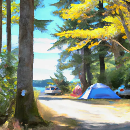
Cascade Marine Trail, Campsite For Human Powered Boats
What's on-site at Cascade Marine Trail, Campsite For Human Powered Boats
Key facilities Snoflo tracks for this campground. Confirm with the operator before booking -- amenities can change seasonally.
Plan your trip down to the hour
Same weather feed Snoflo's iOS app uses -- updated continuously from NOAA / yr.no.
Next 5 days, hour by hour
Temperature line with weather symbols on top, snow + rain accumulation as columns, humidity as a dotted line.
5-day forecast table
Every 3 hours, broken out across temperature, snow, rain, humidity, and wind. Each cell is colour-coded relative to the column min/max so trends jump out at a glance.
| Time | Condition | Temp (°F) | Snow (in) | Rain (in) | Humidity (%) | Wind (mps) | Wind dir |
|---|---|---|---|---|---|---|---|
| Loading detailed forecast… | |||||||
15-day temperature & precipitation
Daily temperatures, snow, and rain projected over the next two weeks. Hover any point for the full breakdown.
Other campgrounds in the area
Snoflo-tracked campsites within driving distance of Cascade Marine Trail, Campsite For Human Powered Boats, with reservations status.
| Campground | Reservations | Toilets | View |
|---|---|---|---|
| Washington Park Campground | ✗ | ✗ | → |
| Cascade Marine Trail Campsite For Human Powered Boaters | ✗ | ✗ | → |
| James Island | ✗ | ✗ | → |
Nearby streamflow
USGS streamgauges within reach of Cascade Marine Trail, Campsite For Human Powered Boats -- pulled live from the National Water Information System.
| Streamgauge | Discharge | View |
|---|---|---|
| Samish River Near Burlington | 30 cfs | → |
| Skagit River Near Mount Vernon | 8,380 cfs | → |
| Brannian Creek At S Bay Dr Nr Wickersham | 0 cfs | → |
| Olsen Creek Near Bellingham | 1 cfs | → |
| Carpenter Creek At N Shore Drive Nr Bellingham | 0 cfs | → |
| Nooksack River At Ferndale | 1,450 cfs | → |
Nearby snow depths
NRCS SNOTEL stations within reach of Cascade Marine Trail, Campsite For Human Powered Boats -- relevant when planning a shoulder-season or alpine trip.
| SNOTEL station | Snowpack | 24h Snowfall | View |
|---|---|---|---|
| Elbow Lake | 0.0 in | 0.0 in | → |
| Elbow Lake | 0.0 in | 0.0 in | → |
| Nohrsc Mf Nooksack | 0.0 in | 0.0 in | → |
| Mf Nooksack | 0.0 in | 0.0 in | → |
| Nohrsc Wells Creek | 0.0 in | 0.0 in | → |
| Wells Creek | 0.0 in | 0.0 in | → |
Plan a longer trip
The closest parks, lakes, boat launches, and paddle runs so a camping night can grow into a full weekend.
Parks
- Cone Islands State Park
- Cap Sante Park
- John Storvik Playground
- Saddlebag Island State Park
- James Island State Park
- Doe Island Marine State Park
Boat launches
- Cypress Head Trail Skagit County
- T Avenue 209, Anacortes
- Washington Park Loop, Anacortes
- Skyline Marina
- Anacortes Marina
- Fidalgo Marina
Points of interest
- W.T. Preston Museum
- Crown Yacht Charters
- Jolly Mon Charters
- Anacortes Kayak Tours
- Island Express Charters
- Paraclete Charters
Paddle runs
- Fish Hatchery To Confluence With South Fork Nooksack River
- Nooksack Falls Power Plant To Fish Hatchery Near Kendall, Wa
- Canyon Creek To Confluence With North Fork Stillaguamish River
- Headwaters In Ne1/4 Of Sec 23, T37n, R7e To Confluence With Soufh Fork Nooksack River
- Headwaters To Confluence With Bell Creek
- Bell Creek To Mt. Baker-Snoqualmie Nf Boundary
Camping essentials & Leave No Trace
- Pack it in, pack it out
- Take all trash, food scraps, and gear back with you to keep campsites clean and protect wildlife.
- Respect wildlife
- Observe animals from a distance, store food securely, and never feed wildlife to maintain natural behavior and safety.
- Know before you go
- Check weather, fire restrictions, trail conditions, and permit requirements to ensure a safe and well-planned trip.
- Minimize campfire impact
- Use established fire rings, keep fires small, fully extinguish them, or opt for a camp stove when fires are restricted.
- Leave what you find
- Preserve natural and cultural features by avoiding removal of plants, rocks, artifacts, or other elements of the environment.
Set push alerts in the Snoflo app
Save Cascade Marine Trail, Campsite For Human Powered Boats as a favorite, set a custom threshold (precipitation, snowpack, freezing temperatures), and the iOS app will push the moment conditions cross.
About Cascade Marine Trail, Campsite For Human Powered Boats
Can I make reservations at Cascade Marine Trail, Campsite For Human Powered Boats?
This campground does not appear to accept reservations -- it's typically first-come, first-served. Arrive early on summer weekends.
How fresh is the weather data on this page?
The hourly forecast updates throughout the day from the NOAA / yr.no public feeds. Streamflow data is pulled live from USGS streamgauges and snowpack from the NRCS SNOTEL network.
What's the best time of year to visit?
Use the 15-day temperature & precipitation outlook on this page to plan -- pick a window with comfortable temperatures and low precipitation. For longer trips, the 5-day hourly meteogram shows snow + rain accumulation hour-by-hour.
How do I get to Cascade Marine Trail, Campsite For Human Powered Boats?
Tap Directions in the hero above to open driving directions in Google Maps, or Open in map to center the Snoflo interactive map on the campground.
Can I get alerts when conditions change?
Yes -- alerts are managed through the Snoflo iOS app. Favorite this campground, set a threshold (temperature, snowpack, precipitation), and you'll get a push the moment it crosses.
Other campgrounds near here
Snoflo-tracked campgrounds within driving distance of Cascade Marine Trail, Campsite For Human Powered Boats.