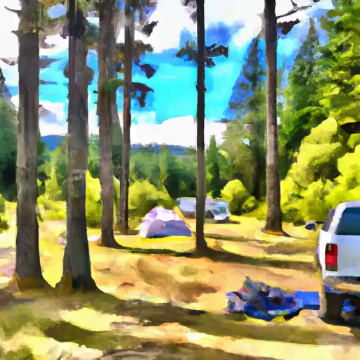
Clover Flats- State Forest campground
Community Reviews
Been here? Share the conditions.
Reviews, ratings & photos are added in the free Snoflo iOS app — rate a spot, tag the conditions, and your visit is verified by location. Add or manage your reviews from the app.
Clover Flats- State Forest
What's on-site at Clover Flats- State Forest
Key facilities Snoflo tracks for this campground. Confirm with the operator before booking -- amenities can change seasonally.
Plan your trip down to the hour
Same weather feed Snoflo's iOS app uses -- updated continuously from NOAA / yr.no.
Next 5 days, hour by hour
Temperature line with weather symbols on top, snow + rain accumulation as columns, humidity as a dotted line.
5-day forecast table
Every 3 hours, broken out across temperature, snow, rain, humidity, and wind. Each cell is colour-coded relative to the column min/max so trends jump out at a glance.
| Time | Condition | Temp (°F) | Snow (in) | Rain (in) | Humidity (%) | Wind (mps) | Wind dir |
|---|---|---|---|---|---|---|---|
| Loading detailed forecast… | |||||||
15-day temperature & precipitation
Daily temperatures, snow, and rain projected over the next two weeks. Hover any point for the full breakdown.
Other campgrounds in the area
Snoflo-tracked campsites within driving distance of Clover Flats- State Forest, with reservations status.
| Campground | Reservations | Toilets | View |
|---|---|---|---|
| Clover Flats Campground | ✗ | ✗ | → |
| Snow Cabin Campground | ✗ | ✗ | → |
| Tree Phones Campground | ✗ | ✗ | → |
| Tree Phones- State Forest | ✗ | ✓ | → |
| Minnie Meadows Dispersed Camping Area | ✗ | ✗ | → |
Nearby streamflow
USGS streamgauges within reach of Clover Flats- State Forest -- pulled live from the National Water Information System.
| Streamgauge | Discharge | View |
|---|---|---|
| Klickitat River Above West Fork Near Glenwood | 78 cfs | → |
| Toppenish Creek Near Fort Simcoe | 6 cfs | → |
| Cowlitz River At Packwood | 918 cfs | → |
| Cispus River Ab Yellowjacket Creek Near Randle | 401 cfs | → |
| American River Near Nile | 64 cfs | → |
| Ahtanum Creek At Union Gap | 11 cfs | → |
Nearby snow depths
NRCS SNOTEL stations within reach of Clover Flats- State Forest -- relevant when planning a shoulder-season or alpine trip.
| SNOTEL station | Snowpack | 24h Snowfall | View |
|---|---|---|---|
| Green Lake | 0.0 in | 0.0 in | → |
| Lost Horse | 0.0 in | 0.0 in | → |
| Lost Horse | 0.0 in | 0.0 in | → |
| Pigtail Peak | 0.0 in | 0.0 in | → |
| White Pass Upper | 6.9 in | 0.0 in | → |
| Pigtail Peak | 0.0 in | 0.0 in | → |
Plan a longer trip
The closest parks, lakes, boat launches, and paddle runs so a camping night can grow into a full weekend.
Parks
- Mount Baker-Snoqualmie National Forest
- Wilderness William O. Douglas
- Wilderness Goat Rocks
- Fort Simcoe State Park
- Mount Rainier National Park
- Wilderness Tatoosh
Boat launches
- Clear Lake Recreation Area
- Rimrock Lake Resort
- Horseshoe Cove
- National Forest Development Road 714, Naches
- Silver Beach Resort
- Dog Lake Campground
Points of interest
- Clear Creek Overlook Interpretive Site
- Boxx Gallery
- Historic Packwood Station
- White Pass Country Historical Museum
- Big Cedar
- Stop 2 Cowiche Canyon Watchable Wildflowers
Paddle runs
- Headwaters In Se1/4 Of Sec 9, T14n, R11e To Goat Rocks Wilderness Boundary
- Headwaters In Sw1/4 Of Sec 27, T12n, R11e To Goat Rocks Wilderness Boundary
- Mt. Ranier Np/Gifford Pinchot Nf Boundary To Confluence With Clear Fork Cowlitz River
- Goat Rocks Wilderness Boundary To Confluence With Muddy Fork Cowlitz River
- Tatoosh Wilderness Boundary To Confluence With Clear Fork Cowlitz River
- Junction Of Muddy And Clear Forks Cowlitz To Gifford Pinchot Nf Boundary
Camping essentials & Leave No Trace
- Pack it in, pack it out
- Take all trash, food scraps, and gear back with you to keep campsites clean and protect wildlife.
- Respect wildlife
- Observe animals from a distance, store food securely, and never feed wildlife to maintain natural behavior and safety.
- Know before you go
- Check weather, fire restrictions, trail conditions, and permit requirements to ensure a safe and well-planned trip.
- Minimize campfire impact
- Use established fire rings, keep fires small, fully extinguish them, or opt for a camp stove when fires are restricted.
- Leave what you find
- Preserve natural and cultural features by avoiding removal of plants, rocks, artifacts, or other elements of the environment.
Set push alerts in the Snoflo app
Save Clover Flats- State Forest as a favorite, set a custom threshold (precipitation, snowpack, freezing temperatures), and the iOS app will push the moment conditions cross.
About Clover Flats- State Forest
Can I make reservations at Clover Flats- State Forest?
This campground does not appear to accept reservations -- it's typically first-come, first-served. Arrive early on summer weekends.
How fresh is the weather data on this page?
The hourly forecast updates throughout the day from the NOAA / yr.no public feeds. Streamflow data is pulled live from USGS streamgauges and snowpack from the NRCS SNOTEL network.
What's the best time of year to visit?
Use the 15-day temperature & precipitation outlook on this page to plan -- pick a window with comfortable temperatures and low precipitation. For longer trips, the 5-day hourly meteogram shows snow + rain accumulation hour-by-hour.
How do I get to Clover Flats- State Forest?
Tap Directions in the hero above to open driving directions in Google Maps, or Open in map to center the Snoflo interactive map on the campground.
Can I get alerts when conditions change?
Yes -- alerts are managed through the Snoflo iOS app. Favorite this campground, set a threshold (temperature, snowpack, precipitation), and you'll get a push the moment it crosses.
Other campgrounds near here
Snoflo-tracked campgrounds within driving distance of Clover Flats- State Forest.