Wahtum Lake Campground
Community Reviews
Been here? Share the conditions.
Reviews, ratings & photos are added in the free Snoflo iOS app — rate a spot, tag the conditions, and your visit is verified by location. Add or manage your reviews from the app.
Wahtum Lake
An interesting fact about the Wahtum Lake area is that it is believed to have been used as a fishing and hunting location by Native American tribes for thousands of years. Visitors can still see evidence of their presence in the form of petroglyphs scattered around the area.
The best time to visit Wahtum Lake Camping Area is during the summer months when temperatures are mild, averaging in the high 70s to low 80s during the day and dropping to the low 50s at night. However, visitors should be aware that the area can be prone to thunderstorms during the summer months.
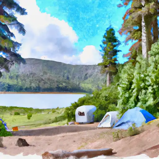
What's on-site at Wahtum Lake
Key facilities Snoflo tracks for this campground. Confirm with the operator before booking -- amenities can change seasonally.
Plan your trip down to the hour
Same weather feed Snoflo's iOS app uses -- updated continuously from NOAA / yr.no.
Next 5 days, hour by hour
Temperature line with weather symbols on top, snow + rain accumulation as columns, humidity as a dotted line.
5-day forecast table
Every 3 hours, broken out across temperature, snow, rain, humidity, and wind. Each cell is colour-coded relative to the column min/max so trends jump out at a glance.
| Time | Condition | Temp (°F) | Snow (in) | Rain (in) | Humidity (%) | Wind (mps) | Wind dir |
|---|---|---|---|---|---|---|---|
| Loading detailed forecast… | |||||||
15-day temperature & precipitation
Daily temperatures, snow, and rain projected over the next two weeks. Hover any point for the full breakdown.
Other campgrounds in the area
Snoflo-tracked campsites within driving distance of Wahtum Lake, with reservations status.
| Campground | Reservations | Toilets | View |
|---|---|---|---|
| Wahtum Lake Campground | ✗ | ✗ | → |
| Wahtum Lake Camground | ✗ | ✗ | → |
| Upper Eagle Creek Camp | ✗ | ✗ | → |
| Indian Springs Campground (Not Maintained) | ✗ | ✗ | → |
| Noble Camp | ✗ | ✗ | → |
Nearby streamflow
USGS streamgauges within reach of Wahtum Lake -- pulled live from the National Water Information System.
| Streamgauge | Discharge | View |
|---|---|---|
| Bull Run River At Lower Flume Nr Brightwood | 19 cfs | → |
| Blazed Alder Creek Near Rhododendron | 3 cfs | → |
| Bull Run River Near Multnomah Falls | 47 cfs | → |
| Hood River At Tucker Bridge | 234 cfs | → |
| North Fork Bull Run River Near Multnomah Falls | 11 cfs | → |
| Fir Creek Near Brightwood | 4 cfs | → |
Nearby snow depths
NRCS SNOTEL stations within reach of Wahtum Lake -- relevant when planning a shoulder-season or alpine trip.
| SNOTEL station | Snowpack | 24h Snowfall | View |
|---|---|---|---|
| Nohrsc Greenpoint | 0.0 in | 0.0 in | → |
| Greenpoint | 0.0 in | 0.0 in | → |
| Cascade Locks | 0.0 in | 0.0 in | → |
| Bonneville Dam | 0.0 in | 0.0 in | → |
| Nohrsc Red Hill | 0.0 in | 0.0 in | → |
| Red Hill | 1.0 in | 1.0 in | → |
Plan a longer trip
The closest parks, lakes, boat launches, and paddle runs so a camping night can grow into a full weekend.
Parks
- Wilderness Mark O. Hatfield
- Wyeth State Recreation Area
- Toll House Park
- Cascade Locks Marine Park
- Lindsey Creek State Scenic Corridor
- Lang Forest State Scenic Corridor
Boat launches
- Lost Lake Resort
- Kingsley Campground
- Port Of Cascade Locks
- Stevenson
- Columbia Trail, North Bonneville
- Hamilton Island
Points of interest
- Columbia River Highway Historic District
- Columbia River Gorge National Scenic Area
- Bridge Of The Gods
- Cascade Locks Historical Museum
- Sternwheeler Columbia Gorge
- Dog Creek Falls Observation Site
Paddle runs
- Confluence Clear And Coe Creeks To Mt. Hood Nf Boundary
- Hemlock Road Bridge To Gifford Pinchot Nf Boundary
- Headwaters In Sw1/4 Of Sec 13, T6n, R7e To Hemlock Road Bridge In Nw1/4 Of Sec 26, T4n, R7e
- Mt. Hood Wilderness Boundary To Confluence With Sandy River
- Sandy River
- Welches Run
Camping essentials & Leave No Trace
- Pack it in, pack it out
- Take all trash, food scraps, and gear back with you to keep campsites clean and protect wildlife.
- Respect wildlife
- Observe animals from a distance, store food securely, and never feed wildlife to maintain natural behavior and safety.
- Know before you go
- Check weather, fire restrictions, trail conditions, and permit requirements to ensure a safe and well-planned trip.
- Minimize campfire impact
- Use established fire rings, keep fires small, fully extinguish them, or opt for a camp stove when fires are restricted.
- Leave what you find
- Preserve natural and cultural features by avoiding removal of plants, rocks, artifacts, or other elements of the environment.
Set push alerts in the Snoflo app
Save Wahtum Lake as a favorite, set a custom threshold (precipitation, snowpack, freezing temperatures), and the iOS app will push the moment conditions cross.
About Wahtum Lake
Can I make reservations at Wahtum Lake?
This campground does not appear to accept reservations -- it's typically first-come, first-served. Arrive early on summer weekends.
How fresh is the weather data on this page?
The hourly forecast updates throughout the day from the NOAA / yr.no public feeds. Streamflow data is pulled live from USGS streamgauges and snowpack from the NRCS SNOTEL network.
What's the best time of year to visit?
Use the 15-day temperature & precipitation outlook on this page to plan -- pick a window with comfortable temperatures and low precipitation. For longer trips, the 5-day hourly meteogram shows snow + rain accumulation hour-by-hour.
How do I get to Wahtum Lake?
Tap Directions in the hero above to open driving directions in Google Maps, or Open in map to center the Snoflo interactive map on the campground.
Can I get alerts when conditions change?
Yes -- alerts are managed through the Snoflo iOS app. Favorite this campground, set a threshold (temperature, snowpack, precipitation), and you'll get a push the moment it crosses.
Other campgrounds near here
Snoflo-tracked campgrounds within driving distance of Wahtum Lake.