Hidden Hand Campground
Community Reviews
Been here? Share the conditions.
Reviews, ratings & photos are added in the free Snoflo iOS app — rate a spot, tag the conditions, and your visit is verified by location. Add or manage your reviews from the app.
Hidden Hand
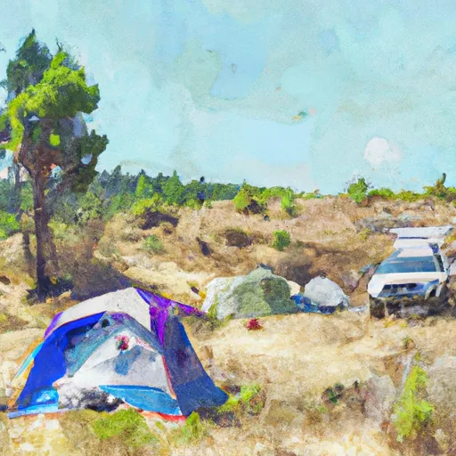
Reservations are required at Hidden Hand camping area, allowing visitors to secure their spot in advance. This ensures that campers can plan their trip accordingly and avoid any disappointment upon arrival. It is advisable to make reservations well in advance, especially during peak seasons when the campground tends to be more crowded.
The best time to visit Hidden Hand camping area is during the summer months when the weather is pleasant and the campground is in full swing. The picturesque surroundings offer opportunities for hiking, fishing, and wildlife spotting. However, it is essential to be cautious of wildlife encounters, as the area is home to various species. Following the guidelines provided by the campground and the park rangers will ensure a safe and enjoyable experience for all visitors.
Overall, Hidden Hand camping area in Washington state is a well-equipped campground that offers a peaceful and enjoyable camping experience. With its amenities, reservation system, and beautiful natural surroundings, it is a great destination for outdoor enthusiasts seeking a memorable camping adventure.
What's on-site at Hidden Hand
Key facilities Snoflo tracks for this campground. Confirm with the operator before booking -- amenities can change seasonally.
Plan your trip down to the hour
Same weather feed Snoflo's iOS app uses -- updated continuously from NOAA / yr.no.
Next 5 days, hour by hour
Temperature line with weather symbols on top, snow + rain accumulation as columns, humidity as a dotted line.
5-day forecast table
Every 3 hours, broken out across temperature, snow, rain, humidity, and wind. Each cell is colour-coded relative to the column min/max so trends jump out at a glance.
| Time | Condition | Temp (°F) | Snow (in) | Rain (in) | Humidity (%) | Wind (mps) | Wind dir |
|---|---|---|---|---|---|---|---|
| Loading detailed forecast… | |||||||
15-day temperature & precipitation
Daily temperatures, snow, and rain projected over the next two weeks. Hover any point for the full breakdown.
Other campgrounds in the area
Snoflo-tracked campsites within driving distance of Hidden Hand, with reservations status.
| Campground | Reservations | Toilets | View |
|---|---|---|---|
| Ruby Pasture | ✗ | ✗ | → |
| Cougar Island | ✗ | ✗ | → |
| Cougar Island Camp | ✗ | ✗ | → |
| Green Point Camp | ✗ | ✗ | → |
| Roland Point Camp | ✗ | ✗ | → |
Nearby streamflow
USGS streamgauges within reach of Hidden Hand -- pulled live from the National Water Information System.
| Streamgauge | Discharge | View |
|---|---|---|
| Thunder Creek Near Newhalem | 677 cfs | → |
| Skagit River At Newhalem | 3,290 cfs | → |
| Newhalem Creek Near Newhalem | 32 cfs | → |
| Bacon Creek Below Oakes Creek Near Marblemount | 109 cfs | → |
| Cascade River At Marblemount | 431 cfs | → |
| Skagit River At Marblemount | 3,470 cfs | → |
Nearby snow depths
NRCS SNOTEL stations within reach of Hidden Hand -- relevant when planning a shoulder-season or alpine trip.
| SNOTEL station | Snowpack | 24h Snowfall | View |
|---|---|---|---|
| Diablo Dam | 0.0 in | 0.0 in | → |
| Diablo Reservoir | 0.0 in | 0.0 in | → |
| Newhalem | 0.0 in | 0.0 in | → |
| Thunder Basin | 0.0 in | 0.0 in | → |
| Nohrsc Thunder Basin | 0.0 in | 0.0 in | → |
| Nohrsc Swamp Creek | 0.0 in | 0.0 in | → |
Plan a longer trip
The closest parks, lakes, boat launches, and paddle runs so a camping night can grow into a full weekend.
Parks
- Ross Lake National Recreation Area
- Wilderness Pasayten
- Wilderness Noisy-Diobsud
- North Cascades National Park
- Rockport State Park
- Upper Skagit Garden Club Park
Boat launches
Points of interest
- Sourdough Mountain Lookout
- Rock Cabin
- Gorge Powerhouse Visitor Gallery
- "Old Number 6" Seattle City Light Locomotive
- Pasayten Airstrip Guard Station
- Washington Pass Observation Site
Paddle runs
- Ross Lake National Recreation Area Boundary To Slack Water Of Ross Lake
- Confluence Of Canyon And Granite Creeks To Ross Lake National Recreation Area Boundary
- Point On Range Line To Ruby Creek
- Pasayten Wilderness Boundary To Point On Range Line Between Sec 12, R14e And Sec 17, R16e
- Begins Below Gorge Powerhouse To Ross Lake National Recreation Area Boundary
- Begins Upstream Of The Diversion Dam (Rm 1) To Confluence With Skagit River
Camping essentials & Leave No Trace
- Pack it in, pack it out
- Take all trash, food scraps, and gear back with you to keep campsites clean and protect wildlife.
- Respect wildlife
- Observe animals from a distance, store food securely, and never feed wildlife to maintain natural behavior and safety.
- Know before you go
- Check weather, fire restrictions, trail conditions, and permit requirements to ensure a safe and well-planned trip.
- Minimize campfire impact
- Use established fire rings, keep fires small, fully extinguish them, or opt for a camp stove when fires are restricted.
- Leave what you find
- Preserve natural and cultural features by avoiding removal of plants, rocks, artifacts, or other elements of the environment.
Set push alerts in the Snoflo app
Save Hidden Hand as a favorite, set a custom threshold (precipitation, snowpack, freezing temperatures), and the iOS app will push the moment conditions cross.
About Hidden Hand
Can I make reservations at Hidden Hand?
This campground does not appear to accept reservations -- it's typically first-come, first-served. Arrive early on summer weekends.
How fresh is the weather data on this page?
The hourly forecast updates throughout the day from the NOAA / yr.no public feeds. Streamflow data is pulled live from USGS streamgauges and snowpack from the NRCS SNOTEL network.
What's the best time of year to visit?
Use the 15-day temperature & precipitation outlook on this page to plan -- pick a window with comfortable temperatures and low precipitation. For longer trips, the 5-day hourly meteogram shows snow + rain accumulation hour-by-hour.
How do I get to Hidden Hand?
Tap Directions in the hero above to open driving directions in Google Maps, or Open in map to center the Snoflo interactive map on the campground.
Can I get alerts when conditions change?
Yes -- alerts are managed through the Snoflo iOS app. Favorite this campground, set a threshold (temperature, snowpack, precipitation), and you'll get a push the moment it crosses.
Other campgrounds near here
Snoflo-tracked campgrounds within driving distance of Hidden Hand.