Napeequa Crossing Campground
Community Reviews
Been here? Share the conditions.
Reviews, ratings & photos are added in the free Snoflo iOS app — rate a spot, tag the conditions, and your visit is verified by location. Add or manage your reviews from the app.
Napeequa Crossing
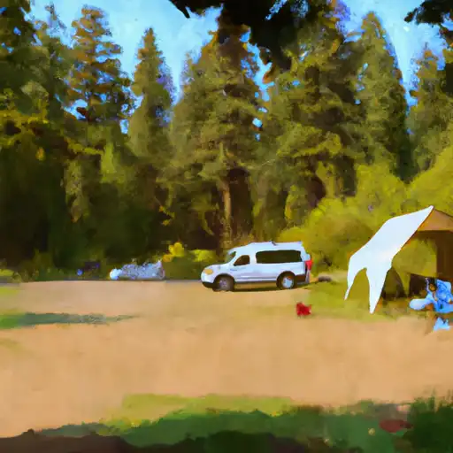
The campground provides amenities such as picnic tables, fire pits, and vault toilets, making it convenient for visitors. However, it is important to note that there is no potable water available, so campers must bring their own. Additionally, it is advised to bring bug repellent, as mosquitoes can be quite prevalent in the area.
Reservations are not accepted at Napeequa Crossing campground, as it operates on a first-come, first-served basis. Therefore, it is recommended to arrive early in the day to secure a spot, especially during peak season. The best time to visit is typically during the summer months, from late June to early September, when the weather is warm and dry, allowing for enjoyable hikes and other outdoor activities.
While camping at Napeequa Crossing, campers can explore the nearby Napeequa River, which offers opportunities for fishing and swimming. Additionally, the area is known for its stunning wildflower displays, making it a paradise for nature photographers. It is important to be cautious while hiking in the area, as the terrain can be challenging, with steep slopes and uneven surfaces. Overall, Napeequa Crossing is a scenic and secluded camping area that provides a great opportunity to connect with nature.
What's on-site at Napeequa Crossing
Key facilities Snoflo tracks for this campground. Confirm with the operator before booking -- amenities can change seasonally.
Plan your trip down to the hour
Same weather feed Snoflo's iOS app uses -- updated continuously from NOAA / yr.no.
Next 5 days, hour by hour
Temperature line with weather symbols on top, snow + rain accumulation as columns, humidity as a dotted line.
5-day forecast table
Every 3 hours, broken out across temperature, snow, rain, humidity, and wind. Each cell is colour-coded relative to the column min/max so trends jump out at a glance.
| Time | Condition | Temp (°F) | Snow (in) | Rain (in) | Humidity (%) | Wind (mps) | Wind dir |
|---|---|---|---|---|---|---|---|
| Loading detailed forecast… | |||||||
15-day temperature & precipitation
Daily temperatures, snow, and rain projected over the next two weeks. Hover any point for the full breakdown.
Other campgrounds in the area
Snoflo-tracked campsites within driving distance of Napeequa Crossing, with reservations status.
| Campground | Reservations | Toilets | View |
|---|---|---|---|
| Napeequa Crossing (Free) | ✗ | ✗ | → |
| Napeequa Crossing Campground | ✗ | ✗ | → |
| Grasshopper Meadows | ✗ | ✓ | → |
| Grasshopper Meadows Campground | ✗ | ✗ | → |
| White River Falls Campground | ✗ | ✗ | → |
Nearby streamflow
USGS streamgauges within reach of Napeequa Crossing -- pulled live from the National Water Information System.
| Streamgauge | Discharge | View |
|---|---|---|
| Chiwawa River Near Plain | 232 cfs | → |
| Wenatchee River At Plain | 824 cfs | → |
| Entiat River Near Ardenvoir | 164 cfs | → |
| Wenatchee River At Peshastin | 1,010 cfs | → |
| Icicle Creek Above Snow Creek Near Leavenworth | 204 cfs | → |
| Mad River At Ardenvoir | 20 cfs | → |
Nearby snow depths
NRCS SNOTEL stations within reach of Napeequa Crossing -- relevant when planning a shoulder-season or alpine trip.
| SNOTEL station | Snowpack | 24h Snowfall | View |
|---|---|---|---|
| Berne | 2.0 in | 0.0 in | → |
| Nohrsc Trinity Snotel | 0.0 in | 0.0 in | → |
| Trinity | 0.0 in | 0.0 in | → |
| Stevens Pass | 0.0 in | -1.0 in | → |
| Stevens Pass - Schmidt Haus | 4.3 in | 0.0 in | → |
| Plain | 0.0 in | 0.0 in | → |
Plan a longer trip
The closest parks, lakes, boat launches, and paddle runs so a camping night can grow into a full weekend.
Parks
- Wilderness Glacier Peak
- Lake Wenatchee State Park
- Wilderness Wild Sky
- National Wild And Scenic River Skagit, Washington
- Wilderness Lake Chelan-Sawtooth
- Wilderness Stephen Mather
Boat launches
Points of interest
- Bygone Byways Trailhead
- Old Stevens Pass Highway (Fs Road #6099)
- Leavenworth Ziplines
- Entiat Falls Viewpoint
- Reindeer Lodge
- Box Canyon Viewpoint
Paddle runs
- Glacier Peak Wilderness Boundary To Confluence With White River
- Headwaters In Sw1/4 Of Sec 21, T30n, R15e To Glacier Peak Wilderness Boundary And Including Twin Lakes Creek In Secs 16/17, T28n, R16e
- Glacier Peak Wilderness Boundary To A Point Approximately 0.5 Mile Above The Tall Timbers Range At East Section Line Of Sec 13, T28n, R15e
- Headwaters In Sw1/4 Of Sec 5, T29n, R14e To Glacier Peak Wilderness Boundary
- Point At East Section Line Of Sec 13, T28n, R15e To Lake Wenatchee
- Headwaters In Ne1/4 Of Sec 36,T31n, R15e To Glacier Peak Wilderness Boundary
Camping essentials & Leave No Trace
- Pack it in, pack it out
- Take all trash, food scraps, and gear back with you to keep campsites clean and protect wildlife.
- Respect wildlife
- Observe animals from a distance, store food securely, and never feed wildlife to maintain natural behavior and safety.
- Know before you go
- Check weather, fire restrictions, trail conditions, and permit requirements to ensure a safe and well-planned trip.
- Minimize campfire impact
- Use established fire rings, keep fires small, fully extinguish them, or opt for a camp stove when fires are restricted.
- Leave what you find
- Preserve natural and cultural features by avoiding removal of plants, rocks, artifacts, or other elements of the environment.
Set push alerts in the Snoflo app
Save Napeequa Crossing as a favorite, set a custom threshold (precipitation, snowpack, freezing temperatures), and the iOS app will push the moment conditions cross.
About Napeequa Crossing
Can I make reservations at Napeequa Crossing?
This campground does not appear to accept reservations -- it's typically first-come, first-served. Arrive early on summer weekends.
How fresh is the weather data on this page?
The hourly forecast updates throughout the day from the NOAA / yr.no public feeds. Streamflow data is pulled live from USGS streamgauges and snowpack from the NRCS SNOTEL network.
What's the best time of year to visit?
Use the 15-day temperature & precipitation outlook on this page to plan -- pick a window with comfortable temperatures and low precipitation. For longer trips, the 5-day hourly meteogram shows snow + rain accumulation hour-by-hour.
How do I get to Napeequa Crossing?
Tap Directions in the hero above to open driving directions in Google Maps, or Open in map to center the Snoflo interactive map on the campground.
Can I get alerts when conditions change?
Yes -- alerts are managed through the Snoflo iOS app. Favorite this campground, set a threshold (temperature, snowpack, precipitation), and you'll get a push the moment it crosses.
Other campgrounds near here
Snoflo-tracked campgrounds within driving distance of Napeequa Crossing.