Olallie Creek Camp Campground
Community Reviews
Been here? Share the conditions.
Reviews, ratings & photos are added in the free Snoflo iOS app — rate a spot, tag the conditions, and your visit is verified by location. Add or manage your reviews from the app.
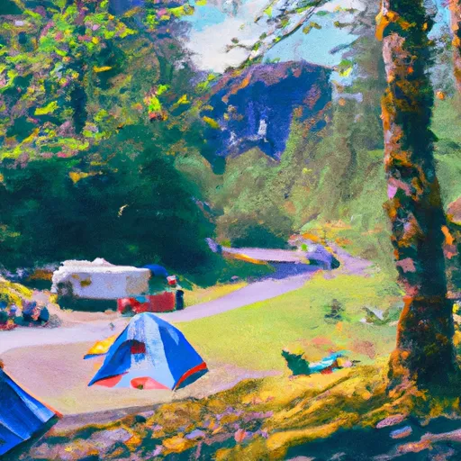
Olallie Creek Camp
Reservations are not accepted at Olallie Creek Camp, as it operates on a first-come, first-served basis. Therefore, it is advisable to arrive early, especially during peak seasons, to secure a desirable campsite. The best time to visit this camping area is during the summer months when the weather is pleasant and ideal for outdoor activities like hiking, fishing, and wildlife viewing.
While exploring Olallie Creek Camp, campers should be cautious of the wildlife present in the area, including bears and cougars. Proper food storage and disposal are crucial to avoid any unwelcome encounters. Additionally, it is important to bring mosquito repellent, as these pesky insects can be quite active in the summer months. Overall, Olallie Creek Camp offers a peaceful and natural camping experience for those seeking a retreat in Washington's beautiful outdoors.
What's on-site at Olallie Creek Camp
Key facilities Snoflo tracks for this campground. Confirm with the operator before booking -- amenities can change seasonally.
Plan your trip down to the hour
Same weather feed Snoflo's iOS app uses -- updated continuously from NOAA / yr.no.
Next 5 days, hour by hour
Temperature line with weather symbols on top, snow + rain accumulation as columns, humidity as a dotted line.
5-day forecast table
Every 3 hours, broken out across temperature, snow, rain, humidity, and wind. Each cell is colour-coded relative to the column min/max so trends jump out at a glance.
| Time | Condition | Temp (°F) | Snow (in) | Rain (in) | Humidity (%) | Wind (mps) | Wind dir |
|---|---|---|---|---|---|---|---|
| Loading detailed forecast… | |||||||
15-day temperature & precipitation
Daily temperatures, snow, and rain projected over the next two weeks. Hover any point for the full breakdown.
Other campgrounds in the area
Snoflo-tracked campsites within driving distance of Olallie Creek Camp, with reservations status.
| Campground | Reservations | Toilets | View |
|---|---|---|---|
| Nickel Creek | ✗ | ✗ | → |
| Ohanapecosh | ✗ | ✗ | → |
| Ohanapecosh - Mount Rainier National Park | ✓ | ✗ | → |
| Maple Creek Camp | ✓ | ✗ | → |
| Indian Bar Camp | ✓ | ✓ | → |
Nearby streamflow
USGS streamgauges within reach of Olallie Creek Camp -- pulled live from the National Water Information System.
| Streamgauge | Discharge | View |
|---|---|---|
| Cowlitz River At Packwood | 554 cfs | → |
| Puyallup River Near Electron | 488 cfs | → |
| Nisqually River Near National | 500 cfs | → |
| American River Near Nile | 54 cfs | → |
| Cowlitz River At Randle | 889 cfs | → |
| Cispus River Ab Yellowjacket Creek Near Randle | 406 cfs | → |
Nearby snow depths
NRCS SNOTEL stations within reach of Olallie Creek Camp -- relevant when planning a shoulder-season or alpine trip.
| SNOTEL station | Snowpack | 24h Snowfall | View |
|---|---|---|---|
| Cayuse Pass | 0.0 in | 0.0 in | → |
| Rainier Paradise Ranger Stn | 0.0 in | 0.0 in | → |
| Paradise | 4.9 in | 0.0 in | → |
| Paradise | 0.0 in | 0.0 in | → |
| Cayuse Pass | 0.0 in | 0.0 in | → |
| Nohrsc Paradise | 0.0 in | 0.0 in | → |
Plan a longer trip
The closest parks, lakes, boat launches, and paddle runs so a camping night can grow into a full weekend.
Parks
- Mount Rainier National Park
- Wilderness Tatoosh
- Wilderness William O. Douglas
- Wilderness Norse Peak
- Wilderness Glacier View
- Wilderness Clearwater
Boat launches
- Dog Lake Campground
- Bumping Lake Marina
- Bumping Lake Public Boat Landing
- Clear Lake Recreation Area
- Silver Beach Resort
- Horseshoe Cove
Points of interest
Paddle runs
- Confluence With Chinook Creek To Southern Boundary Of Mount Rainier National Park
- Begins 1/4 Mile South Of Box Canyon To Southern Boundary Of Mount Rainier National Park
- Begins 1/4 Mile North Of Box Canyon To Ends 1/4 Mile South Of Box Canyon
- Headwaters On The Southeast Flank Of Mount Rainier At An Elevation Of 5500 Ft To Confluence With Chinook Creek
- Headwaters At The Terminus Of The Ingraham Glacier To Ends 1/4 Mile North Of Box Canyon
- Goat Rocks Wilderness Boundary To Confluence With Muddy Fork Cowlitz River
Camping essentials & Leave No Trace
- Pack it in, pack it out
- Take all trash, food scraps, and gear back with you to keep campsites clean and protect wildlife.
- Respect wildlife
- Observe animals from a distance, store food securely, and never feed wildlife to maintain natural behavior and safety.
- Know before you go
- Check weather, fire restrictions, trail conditions, and permit requirements to ensure a safe and well-planned trip.
- Minimize campfire impact
- Use established fire rings, keep fires small, fully extinguish them, or opt for a camp stove when fires are restricted.
- Leave what you find
- Preserve natural and cultural features by avoiding removal of plants, rocks, artifacts, or other elements of the environment.
Set push alerts in the Snoflo app
Save Olallie Creek Camp as a favorite, set a custom threshold (precipitation, snowpack, freezing temperatures), and the iOS app will push the moment conditions cross.
About Olallie Creek Camp
Can I make reservations at Olallie Creek Camp?
Yes -- this campground accepts reservations. Snoflo recommends booking early for peak season; check the operator (Recreation.gov / state park system / private operator) for the booking window and cancellation policy.
How fresh is the weather data on this page?
The hourly forecast updates throughout the day from the NOAA / yr.no public feeds. Streamflow data is pulled live from USGS streamgauges and snowpack from the NRCS SNOTEL network.
What's the best time of year to visit?
Use the 15-day temperature & precipitation outlook on this page to plan -- pick a window with comfortable temperatures and low precipitation. For longer trips, the 5-day hourly meteogram shows snow + rain accumulation hour-by-hour.
How do I get to Olallie Creek Camp?
Tap Directions in the hero above to open driving directions in Google Maps, or Open in map to center the Snoflo interactive map on the campground.
Can I get alerts when conditions change?
Yes -- alerts are managed through the Snoflo iOS app. Favorite this campground, set a threshold (temperature, snowpack, precipitation), and you'll get a push the moment it crosses.
Other campgrounds near here
Snoflo-tracked campgrounds within driving distance of Olallie Creek Camp.