Upper Palisades Lake Camp Campground
Community Reviews
Been here? Share the conditions.
Reviews, ratings & photos are added in the free Snoflo iOS app — rate a spot, tag the conditions, and your visit is verified by location. Add or manage your reviews from the app.
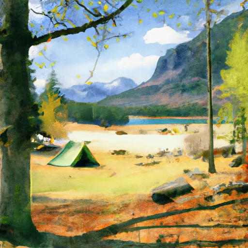
Upper Palisades Lake Camp
The campsite is a perfect base for exploring the nearby points of interest such as the Palisades Glacier, which is the largest glacier in the lower 48 states. The area also offers excellent hiking opportunities, including the popular Palisades Trail.
The Upper Palisades Lake Camp offers basic amenities such as picnic tables, fire rings, and vault toilets. There are no electric or water hookups, and visitors are advised to bring their own water. The campsite operates on a first-come, first-served basis, and there are a total of eight campsites available.
An interesting fact about the area is that it was once used by Native Americans for hunting and gathering before European settlers arrived. The best time of year to visit is during the summer months when the temperatures range from 70-80 degrees Fahrenheit during the day and 40-50 degrees Fahrenheit at night. Visitors should be prepared for cooler temperatures in the evenings and bring appropriate clothing. Overall, the Upper Palisades Lake Camp is a beautiful camping area that offers a unique camping experience for visitors.
What's on-site at Upper Palisades Lake Camp
Key facilities Snoflo tracks for this campground. Confirm with the operator before booking -- amenities can change seasonally.
Plan your trip down to the hour
Same weather feed Snoflo's iOS app uses -- updated continuously from NOAA / yr.no.
Next 5 days, hour by hour
Temperature line with weather symbols on top, snow + rain accumulation as columns, humidity as a dotted line.
5-day forecast table
Every 3 hours, broken out across temperature, snow, rain, humidity, and wind. Each cell is colour-coded relative to the column min/max so trends jump out at a glance.
| Time | Condition | Temp (°F) | Snow (in) | Rain (in) | Humidity (%) | Wind (mps) | Wind dir |
|---|---|---|---|---|---|---|---|
| Loading detailed forecast… | |||||||
15-day temperature & precipitation
Daily temperatures, snow, and rain projected over the next two weeks. Hover any point for the full breakdown.
Other campgrounds in the area
Snoflo-tracked campsites within driving distance of Upper Palisades Lake Camp, with reservations status.
| Campground | Reservations | Toilets | View |
|---|---|---|---|
| Dick's Lake Camp | ✓ | ✗ | → |
| Forest Lake Camp | ✓ | ✓ | → |
| White River - Mount Rainier National Park | ✗ | ✗ | → |
| Sunrise Camp | ✓ | ✓ | → |
| Silver Springs Campground | ✓ | ✗ | → |
Nearby streamflow
USGS streamgauges within reach of Upper Palisades Lake Camp -- pulled live from the National Water Information System.
| Streamgauge | Discharge | View |
|---|---|---|
| Greenwater River At Greenwater | 47 cfs | → |
| White River Below Clearwater River Nr Buckley | 2,550 cfs | → |
| American River Near Nile | 59 cfs | → |
| Puyallup River Near Electron | 711 cfs | → |
| Carbon River Near Fairfax | 452 cfs | → |
| Cowlitz River At Packwood | 648 cfs | → |
Nearby snow depths
NRCS SNOTEL stations within reach of Upper Palisades Lake Camp -- relevant when planning a shoulder-season or alpine trip.
| SNOTEL station | Snowpack | 24h Snowfall | View |
|---|---|---|---|
| Crystal - Green Valley | 24.5 in | 0.0 in | → |
| Crystal - Campbell Basin | 2.5 in | 0.0 in | → |
| Crystal Base | 0.0 in | 0.0 in | → |
| Nohrsc Morse Lake | 0.0 in | 0.0 in | → |
| Morse Lake | 0.0 in | 0.0 in | → |
| Cayuse Pass | 0.0 in | 0.0 in | → |
Plan a longer trip
The closest parks, lakes, boat launches, and paddle runs so a camping night can grow into a full weekend.
Parks
- Wilderness Clearwater
- Wilderness Norse Peak
- Federation Forest State Park
- Mount Rainier National Park
- Wilderness Glacier View
- Wilderness Tatoosh
Boat launches
Points of interest
- Mount Fremont Fire Lookout
- Sourdough Gap
- Snoquera Falls
- The Trident
- Coffee Cup
- Shriner Peak Fire Lookout
Paddle runs
- Headwaters In The Mystic Lake Basin On The North Side Of Mount Rainier To Northern Boundary Of Mount Rainier National Park
- Headwaters On The Southeast Flank Of Mount Rainier At An Elevation Of 5500 Ft To Confluence With Chinook Creek
- Headwaters At American Lake To Confluence With Ranier Fork
- Mt. Baker-Snoqualmie Nf/Mt. Ranier Np Boundary At North Section Line Of Sec 3, T17 N, R10e To Confluence With Huckleberry Creek
- Headwaters On The Nw Slope Of Mount Rainier At Carbon Glacier To Confluence With Ipsut Creek
- Headwaters At The Terminus Of The Ingraham Glacier To Ends 1/4 Mile North Of Box Canyon
Camping essentials & Leave No Trace
- Pack it in, pack it out
- Take all trash, food scraps, and gear back with you to keep campsites clean and protect wildlife.
- Respect wildlife
- Observe animals from a distance, store food securely, and never feed wildlife to maintain natural behavior and safety.
- Know before you go
- Check weather, fire restrictions, trail conditions, and permit requirements to ensure a safe and well-planned trip.
- Minimize campfire impact
- Use established fire rings, keep fires small, fully extinguish them, or opt for a camp stove when fires are restricted.
- Leave what you find
- Preserve natural and cultural features by avoiding removal of plants, rocks, artifacts, or other elements of the environment.
Set push alerts in the Snoflo app
Save Upper Palisades Lake Camp as a favorite, set a custom threshold (precipitation, snowpack, freezing temperatures), and the iOS app will push the moment conditions cross.
About Upper Palisades Lake Camp
Can I make reservations at Upper Palisades Lake Camp?
Yes -- this campground accepts reservations. Snoflo recommends booking early for peak season; check the operator (Recreation.gov / state park system / private operator) for the booking window and cancellation policy.
How fresh is the weather data on this page?
The hourly forecast updates throughout the day from the NOAA / yr.no public feeds. Streamflow data is pulled live from USGS streamgauges and snowpack from the NRCS SNOTEL network.
What's the best time of year to visit?
Use the 15-day temperature & precipitation outlook on this page to plan -- pick a window with comfortable temperatures and low precipitation. For longer trips, the 5-day hourly meteogram shows snow + rain accumulation hour-by-hour.
How do I get to Upper Palisades Lake Camp?
Tap Directions in the hero above to open driving directions in Google Maps, or Open in map to center the Snoflo interactive map on the campground.
Can I get alerts when conditions change?
Yes -- alerts are managed through the Snoflo iOS app. Favorite this campground, set a threshold (temperature, snowpack, precipitation), and you'll get a push the moment it crosses.
Other campgrounds near here
Snoflo-tracked campgrounds within driving distance of Upper Palisades Lake Camp.