148th Avenue Southeast Kent Boat Launch
Community Reviews
Been here? Share the conditions.
Reviews, ratings & photos are added in the free Snoflo iOS app — rate a spot, tag the conditions, and your visit is verified by location. Add or manage your reviews from the app.
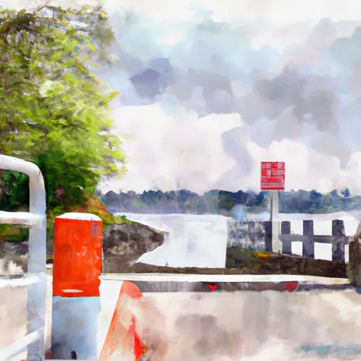
148th Avenue Southeast Kent
However, there are several boat ramps in Kent, Washington that service different bodies of water and have varying regulations for permitted watercraft. For example, the Lake Meridian Park Boat Launch is located on the eastern shore of Lake Meridian and is open to non-motorized and electric-motorized boats. The ramp is 25 feet wide and has a maximum parking capacity of 25 vehicles.
Another boat ramp in Kent is the Russell Road Boat Launch, located on the Green River. This ramp is open to motorized and non-motorized boats and has a maximum parking capacity of 30 vehicles.
It is important to always check the latest information and regulations for any boat ramp before launching a watercraft. This can typically be found on the website of the governing authority for the body of water, such as the Washington Department of Fish and Wildlife or a local parks and recreation department.
Plan your launch down to the hour
Same weather feed Snoflo's iOS app uses -- updated continuously from NOAA / yr.no.
Next 5 days, hour by hour
Temperature line with weather symbols on top, snow + rain accumulation as columns, humidity as a dotted line.
5-day forecast table
Every 3 hours, broken out across temperature, snow, rain, humidity, and wind.
| Time | Condition | Temp (°F) | Snow (in) | Rain (in) | Humidity (%) | Wind (mps) | Wind dir |
|---|---|---|---|---|---|---|---|
| Loading detailed forecast… | |||||||
15-day temperature & precipitation
Daily temperatures, snow, and rain projected over the next two weeks.
Area streamflow levels
USGS streamgauges around 148th Avenue Southeast Kent -- the same readings that determine whether your launch is safe and your boat is the right craft.
| Streamgauge | Discharge | View |
|---|---|---|
| Big Soos Creek Above Hatchery Near Auburn | 37 cfs | → |
| Mill Creek At Earthworks Park At Kent | 1 cfs | → |
| Green River Near Auburn | 263 cfs | → |
| Rock Creek Near Maple Valley | 2 cfs | → |
| Rock Creek At Highway 516 Near Ravensdale | 4 cfs | → |
| Spring Brook Creek At Orillia | 2 cfs | → |
Plan a longer trip
The closest paddle runs, fishing spots, and other boat launches so you can extend a day on the water.
River runs
- Snoqualmie Falls To Plum's Landing
- Wagner Bridge To Confluence With Middle Fork Snoqualmie River
- Confluence With Taylor River To Confluence With North Fork Snoqualmie River
- Huckleberry Creek To Confluence With Clearwater River
- Confluence With Ipsut Creek To Western Boundary Of Mount Rainier National Park
- Quartz Road To Confluence With Middle Fork Snoqualmie River
Boating safety & etiquette
- Check the conditions before you launch
- Use the streamflow numbers, weather, and wind forecast on this page. High-cfs whitewater requires whitewater-specific craft and skill.
- Wear your life jacket
- Statistically the single biggest survival factor in a boating incident. State law often requires one per passenger.
- File a float plan
- Tell someone on shore your put-in, take-out, and expected return time. Especially for multi-day or remote trips.
- Yield at the ramp
- Prep gear in the parking lot, not on the ramp. Launch and clear quickly so others can use the lane.
- Clean, drain, dry
- Inspect, clean, drain and dry your boat between waters to prevent the spread of aquatic invasive species.
Set push alerts in the Snoflo app
Save 148th Avenue Southeast Kent as a favorite, set a discharge threshold or a wind/precipitation alert, and the iOS app will push the moment conditions cross.
About 148th Avenue Southeast Kent
Can I launch a motorboat here?
Most Snoflo-tracked launches support motorboats; check the operator for any horsepower restrictions, paddle-only zones, or seasonal closures.
How fresh is the streamflow data?
USGS streamgauges report continuously (every 15 minutes); the table on this page pulls the latest reading at page load.
Is there a fee?
Many federal and state boat launches charge a day-use fee. Check the operator's site before driving out.
What boat is right for these conditions?
Use the nearby streamflow numbers and river-run panel on this page to gauge current conditions. Wider, slower water is friendly for casual paddling and powerboats; high-cfs whitewater requires whitewater-specific craft and skill.
Can I get alerts when conditions change?
Yes -- alerts are managed in the Snoflo iOS app. Favorite this launch, set a threshold (discharge, wind), and you'll get a push the moment it crosses.
Other launches near here
Snoflo-tracked boat launches within driving distance of 148th Avenue Southeast Kent.