Gatewood Campground Campground
Community Reviews
Been here? Share the conditions.
Reviews, ratings & photos are added in the free Snoflo iOS app — rate a spot, tag the conditions, and your visit is verified by location. Add or manage your reviews from the app.
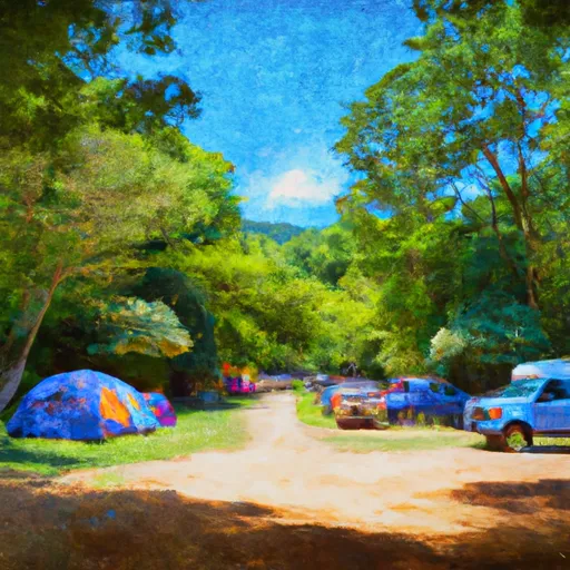
Gatewood Campground
Gatewood Campground is a campground in West-Virginia tracked by Snoflo. This page combines live weather, USGS streamflow, NRCS snowpack readings, and amenity data with nearby parks, lakes, and boat launches so you can plan a trip from a single screen.
Use the forecast meteograms to pick a weather window, the amenities card to confirm reservations and facilities, and the Nearby section to extend a single night into a longer trip. For push alerts when conditions change, save this campground as a favorite in the Snoflo iOS app.
What's on-site at Gatewood Campground
Key facilities Snoflo tracks for this campground. Confirm with the operator before booking -- amenities can change seasonally.
Plan your trip down to the hour
Same weather feed Snoflo's iOS app uses -- updated continuously from NOAA / yr.no.
Next 5 days, hour by hour
Temperature line with weather symbols on top, snow + rain accumulation as columns, humidity as a dotted line.
5-day forecast table
Every 3 hours, broken out across temperature, snow, rain, humidity, and wind. Each cell is colour-coded relative to the column min/max so trends jump out at a glance.
| Time | Condition | Temp (°F) | Snow (in) | Rain (in) | Humidity (%) | Wind (mps) | Wind dir |
|---|---|---|---|---|---|---|---|
| Loading detailed forecast… | |||||||
15-day temperature & precipitation
Daily temperatures, snow, and rain projected over the next two weeks. Hover any point for the full breakdown.
Other campgrounds in the area
Snoflo-tracked campsites within driving distance of Gatewood Campground, with reservations status.
| Campground | Reservations | Toilets | View |
|---|---|---|---|
| Spruce Knob Lake Campground | ✓ | ✗ | → |
| Back Ridge Shadows Campground | ✗ | ✗ | → |
| Judy Springs | ✗ | ✗ | → |
| Scenic Campground | ✗ | ✗ | → |
| Laurel Fork | ✗ | ✗ | → |
Nearby streamflow
USGS streamgauges within reach of Gatewood Campground -- pulled live from the National Water Information System.
| Streamgauge | Discharge | View |
|---|---|---|
| South Branch Potomac River At Franklin | 59 cfs | → |
| Shavers Fork Below Bowden | 100 cfs | → |
| Shavers Fork Nr Cheat Bridge | 27 cfs | → |
| Tygart Valley River Near Dailey | 32 cfs | → |
| Greenbrier River At Durbin | 42 cfs | → |
| So Fk So Br Potomac R At Brandywine | 34 cfs | → |
Nearby snow depths
NRCS SNOTEL stations within reach of Gatewood Campground -- relevant when planning a shoulder-season or alpine trip.
| SNOTEL station | Snowpack | 24h Snowfall | View |
|---|---|---|---|
| Bartow 1s | 0.0 in | 0.0 in | → |
| Elkins Arpt Snow Observation | 0.0 in | 0.0 in | → |
| Green Bank 1.2 Ese | 0.0 in | 0.0 in | → |
| Canaan Valley | 0.0 in | 0.0 in | → |
| Monterey 6.5 Ssw | 0.0 in | 0.0 in | → |
| Davis. | 0.0 in | 0.0 in | → |
Plan a longer trip
The closest parks, lakes, boat launches, and paddle runs so a camping night can grow into a full weekend.
Parks
- Wilderness Laurel Fork
- Spruce Knob-Seneca Rocks National Recreation Area
- Wilderness Roaring Plains West
- Widney Park
- Wilderness Otter Creek
- Wilderness Dolly Sods
Boat launches
Fishing spots
- Dry Fork
- Briery Branch Day Use Area
- Elkhorn Lake Day Use Area
- Braley Pond Day Use Area
- Staunton Dam Day Use Area
- Tomahawk Pond Day Use Area
Points of interest
- Spruce Knob And Spruce Knob Observation Tower
- Middle Mountain Cabins
- Seneca Caverns
- Priest Mill
- Gaudineer Picnic Area
- Gaudineer Scenic Area
Paddle runs
- Trussel Run To Run North Of Judy Springs
- Run North Of Judy Springs To Private Land
- Forest Land At Entrance Of Laurel Fork South Wilderness To Exit Laurel Fork North Wilderness
- Private Land Above Falls Of Seneca To Whites Run
- Forks To Frazier Creek
- Mcgee Run To .5 Mile Above Route 22
Camping essentials & Leave No Trace
- Pack it in, pack it out
- Take all trash, food scraps, and gear back with you to keep campsites clean and protect wildlife.
- Respect wildlife
- Observe animals from a distance, store food securely, and never feed wildlife to maintain natural behavior and safety.
- Know before you go
- Check weather, fire restrictions, trail conditions, and permit requirements to ensure a safe and well-planned trip.
- Minimize campfire impact
- Use established fire rings, keep fires small, fully extinguish them, or opt for a camp stove when fires are restricted.
- Leave what you find
- Preserve natural and cultural features by avoiding removal of plants, rocks, artifacts, or other elements of the environment.
Set push alerts in the Snoflo app
Save Gatewood Campground as a favorite, set a custom threshold (precipitation, snowpack, freezing temperatures), and the iOS app will push the moment conditions cross.
About Gatewood Campground
Can I make reservations at Gatewood Campground?
Yes -- this campground accepts reservations. Snoflo recommends booking early for peak season; check the operator (Recreation.gov / state park system / private operator) for the booking window and cancellation policy.
How fresh is the weather data on this page?
The hourly forecast updates throughout the day from the NOAA / yr.no public feeds. Streamflow data is pulled live from USGS streamgauges and snowpack from the NRCS SNOTEL network.
What's the best time of year to visit?
Use the 15-day temperature & precipitation outlook on this page to plan -- pick a window with comfortable temperatures and low precipitation. For longer trips, the 5-day hourly meteogram shows snow + rain accumulation hour-by-hour.
How do I get to Gatewood Campground?
Tap Directions in the hero above to open driving directions in Google Maps, or Open in map to center the Snoflo interactive map on the campground.
Can I get alerts when conditions change?
Yes -- alerts are managed through the Snoflo iOS app. Favorite this campground, set a threshold (temperature, snowpack, precipitation), and you'll get a push the moment it crosses.
Other campgrounds near here
Snoflo-tracked campgrounds within driving distance of Gatewood Campground.