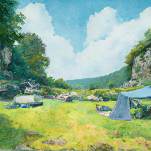
Spring Gap Campground
Community Reviews
Been here? Share the conditions.
Reviews, ratings & photos are added in the free Snoflo iOS app — rate a spot, tag the conditions, and your visit is verified by location. Add or manage your reviews from the app.
Spring Gap
Reservations are accepted at Spring Gap camping area, making it convenient for campers to secure a spot in advance. This is particularly recommended during peak seasons when the campground tends to fill up quickly. The best time of year to visit Spring Gap is during the spring and fall seasons, when the weather is pleasant and the scenic surroundings are at their most vibrant.
It is worth noting that Spring Gap camping area is situated near the Potomac River, providing opportunities for fishing and boating. The nearby C&O Canal National Historical Park offers hiking and biking trails for outdoor enthusiasts. However, campers should be cautious of wildlife in the area, including bears, and should take necessary precautions to store food properly and avoid attracting animals to their campsites. Overall, Spring Gap camping area in West Virginia is a great destination for nature lovers looking to immerse themselves in the beauty of the outdoors while enjoying basic amenities and recreational activities.
What's on-site at Spring Gap
Key facilities Snoflo tracks for this campground. Confirm with the operator before booking -- amenities can change seasonally.
Plan your trip down to the hour
Same weather feed Snoflo's iOS app uses -- updated continuously from NOAA / yr.no.
Next 5 days, hour by hour
Temperature line with weather symbols on top, snow + rain accumulation as columns, humidity as a dotted line.
5-day forecast table
Every 3 hours, broken out across temperature, snow, rain, humidity, and wind. Each cell is colour-coded relative to the column min/max so trends jump out at a glance.
| Time | Condition | Temp (°F) | Snow (in) | Rain (in) | Humidity (%) | Wind (mps) | Wind dir |
|---|---|---|---|---|---|---|---|
| Loading detailed forecast… | |||||||
15-day temperature & precipitation
Daily temperatures, snow, and rain projected over the next two weeks. Hover any point for the full breakdown.
Other campgrounds in the area
Snoflo-tracked campsites within driving distance of Spring Gap, with reservations status.
| Campground | Reservations | Toilets | View |
|---|---|---|---|
| Spring Gap Campsite | ✗ | ✗ | → |
| Spring Gap - C And O Canal National Park | ✗ | ✗ | → |
| Iron Mountain Campsite | ✗ | ✗ | → |
| Irons Mountain Hiker Biker Campsite | ✗ | ✗ | → |
| Evitts Creek Campsite | ✗ | ✗ | → |
Nearby streamflow
USGS streamgauges within reach of Spring Gap -- pulled live from the National Water Information System.
| Streamgauge | Discharge | View |
|---|---|---|
| North Branch Potomac River Near Cumberland | 428 cfs | → |
| Wills Creek Near Cumberland | 54 cfs | → |
| Town Creek Near Oldtown | 17 cfs | → |
| South Branch Potomac River Near Springfield | 449 cfs | → |
| Patterson Creek Near Headsville | 36 cfs | → |
| Potomac River At Paw Paw | 1,080 cfs | → |
Nearby snow depths
NRCS SNOTEL stations within reach of Spring Gap -- relevant when planning a shoulder-season or alpine trip.
| SNOTEL station | Snowpack | 24h Snowfall | View |
|---|---|---|---|
| Cumberland 2 Coop | 0.0 in | 0.0 in | → |
| Frostburg 2 Coop | 0.0 in | 0.0 in | → |
| Frostburg 1 Nnw | 0.0 in | 0.0 in | → |
| Keyser 2 Ssw Coop | 0.0 in | 0.0 in | → |
| Glencoe | 0.0 in | 0.0 in | → |
| Cacapon St Park | 0.0 in | 0.0 in | → |
Plan a longer trip
The closest parks, lakes, boat launches, and paddle runs so a camping night can grow into a full weekend.
Parks
- C Eugene Mason Sports Complex
- Wills Mountain State Park
- Rocky Gap State Park
- Dans Mountain State Park
- Green Ridge State Forest
- Paris N. Glendening Recreation Complex
Boat launches
- Chesapeake And Ohio Canal Trail Allegany County
- Wiley Ford
- Paw Paw Cr 1/1
- Blue Ford North
- Springfield Pike Hampshire County
- Rocky Gap State Park
Fishing spots
- North Branch Potomac River
- Battie Mixon Ponds
- Evitts Creek Ponds
- Wills Creek
- Town Creek
- Jennings Run
Points of interest
- Evitts Creek Aqueduct
- Cumberland Visitor Center
- Allegany Museum
- The Three Stars Arts
- Allegany Arts Council
- Springfield Brick House
Paddle runs
- Begins South Of Largent To The Confluence With The Potomac At Great Cacapon
- Capon Bridge To Ends Just South Of Largent
- Begins Where The Lost River Becomes The Cacapon River To Wardensville
- Wardensville To The Town Of Capon Bridge
- The West Virginia 259 Bridge South Of Wardensville To Ends Where The Lost River Becomes The Cacapon River
- Begins Below The Youghiogheny River Lake Dam In Confluence, Pennsylvania To Ends In South Connellsville, Pennsylvania
Camping essentials & Leave No Trace
- Pack it in, pack it out
- Take all trash, food scraps, and gear back with you to keep campsites clean and protect wildlife.
- Respect wildlife
- Observe animals from a distance, store food securely, and never feed wildlife to maintain natural behavior and safety.
- Know before you go
- Check weather, fire restrictions, trail conditions, and permit requirements to ensure a safe and well-planned trip.
- Minimize campfire impact
- Use established fire rings, keep fires small, fully extinguish them, or opt for a camp stove when fires are restricted.
- Leave what you find
- Preserve natural and cultural features by avoiding removal of plants, rocks, artifacts, or other elements of the environment.
Set push alerts in the Snoflo app
Save Spring Gap as a favorite, set a custom threshold (precipitation, snowpack, freezing temperatures), and the iOS app will push the moment conditions cross.
About Spring Gap
Can I make reservations at Spring Gap?
This campground does not appear to accept reservations -- it's typically first-come, first-served. Arrive early on summer weekends.
How fresh is the weather data on this page?
The hourly forecast updates throughout the day from the NOAA / yr.no public feeds. Streamflow data is pulled live from USGS streamgauges and snowpack from the NRCS SNOTEL network.
What's the best time of year to visit?
Use the 15-day temperature & precipitation outlook on this page to plan -- pick a window with comfortable temperatures and low precipitation. For longer trips, the 5-day hourly meteogram shows snow + rain accumulation hour-by-hour.
How do I get to Spring Gap?
Tap Directions in the hero above to open driving directions in Google Maps, or Open in map to center the Snoflo interactive map on the campground.
Can I get alerts when conditions change?
Yes -- alerts are managed through the Snoflo iOS app. Favorite this campground, set a threshold (temperature, snowpack, precipitation), and you'll get a push the moment it crosses.
Other campgrounds near here
Snoflo-tracked campgrounds within driving distance of Spring Gap.