Jennings Run fishing
As of July 15, 2026, the nearest streamgauge to Jennings Run — Wills Creek Near Cumberland — reports 76 cfs. Source: USGS gauge data, refreshed throughout the day.
Community Reviews
Been here? Share the conditions.
Reviews, ratings & photos are added in the free Snoflo iOS app — rate a spot, tag the conditions, and your visit is verified by location. Add or manage your reviews from the app.
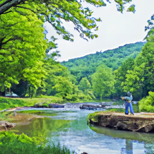
Jennings Run
What's biting at Jennings Run
Species commonly reported here -- tap any card for techniques, target seasons, and other waters where it's been caught.
Plan your trip down to the hour
Same weather feed Snoflo's iOS app uses -- updated continuously from NOAA / yr.no.
Next 5 days, hour by hour
Temperature line with weather symbols on top, snow + rain accumulation as columns, humidity as a dotted line.
5-day forecast table
Every 3 hours, broken out across temperature, snow, rain, humidity, and wind. Each cell is colour-coded relative to the column min/max so trends jump out at a glance.
| Time | Condition | Temp (°F) | Snow (in) | Rain (in) | Humidity (%) | Wind (mps) | Wind dir |
|---|---|---|---|---|---|---|---|
| Loading detailed forecast… | |||||||
15-day temperature & precipitation
Daily temperatures, snow, and rain projected over the next two weeks. Hover any point for the full breakdown.
Nearby streamflow
USGS streamgauges within reach of Jennings Run -- updated continuously from the National Water Information System.
| Streamgauge | Discharge | View |
|---|---|---|
| Wills Creek Near Cumberland | 76 cfs | → |
| North Branch Potomac River Near Cumberland | 484 cfs | → |
| Wills Creek Below Hyndman | 38 cfs | → |
| Town Creek Near Oldtown | 33 cfs | → |
| Patterson Creek Near Headsville | 47 cfs | → |
| Casselman River At Grantsville | 31 cfs | → |
Plan a longer trip
The closest campgrounds, parks, boat launches, and reservoirs so a fishing run can grow into a weekend.
Campgrounds
- Wv House
- Evitts Creek Campsite
- Irons Mountain Hiker Biker Campsite
- Iron Mountain Campsite
- Rocky Gap State Park
- Spring Gap - C And O Canal National Park
Parks
- Wills Mountain State Park
- C Eugene Mason Sports Complex
- State Game Lands 082
- Paris N. Glendening Recreation Complex
- Rocky Gap State Park
- State Game Lands 048
Reservoirs
- Dry Run Detention Dam And Culvert
- Industrial Dam (Blue Bridge)
- Upper Potomac Industrial Park Levee
- Rocky Gap Dam
- Lake Gordon
- Thomas W Koon
Boat launches
- Wiley Ford
- Gordon Lake Boat Access
- Gordon Lake
- Rocky Gap State Park
- Koon Lake Boat Access
- Chesapeake And Ohio Canal Trail Allegany County
Points of interest
- Allegany Arts Council
- The Three Stars Arts
- Cumberland Visitor Center
- Allegany Museum
- Fischtner Covered Bridge
- Evitts Creek Aqueduct
Paddle runs
- Begins South Of Largent To The Confluence With The Potomac At Great Cacapon
- Begins Below The Youghiogheny River Lake Dam In Confluence, Pennsylvania To Ends In South Connellsville, Pennsylvania
- Capon Bridge To Ends Just South Of Largent
- Begins As River Passes Under The Herrington Manor Road Bridge At Oakland, Maryland To The Corporate Boundary Of Friendsville, Maryland
- Begins Where The Lost River Becomes The Cacapon River To Wardensville
- Wardensville To The Town Of Capon Bridge
Angling safety & ethics
- Know the regulations
- Check local fishing rules, seasons, size limits, and license requirements to ensure legal and sustainable angling.
- Handle fish responsibly
- Use wet hands, minimize air exposure, and release fish gently to improve survival rates when practicing catch-and-release.
- Choose the right gear
- Match your rod, line, and tackle to the species and conditions to increase success and reduce unnecessary harm to fish.
- Respect the waterway
- Avoid disturbing habitat, prevent bank erosion, and keep a safe distance from spawning areas to protect ecosystems.
- Keep it clean
- Pack out all line, hooks, bait containers, and trash. Discarded gear can injure wildlife and degrade waterways.
Set push alerts in the Snoflo app
Save Jennings Run as a favorite, set a custom threshold (water temperature, streamflow, snowpack), and the iOS app will push the moment conditions cross.
About Jennings Run
What fish species are found at Jennings Run?
Snoflo tracks the species commonly reported at Jennings Run -- see the Fish Species panel above for the live list with images and links to per-species pages.
How fresh is the weather data on this page?
The hourly forecast updates throughout the day from the NOAA / yr.no public feeds. Streamflow data comes live from USGS streamgauges, also refreshed continuously.
Can I get alerts when conditions change?
Yes -- alerts are managed through the Snoflo iOS app. Favorite this area, set a threshold (water temperature, streamflow, snowpack), and you'll get a push the moment it crosses.
Do I need a fishing license?
Yes. Check your state agency's regulations for license requirements, seasons, size limits, and any waterbody-specific rules before fishing Jennings Run.
How do I get to Jennings Run?
Tap Open in map in the hero above to center the Snoflo interactive map on this area, or grab the coordinates from the location facts panel.
Other angling spots near here
Snoflo-tracked fishing areas within driving distance of Jennings Run.