Bagley Rapids Campground
Community Reviews
Been here? Share the conditions.
Reviews, ratings & photos are added in the free Snoflo iOS app — rate a spot, tag the conditions, and your visit is verified by location. Add or manage your reviews from the app.
Bagley Rapids
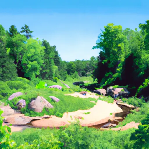
Reservations are accepted at Bagley Rapids camping area, allowing campers to secure their preferred campsites in advance. It is recommended to make reservations, especially during peak seasons, to ensure availability.
The best time to visit Bagley Rapids camping area is during the summer months, from June to August, when the weather is pleasant for outdoor activities. During this time, campers can enjoy fishing in the nearby Bagley Rapids or explore the surrounding hiking trails. Visitors should be cautious during spring as heavy rains can cause the river to overflow, potentially flooding the camping area. It is advisable to check weather conditions and river levels before planning a visit during this season.
In conclusion, Bagley Rapids camping area in Wisconsin offers a variety of amenities, including spacious campsites, clean facilities, and access to recreational activities such as fishing and canoeing. Reservations are accepted, and the best time to visit is during the summer months. However, caution should be exercised during the spring due to potential flooding.
What's on-site at Bagley Rapids
Key facilities Snoflo tracks for this campground. Confirm with the operator before booking -- amenities can change seasonally.
Plan your trip down to the hour
Same weather feed Snoflo's iOS app uses -- updated continuously from NOAA / yr.no.
Next 5 days, hour by hour
Temperature line with weather symbols on top, snow + rain accumulation as columns, humidity as a dotted line.
5-day forecast table
Every 3 hours, broken out across temperature, snow, rain, humidity, and wind. Each cell is colour-coded relative to the column min/max so trends jump out at a glance.
| Time | Condition | Temp (°F) | Snow (in) | Rain (in) | Humidity (%) | Wind (mps) | Wind dir |
|---|---|---|---|---|---|---|---|
| Loading detailed forecast… | |||||||
15-day temperature & precipitation
Daily temperatures, snow, and rain projected over the next two weeks. Hover any point for the full breakdown.
Other campgrounds in the area
Snoflo-tracked campsites within driving distance of Bagley Rapids, with reservations status.
| Campground | Reservations | Toilets | View |
|---|---|---|---|
| Hawk Ridge | ✗ | ✗ | → |
| Squirrel Nest | ✗ | ✗ | → |
| Trail View | ✗ | ✗ | → |
| Whispering Pines | ✗ | ✗ | → |
| Camp Long Lake | ✗ | ✗ | → |
| Windy Ridge | ✗ | ✗ | → |
Nearby streamflow
USGS streamgauges within reach of Bagley Rapids -- pulled live from the National Water Information System.
| Streamgauge | Discharge | View |
|---|---|---|
| Otter Creek At Willow Road Near Plymouth | 31 cfs | → |
| Sheboygan River At Sheboygan | 68 cfs | → |
| East Branch Rock River Near Mayville | 43 cfs | → |
| West Branch Rock River @ State Hwy 49 Nr Waupun | 40 cfs | → |
| Cedar Creek Near Cedarburg | 33 cfs | → |
| South Branch Rock River At Waupun | 4 cfs | → |
Nearby snow depths
NRCS SNOTEL stations within reach of Bagley Rapids -- relevant when planning a shoulder-season or alpine trip.
| SNOTEL station | Snowpack | 24h Snowfall | View |
|---|---|---|---|
| Suring | 0.0 in | 0.0 in | → |
| Crivitz High Falls | 8.0 in | 0.0 in | → |
| Athelstane | 0.0 in | 0.0 in | → |
| Stockbridge-Munsee Reservation | 0.0 in | 0.0 in | → |
| Stiles 1s | 8.0 in | 5.9 in | → |
| Antigo | 0.0 in | 0.0 in | → |
Plan a longer trip
The closest parks, lakes, boat launches, and paddle runs so a camping night can grow into a full weekend.
Camping essentials & Leave No Trace
- Pack it in, pack it out
- Take all trash, food scraps, and gear back with you to keep campsites clean and protect wildlife.
- Respect wildlife
- Observe animals from a distance, store food securely, and never feed wildlife to maintain natural behavior and safety.
- Know before you go
- Check weather, fire restrictions, trail conditions, and permit requirements to ensure a safe and well-planned trip.
- Minimize campfire impact
- Use established fire rings, keep fires small, fully extinguish them, or opt for a camp stove when fires are restricted.
- Leave what you find
- Preserve natural and cultural features by avoiding removal of plants, rocks, artifacts, or other elements of the environment.
Set push alerts in the Snoflo app
Save Bagley Rapids as a favorite, set a custom threshold (precipitation, snowpack, freezing temperatures), and the iOS app will push the moment conditions cross.
About Bagley Rapids
Can I make reservations at Bagley Rapids?
This campground does not appear to accept reservations -- it's typically first-come, first-served. Arrive early on summer weekends.
How fresh is the weather data on this page?
The hourly forecast updates throughout the day from the NOAA / yr.no public feeds. Streamflow data is pulled live from USGS streamgauges and snowpack from the NRCS SNOTEL network.
What's the best time of year to visit?
Use the 15-day temperature & precipitation outlook on this page to plan -- pick a window with comfortable temperatures and low precipitation. For longer trips, the 5-day hourly meteogram shows snow + rain accumulation hour-by-hour.
How do I get to Bagley Rapids?
Tap Directions in the hero above to open driving directions in Google Maps, or Open in map to center the Snoflo interactive map on the campground.
Can I get alerts when conditions change?
Yes -- alerts are managed through the Snoflo iOS app. Favorite this campground, set a threshold (temperature, snowpack, precipitation), and you'll get a push the moment it crosses.
Other campgrounds near here
Snoflo-tracked campgrounds within driving distance of Bagley Rapids.